


Elevating Flight Simulation with PlanetSAT Global Imagery Basemap
Learn how the PlanetSAT global imagery basemap enhances flight simulation environments by delivering realistic, high-resolution terrain visuals that improve pilot training and overall immersion.
Key benefits
PlanetObserver global imagery and elevation data for weather visualization provided a number of benefits to MetraWeather, including:
- Accurate and reliable weather forecasting experience: MetraWeather’s customers benefited from the high-quality imagery and elevation maps provided by PlanetObserver, leading to a more accurate and reliable weather forecasting experience.
- Easy Integration: The maps are designed to fit seamlessly into the Weatherscape XT graphics system, requiring minimal effort for integration.
- Customized Maps: PlanetObserver team of experts were able to adapt the maps to MetraWeather’s technical specifications, in terms of file format, tiling structure and projection, which helped greatly MetraWeather to get ready-to-integrate maps.
Products used
The client : Flight Simulation Providers
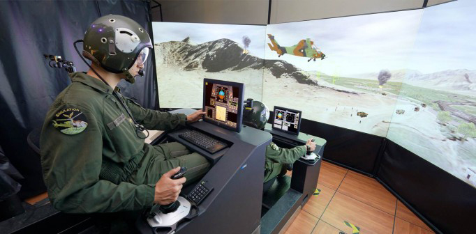
The flight simulation industry, including renowned names Boeing, Sogitec (a Dassault Aviation company), and Thales, is a nexus of innovation and skill. These providers collectively forge advanced training environments that mimic real-world flying experiences, serving as indispensable tools for pilot training, safety reinforcement, and innovation within civil and military aviation.
The Challenge : Transforming the Simulation Experience
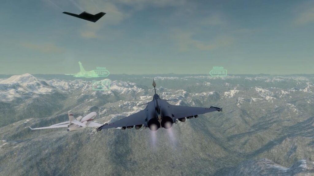
The challenge for flight simulation providers goes beyond maintaining market position; it’s about innovating and advancing the industry. They seek to upgrade global satellite imagery in flight simulators, not just for enhancement but to transform the experience.
The imagery must be coherent, accurate, vivid, and realistic. Providers need solutions that paint a seamless, immersive world view, enhancing user experience while meeting quality standards.
Additionally, they require data that integrate seamlessly with existing systems, ensuring flexibility for future growth. Compatibility, scalability, and ease of implementation and maintenance are essential.
Customer service is also key. The industry seeks partners who actively engage in their vision, providing ongoing support and attentiveness to specific needs.
The Solution : An Off-the-Shelf Seamless Global Imagery Basemap
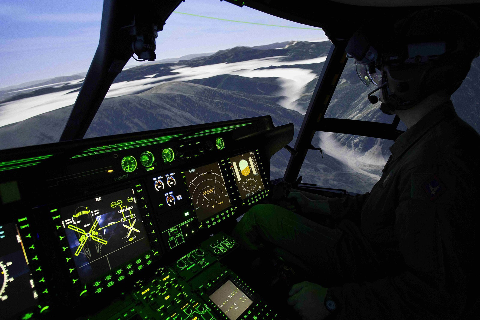
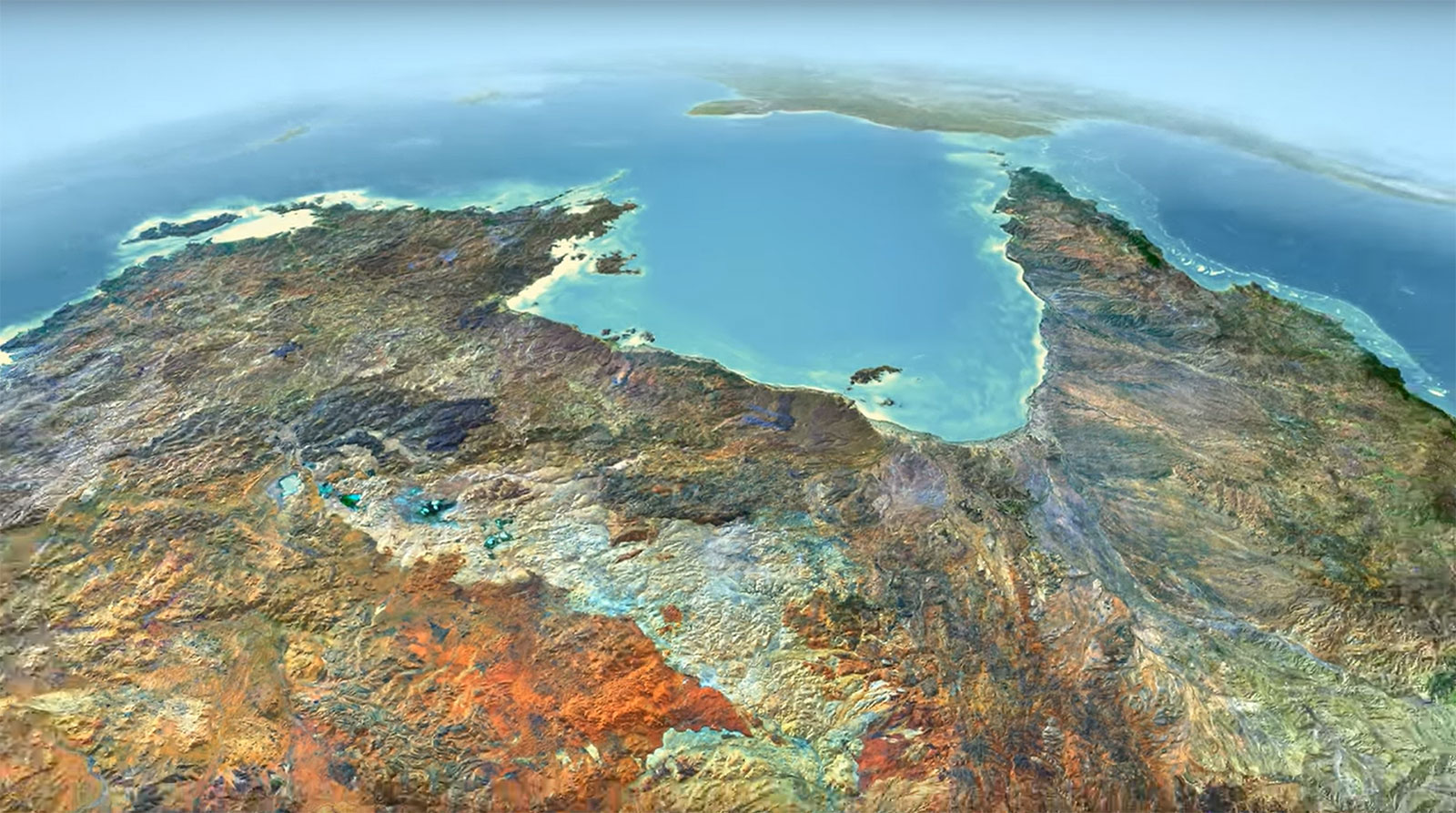
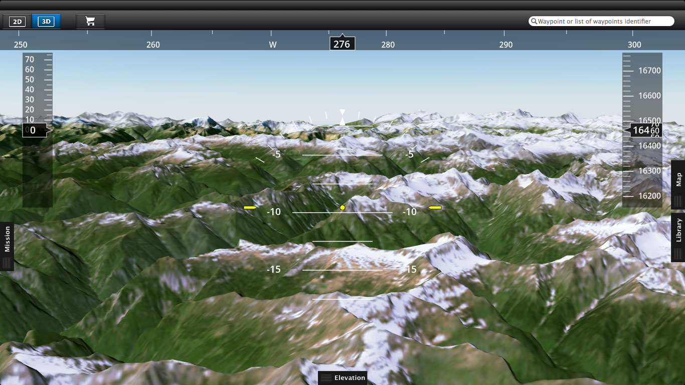
PlanetObserver’s PlanetSAT basemap has emerged as the ideal solution for the flight simulation industry, providing an off-the-shelf global imagery product that perfectly aligns with industry demands. With 10-meter resolution, seamless visual quality, and true-to-life color depiction, PlanetSAT meets the high standards required for flight training, simulation, and Full Flight Simulators (FFS).
The solution’s compatibility with many industry leaders’ solutions has not only enhanced the simulated environments but also streamlined integration. The ease of incorporating the PlanetSAT global basemap is facilitated by the availability of data in multiple formats such as GeoTiff, COG (Cloud Optimized GeoTiff), and JPEG200. This flexibility translates to lower integration costs for our clients, making it an attractive choice for providers across the flight simulation spectrum.
The Benefits : The Strategic Gains of a Powerful Partnership
Collaboration with PlanetObserver has resulted in an array of distinct benefits for our clients in the flight simulation industry:
- Enhanced User Experience: PlanetSAT’s imagery integration simulates real-world flying, making training more engaging and effective.
- Superior Visual Quality: High-quality imagery from PlanetSAT adds precision and realism to landscapes, enriching the visual experience.
- Reinforced Training Effectiveness: Using the PlanetSAT imagery basemap, flight simulation providers create training conditions that feel more like real-world flying.
- Cost-Effective Integration: PlanetSAT global imagery fits smoothly into existing systems, reducing the time, effort, and cost needed for integration, unlike other basemaps that require additional work and processing.
Discover more Customer Success Stories
Let's talk
Ready to enhance your project with high-quality geospatial data? Talk to our team to get started.
