


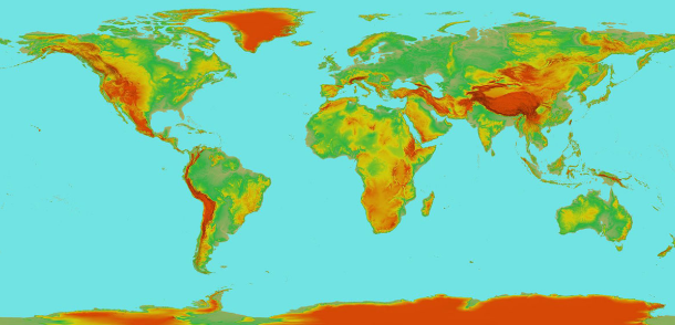
Enhanced 30m Global Elevation Data
PlanetDEM
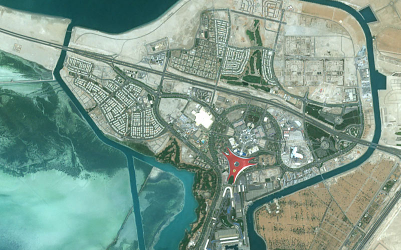
Global Elevation Data for Precision and Performance
Seamless, accurate and ready-to-use for any project, anywhere
PlanetDEM offers seamless, homogenous global elevation data at 30-meter resolution—free from voids, artifacts, or inconsistencies. Developed by PlanetObserver’s expert team, PlanetDEM is ready to use and offers excellent vertical accuracy, making it a reliable base layer for demanding applications.
Designed to streamline your workflow, the dataset delivers clean and consistent data, ideal for mapping, 3D visualization, simulation, or geographic intelligence.
Why PlanetDEM Global Elevation Data Stands Out

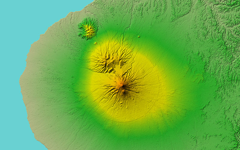
Seamless and Consistent Coverage, Worldwide
PlanetDEM offers a fully harmonized global elevation dataset with no data voids. Thanks to a rigorous production process, you get clean, ready-to-use elevation data that ensures visual and reliable results across your entire area of interest—whether you’re working locally or across continents.
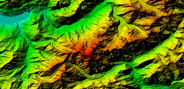
Enhanced Quality for Demanding Applications
PlanetDEM goes beyond open-source elevation data by delivering a refined, gap-free product that has been carefully corrected and enhanced by our in-house team.
With over one-third of the source tiles improved, PlanetDEM ensures stable performance even in complex terrain—ideal for applications where accuracy and reliability are critical.


Fast Integration, No Extra Work
Forget about spending time cleaning or reformatting your data. PlanetDEM is delivered in standard formats, perfectly aligned and quality-checked, so you can integrate it directly into your GIS, 3D, or simulation environment.
This approach drastically reduces project lead times and boosts efficiency for your teams.
Hear What our Amazing Customers Say

« PlanetDEM provides the reliable, high-quality elevation data our Defense clients expect for critical simulation, mapping, and mission planning projects worldwide, with seamless integration and consistent results. »
– Morris Akbari
Applications Engineering Manager, L3 Harris

« PlanetDEM is used across multiple Thales GBUs with excellent results. Its reliability, consistency, and ease of use make it a valuable asset for a wide range of applications. »
– Brigitte Durand
Group Category Manager, Thales
« By integrating PlanetObserver geospatial data into Terra Vista, we deliver a more immersive and accurate simulation experience that enhances decision-making and readiness. »
– Joël Castets
CEO, Agenium
Need a quick overview of PlanetDEM?
Download the product sheet for a clear summary of features, benefits, and technical specs—all in one place.
Focus on your business, we'll handle the data
Save time and streamline your workflow.
With PlanetDEM, you get tailored elevation solutions that integrate smoothly
into your systems, so you can stay focused on your core activities.
Ready-to-Use Global Elevation Data
PlanetDEM provides seamless, enhanced global elevation data that’s ready to use—so you can focus on your project, not the processing.
Select your Area of Interest
Get the data you need, tailored to your specifications—resolution, format, projection, and coverage, from local areas to full global scale.
Flexible Licensing Options
Choose a licensing model that fits your use case—internal use, integration, media, or academic—without hidden costs.
Check before buying!
Enjoy a free data testing service with sample delivery before purchase.
Reliable Global Elevation Data You Can Build On
Depend on proven 30m global elevation data for reliable use in civil or military mapping and simulation.
Let's talk
Ready to enhance your project with high-quality elevation data? Talk to our team to get started.
They trust us
Customer Success Stories
See how organizations around the world use our geospatial data to solve real challenges, drive innovation,
and bring their projects to life. Discover their stories—and imagine what’s possible for yours.


PlanetObserver’s 2D and 3D data boost Digital Moving Maps for situational awareness in civilian and military use.
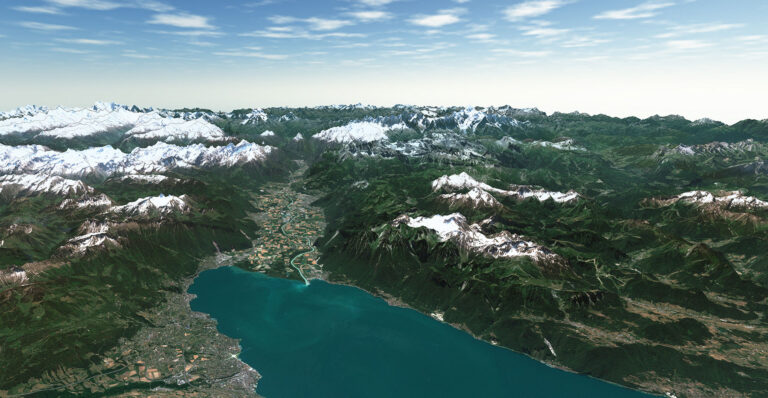
Discover how PlanetSat imagery and PlanetDEM elevation data enhance Terra Vista with high-quality 3D terrain simulation imagery.

A key challenge for Defense is obtaining accurate medium-resolution imagery and elevation data for a reliable terrain view.

For its program AI for Earth, Microsoft has chosen PlanetDEM 30m elevation data to perform geospatial analysis.
Proven Performance around the world
A trusted name in geospatial data since 1989.
Projects delivered globally across five continents.
Organizations across industries rely on PlanetObserver for high-quality geospatial data.
Consistently rated highly for reliability, service, and support.
FAQ
PlanetDEM offers a global coverage of all emerged land surfaces, from pole to pole. No matter where your project is located, PlanetDEM provides consistent and reliable elevation data worldwide.
PlanetDEM is a Digital Surface Model (DSM), which means it includes natural and man-made features such as vegetation and buildings. This differs from a Digital Terrain Model (DTM), which represents the bare earth surface without these features.
PlanetDEM is built from ALOS World 3D – 30m, carefully corrected and enhanced using NASADEM data. Over 35% of the ALOS source tiles have been improved to ensure higher accuracy and seamless results.
PlanetDEM offers horizontal and vertical accuracy of approximately 7 meters, making it suitable for a wide range of professional applications.
Absolutely. We deliver elevation data for any area of interest— from localized areas up to regional and global coverages —tailored to your specific project requirements.
Yes. PlanetDEM is delivered in standard GeoTIFF and DTED2 formats, ready for immediate integration into GIS platforms, simulation tools, and other geospatial applications.
Our licensing model is simple. We offer single or multi-user licenses for all internal use cases, and an integrator license if you need to embed the data into a solution for resale to your end users. We also provide attractive licensing terms for academic institutions and media organizations. Whatever your use case, we’ll help you find the right option.
Contact our sales team with project area and format requirements. We provide tailored pricing and quick, professional advice.
Let's talk
Ready to enhance your project with high-quality elevation data? Talk to our team to get started.
