


High-performing Earth
imagery and Elevation Data
Global, seamless, and ready now.
Your Geospatial Data Experts
Trusted Earth imagery and elevation data for professionals worldwide
At PlanetObserver, we turn complex Earth imagery and elevation data into clear, visual and global insights. With decades of experience in geospatial data, we provide accurate, high-quality visuals of our planet to support your decision-making, innovation and storytelling.
Whether you’re in defence, aerospace, mapping, or broadcasting, our expert team is here to help you make the most of our geospatial data.
Ready-to-use Earth Imagery and Elevation Data
Explore our two core Earth data products designed to meet a wide range of professional needs.
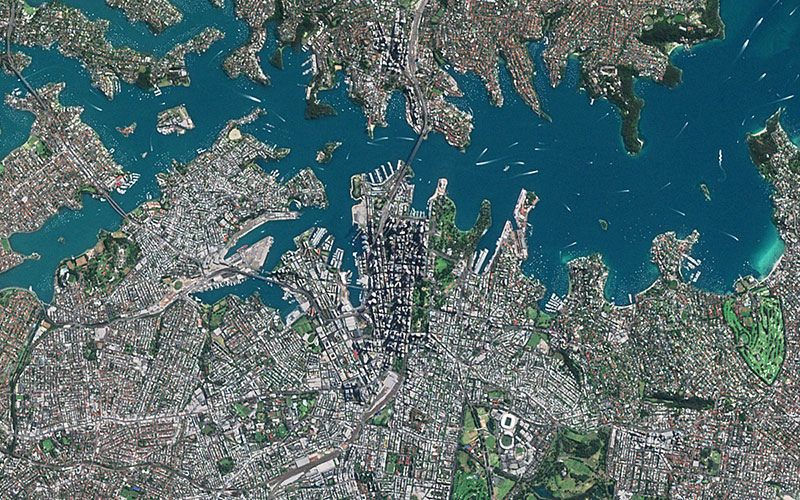
PlanetSAT
Visualize the world like never with our global 10-meter basemap. PlanetSAT delivers seamless, ready-to-use Earth imagery—perfect for mapping, simulation, and immersive visualizations.
PlanetDEM
Bring your 3D projects to life with confidence. PlanetDEM offers a global 30-meter digital elevation data that delivers accurate, reliable terrain data—ideal for modeling, analysis, and simulation.
Who we serve
Defence & Intelligence
Strengthen mission planning, intelligence, and situational awareness with accurate and reliable geospatial data tailored to defense operations.
Discover how our Earth imagery and elevation data enhance simulation, visualization, and mission planning for greater operational efficiency.
Aerospace
Power flight simulation and navigation with high-quality geospatial data designed for global performance.
See how our Earth imagery and elevation data bring accuracy and realism to flight training systems, and flight planning apps.
Mapping & Gis
Enhance mapping solutions and GIS applications with seamless Earth satellite imagery and consistent elevation data.
Discover how our ready-to-use geospatial layers support cartographic production and deliver stunning visual insights within mapping platforms.
Graphics & Animation
Create dynamic news and weather graphics, and power in-flight moving maps with visually rich Earth satellite imagery and global elevation data.
Find out how our geospatial content brings real-world context and visual impact to broadcast graphics systems and interactive display systems.
They trust us
Let's talk
Ready to enhance your project with high-quality geospatial data?
Talk to our team to get started.
Customer Success Stories
See how organizations around the world use our Earth imagery and elevation data to solve real challenges,
drive innovation, and bring their projects to life. Discover their stories and imagine what’s possible for yours.


PlanetSAT imagery basemap enriches flight simulation solutions with vivid imagery, enhancing user experience & training.
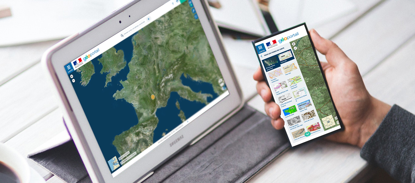
The French Mapping Agency needed to give their geoportal users global context with a World Satellite Map.

For its program AI for Earth, Microsoft has chosen PlanetDEM 30m elevation product to perform geospatial analysis.

Implementing our off-the-shelf imagery basemap in their flight simulation solution helped Thales saving development and production costs.
Proven Performance Around the World
A trusted name in Earth imagery since 1989.
Projects delivered globally across five continents.
Organizations across industries rely on PlanetObserver for high-quality Earth imagery and elevation data.
Consistently rated highly for reliability, service, and support.
Hear What our Amazing Customers Say

« We have successfully updated the Airbus OneAtlas Basemap with PlanetSAT global imagery mosaic. It has surpassed our expectations. PlanetSAT basemap has really improved the user experience. »
– Nicolas Vernon
Product Manager OneAtlas Basemap, Airbus

« PlanetSAT basemap met our main criteria, i.e. enhanced color quality of the imagery, up-to-date data, and standard formats ready-to-use in our flight simulation solutions. »
– Muriel Amouroux
Manager, Thales
“Using PlanetSAT imagery basemap and PlanetDEM elevation data allows us to deliver stunning, real-time weather graphics to our broadcast clients, no matter where they are in the world.”
– Martin Kantor
Lead Creative Engineer, MetraWeather
Let's talk
Ready to enhance your project with high-quality geospatial data?
Talk to our team to get started.
