Skip to content
Menu
Fermer
Home
Products
Global Imagery Basemap
Global Elevation Data
Global Imagery Basemap
Global Elevation Data
Industries
Defence & Intelligence
Aerospace
Mapping
Graphics & Animation
Defence & intelligence
Aerospace
Mapping & GIS
Graphics & Animation
Resources
Blog
Customer Stories
About us
Home
Products
Global Imagery Basemap
Global Elevation Data
Global Imagery Basemap
Global Elevation Data
Industries
Defence & Intelligence
Aerospace
Mapping
Graphics & Animation
Defence & intelligence
Aerospace
Mapping & GIS
Graphics & Animation
Resources
Blog
Customer Stories
About us
Home
Products
Global Imagery Basemap
Global Elevation Data
Industries
Defence & Intelligence
Aerospace
Mapping
Graphics & Animation
Resources
Blog
Customer Stories
About us
Home
Products
Global Imagery Basemap
Global Elevation Data
Industries
Defence & Intelligence
Aerospace
Mapping
Graphics & Animation
Resources
Blog
Customer Stories
About us
Contact us
Explore the world
Menu
Fermer
Home
Products
Global Imagery Basemap
Global Elevation Data
Global Imagery Basemap
Global Elevation Data
Industries
Defence & Intelligence
Aerospace
Mapping
Graphics & Animation
Defence & intelligence
Aerospace
Mapping & GIS
Graphics & Animation
Resources
Blog
Customer Stories
About us
Home
Products
Global Imagery Basemap
Global Elevation Data
Global Imagery Basemap
Global Elevation Data
Industries
Defence & Intelligence
Aerospace
Mapping
Graphics & Animation
Defence & intelligence
Aerospace
Mapping & GIS
Graphics & Animation
Resources
Blog
Customer Stories
About us
Contact us
Explore the world
Aerospace
Back to All Stories
Defense & Intelligence
Aerospace
Mapping & GIS
Graphics & Animation
Aerospace
Elevating Flight Simulation with PlanetSAT Global Imagery Basemap
Aerospace
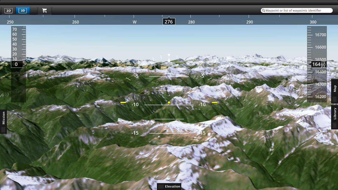
Geospatial Data Benefiting Air Navigation Pro Flight Planning App
Aerospace
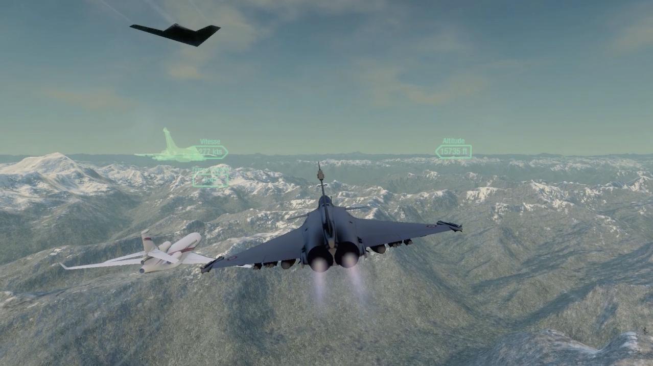
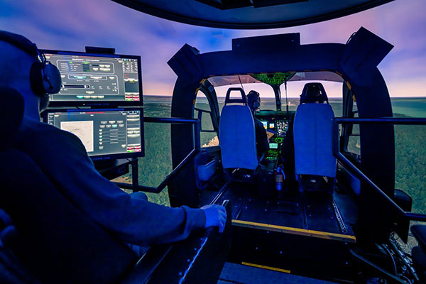
Enhancing Thales Flight Simulator Realism with Global Imagery
Aerospace
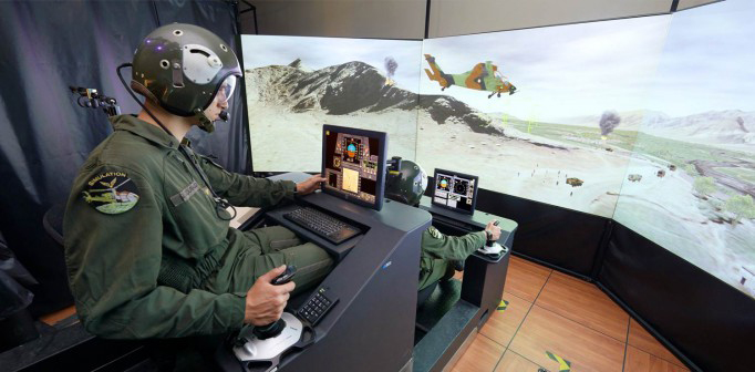
Satellite Imagery for Helicopter Simulators