


10m Global
imagery Basemap
PlanetSAT 2026
Reliable and High-Quality Global Imagery Basemap
Designed to power your mapping, simulation, and GIS projects
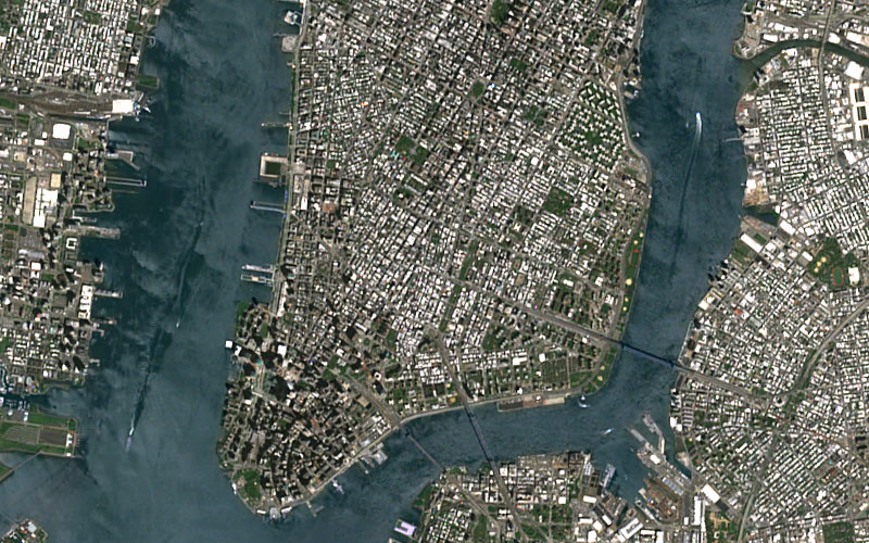
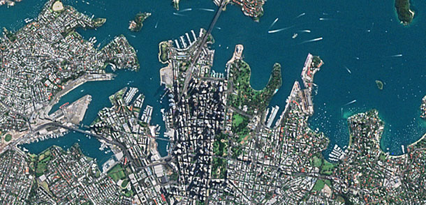
PlanetSAT is a seamless, ready-to-use global imagery basemap with a 10-meter resolution that support professionals in defense, mapping, and visualization sectors. With consistent global coverage, natural color rendering, and annual updates, PlanetSAT stands out for its exceptional visual quality and reliability.
The imagery basemap is optimized for easy integration into all standard applications, including GIS and mapping platforms, offering users more reliable geographic context.
A Basemap Developed for Professional Applications

Enhance the Visual Impact of Your Solutions
PlanetSAT gives your GIS tools, simulations, and mapping applications an immediate visual upgrade. Its cloud-free, color-balanced imagery delivers a clean, consistent, and natural view of the world—free from visible seams, color mismatches or artifacts.
The result is a visually coherent, true-to-life backdrop. With consistent, high-quality imagery, your solution gains credibility, builds user confidence, and communicates information more clearly.
Stay Ahead with Up-to-Date Imagery
Thanks to annual updates, you always have access to the most current imagery, ensuring your maps reflect the latest changes on the ground.
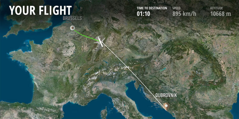
Whether used for flight simulation, mission preparation systems, mapping platforms or news and weather graphics, PlanetSAT keeps your content accurate and relevant.


Make Confident Decisions Anywhere in the World
PlanetSAT delivers consistent, high-quality satellite imagery at 10-meter resolution, providing accurate geographic context wherever your projects are.
Its seamless, cloud-free coverage ensures your applications reflect true terrain across the globe—enabling a clearer understanding of geographic realities.
Hear What our Amazing Customers Say

« We have successfully updated the Airbus OneAtlas Basemap with PlanetSAT Global imagery mosaic. It has surpassed our expectations. PlanetSAT basemap has really improved the user experience. »
– Nicolas Vernon
Product Manager OneAtlas Basemap, Airbus

« PlanetSAT basemap met our main criteria, i.e. enhanced color quality of the imagery, up-to-date data, and standard formats ready-to-use in our flight simulation solutions. »
– Muriel Amouroux
Manager, Thales
By integrating PlanetObserver geospatial data into Terra Vista, we deliver a more immersive and accurate simulation experience that enhances decision-making and readiness.
– Joël Castets
CEO, Agenium

Need a quick overview of PlanetSAT?
Download the product sheet for a clear summary of features, benefits, and technical specs—all in one place.
Focus on your business, we'll handle the data
Save time and streamline your workflow.
With PlanetSAT, you get tailored imagery solutions that integrate smoothly
into your systems, so you can stay focused on your core activities.
Ready-to-Use Global Imagery
PlanetSAT provides seamless, up-to-date global imagery that’s ready to use—so you can skip processing and focus on your project, not the data.
Select your Area of Interest
Get the imagery you need, tailored to your specifications—resolution, format, projection, and coverage, from local areas to full global scale.
Flexible Licensing Options
Choose a licensing model that fits your use case—internal use, integration, media, or academic—without hidden costs.
Check before buying!
Enjoy a free data testing service with sample delivery before purchase.
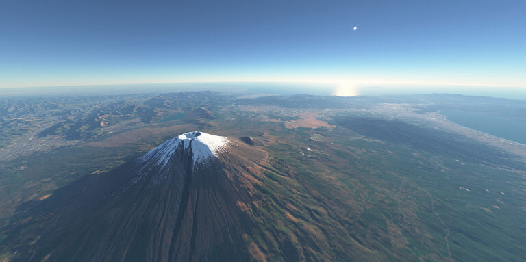
See the Earth as it truly is!
Discover the most true-to-reality 10-meter global imagery basemap on the market.
Let's talk
Ready to enhance your project with high-quality satellite imagery?
Talk to our team to get started.
They trust us
Customer Success Stories
See how organizations around the world use our geospatial data to solve real challenges, drive innovation,
and bring their projects to life. Discover their stories—and imagine what’s possible for yours.
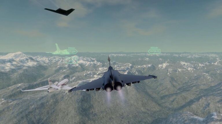

PlanetSAT basemap enriches flight simulation solutions with vivid imagery, enhancing user experience & training.
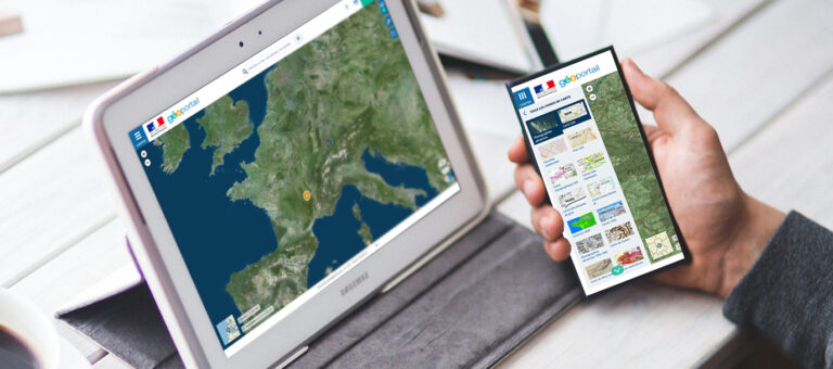
The French Mapping Agency needed to give their geoportal users global context with a World Satellite Map.
Display Interactive’s IFE moving maps, powered by PlanetSAT imagery basemap, transform flights.
Discover how RSA Cosmos & PlanetObserver enhance planetariums worldwide with high-quality world imagery and immersive experiences.
Proven Performance Around the World
A trusted name in geospatial data since 1989.
Projects delivered globally across five continents.
Organizations across industries rely on PlanetObserver for high-quality geospatial data.
Consistently rated highly for reliability, service, and support.
FAQ
PlanetSAT provides a global coverage of all emerged land, pole‑to‑pole. No matter where your project is located, PlanetSAT provides consistent and reliable imagery worldwide.
Over 95% of the globe is free from clouds; remaining clouds are retained digitally to preserve realism in tropical regions.
Unlike fully automated mosaics that often contain visual artefacts or inconsistencies, PlanetSAT combines automated and manual processing to provide a refined, cloud-free mosaic with unmatched visual quality.
Absolutely. We deliver imagery for any area of interest— from localized areas up to regional and global coverages —tailored to your specific project requirements.
Yes. PlanetSAT is delivered in standard GeoTIFF, COG, JPEG 2000, and ECW formats ready for immediate integration into GIS platforms, simulation tools, and all standard applications. Should those standard formats available off-the-shelf not meet your needs, the data can be adapted on-demand in your preferred format. Contact us for more details.
Our licensing model is simple. We offer single or multi-user licenses for all internal use cases, and an integrator license if you need to embed the data into a solution for resale to your end users. We also provide attractive licensing terms for academic institutions and media organizations. Whatever your use case, we’ll help you find the right option.
Contact our sales team with project area and format requirements. We provide tailored pricing and quick, professional advice.
Let's talk
Ready to enhance your project with high-quality satellite imagery?
Talk to our team to get started.
