


Satellite Imagery for Helicopter Simulators
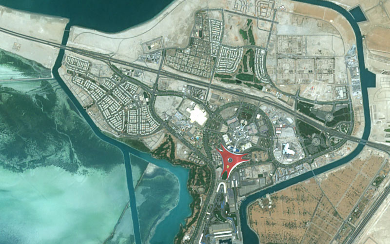
PlanetObserver provides high-resolution satellite imagery (up to 50 cm) for the 3D modeling of helicopter simulators — case study with Coptersafety: Vancouver, Comox Valley, Qualicum Beach.
Key benefits
Supported simulator environments through optimized 3D imagery.
Accelerated production integration with workflow ready datasets.
Realistic training scenarios backed by high geospatial accuracy.
Products used
THE CLIENT - Coptersafety - Independent Helicopter Training
Coptersafety is dedicated to improving helicopter safety by providing world-class simulator training for licensed pilots. Their comprehensive training programs cater to professionals in Helicopter Emergency and Medical Services (HEMS), Search and Rescue (SAR), Offshore operations, and Aerial Work.
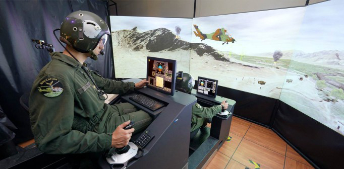
Based just four minutes from Helsinki International Airport, Finland, Coptersafety ensures pilots receive high-quality mission training in a state-of-the-art environment. They offer the largest independent helicopter simulator training facility in the world with the broadest range of simulators.
THE CHALLENGE - Realistic 3D Training Environments for Helicopter Simulators
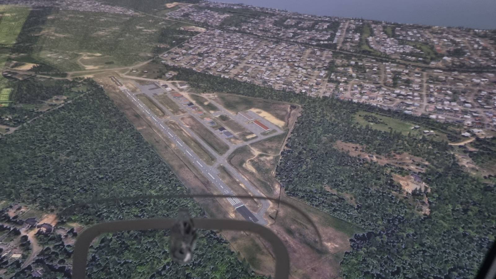
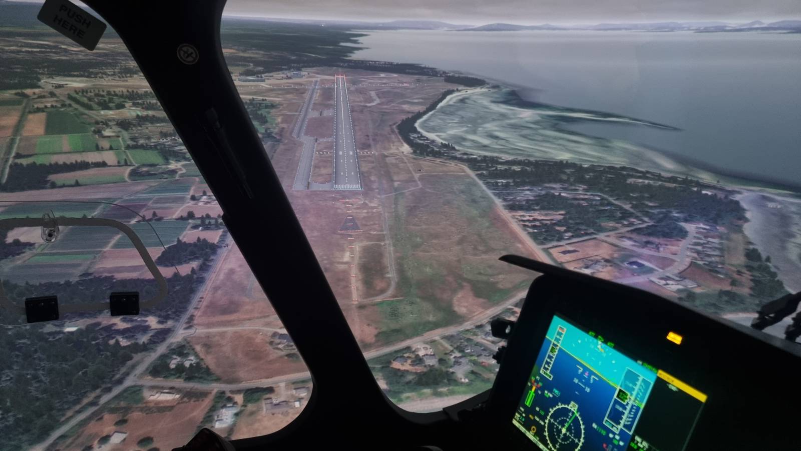
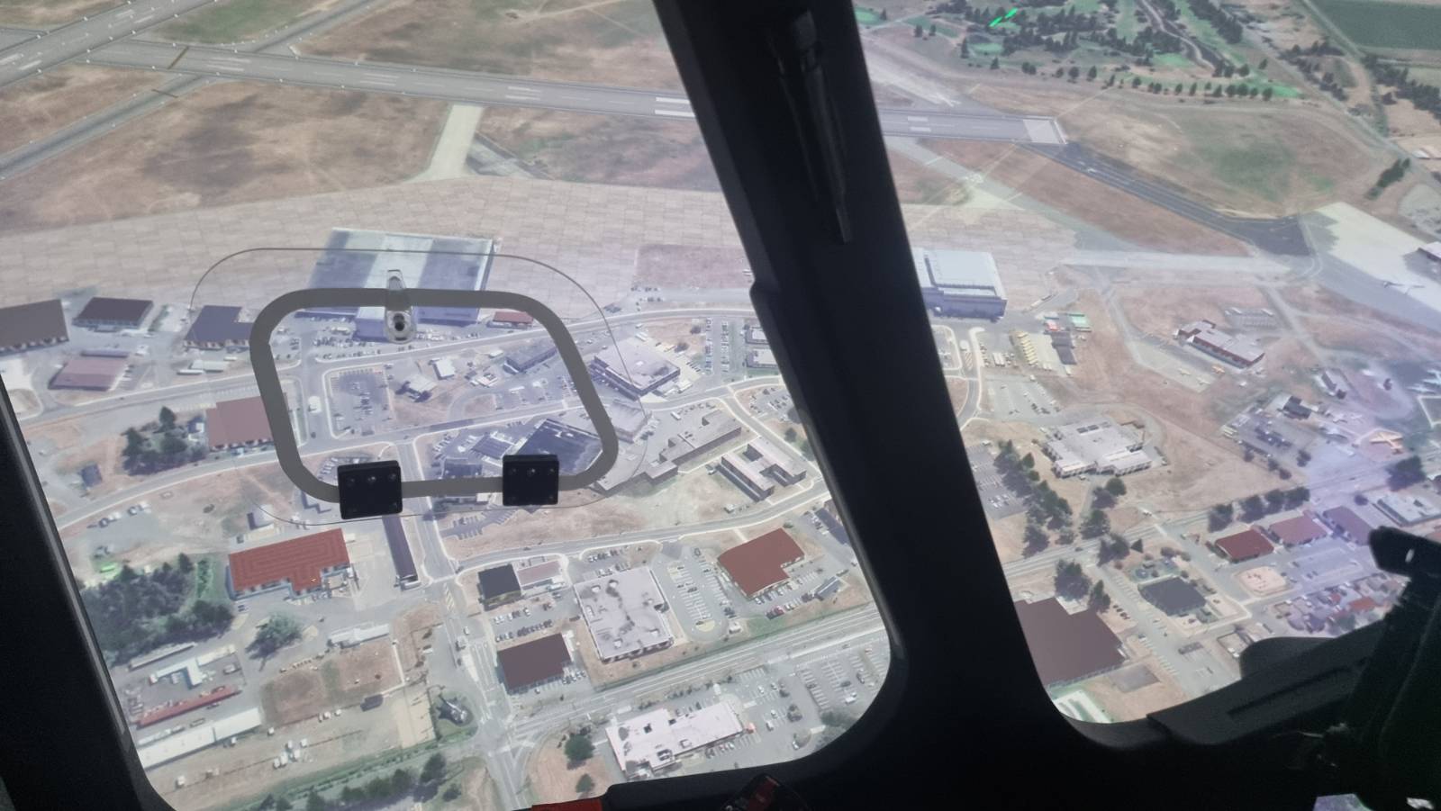
For a Canadian client, Coptersafety needed to develop high-quality 3D models for helicopter simulators featuring three specific locations in Vancouver, British Columbia:
– Nanaimo Hospital Helipad
– Comox Valley Airport
– Qualicum Beach Airport
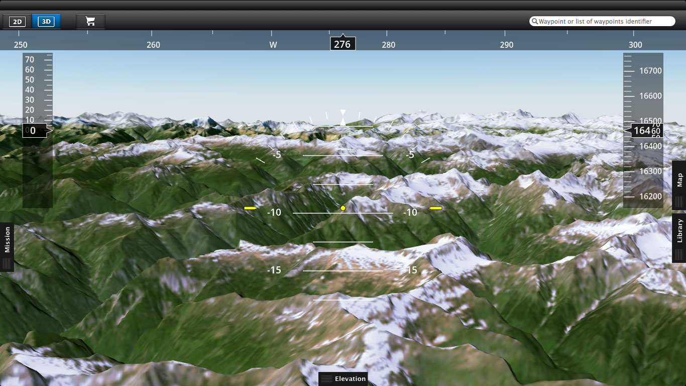
The client operates a fleet of helicopters across the region, and their pilots rely on Coptersafety’s simulators to practice safe landings at airports and helipads. To ensure the highest level of realism and accuracy, the 3D models had to be built using very high-resolution satellite imagery at 50cm resolution.
THE SOLUTION - High-resolution satellite imagery for precision mapping
Having previously collaborated with PlanetObserver on another project in Kazakhstan, Coptersafety once again turned to our expertise for satellite imagery procurement. Our flexibility in sourcing data from multiple providers allowed us to find the best imagery in terms of resolution, clarity, and recency.
For this project, we worked with two trusted partners:
– European Space Imaging (EUSI) – A key provider of Maxar’s industry-leading very high-resolution imagery down to 30 cm, available as both archive and tasked data.
– OmeoSpace – A provider of satellite imagery from Chinese operators, including EarthScanner, which delivers 50 cm resolution optical imagery with an exceptionally large 150km swath—ideal for detailed mapping at 1:2000 scale.
Our team conducted an extensive search through both providers’ archives to identify the best available satellite imagery with optimal quality, minimal cloud cover, and recent acquisition dates. Once selected, the data was swiftly delivered to Coptersafety’s 3D modeling team, ensuring a smooth and efficient workflow.
Copersadety is dedicated to improving helicopter safety by providing world-class simulator training for licensed pilots. Their comprehensive training programs cater to professionals in Helicopter.
Keith Adams
THE BENEFITS - Efficiency and Ease of Use
Efficiency and Ease of Use
By sourcing the right satellite imagery quickly and efficiently, we enabled Coptersafety to focus on their core mission—creating high-quality flight simulation environments for helicopters.
- Ready-to-use data – High-resolution imagery optimized for 3D modeling
- Plug-and-play approach – Seamless integration into their production process
- Time-saving solution – No need for additional image processing or sourcing delays
- Reliable and accurate – Ensuring precise, real-world flight training environments
The Coptersafety team, including their visual modelers and 3D designers, appreciated the hassle-free experience, allowing them to concentrate on developing immersive, high-fidelity training environments for helicopter pilots.
By delivering high-quality satellite imagery tailored to their needs, PlanetObserver helped Coptersafety enhance their training environments, ensuring a more realistic and effective simulation experience for helicopter pilots.
Discover more Customer Success Stories
Let's talk
Ready to enhance your project with high-quality geospatial data? Talk to our team to get started.
