


Sogitec : Leading the Defense Flight Simulation with Geospatial Data
Discover how Sogitec leverages high-quality geospatial data to power defense flight simulation, delivering highly realistic environments and advanced mission training capabilities.
THE CLIENT - Sogitec
Sogitec Industries is a subsidiary of Dassault Aviation, a leading company in the aerospace industry that provides support products and services for aerospace systems. Sogitec is a prominent player in the simulation and training products and services market, specializing in flight simulation for the Defense industry.
The company’s mission is to support aircraft and crews by leveraging new technologies, and their strategy is to be a world leader in flight simulation for Defense actors. This is achieved through their skilled and experienced team of engineers, high customer satisfaction, and a wide range of networked simulation products.
THE CHALLENGE - The Need of a Highly Realistic Experience in Flight Simulation
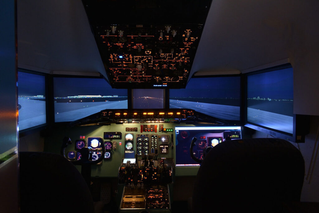
Sogitec faced the challenge of upgrading their visual database for their flight simulators to maintain their high standards of simulation and training in the Defense industry.
Sogitec’s high standards of simulation and training include aspects such as accuracy, realism, and effectiveness. As a leader in the flight simulation and training market, they use cutting-edge technology and techniques to provide a highly immersive and realistic experience for their clients.
This could involve replicating real-world scenarios and environments, providing in-depth training for aircraft and crew, and continually updating and upgrading their systems to stay ahead of the competition.
Maintaining high standards of simulation and training is crucial for Sogitec. As a leader in the industry, including the Defense sector, the company needs to provide the highest quality solutions. Failure to upgrade to more accurate and reliable data may result in clients seeking better, more up-to-date alternatives.
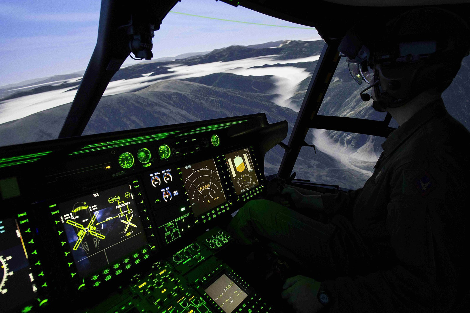
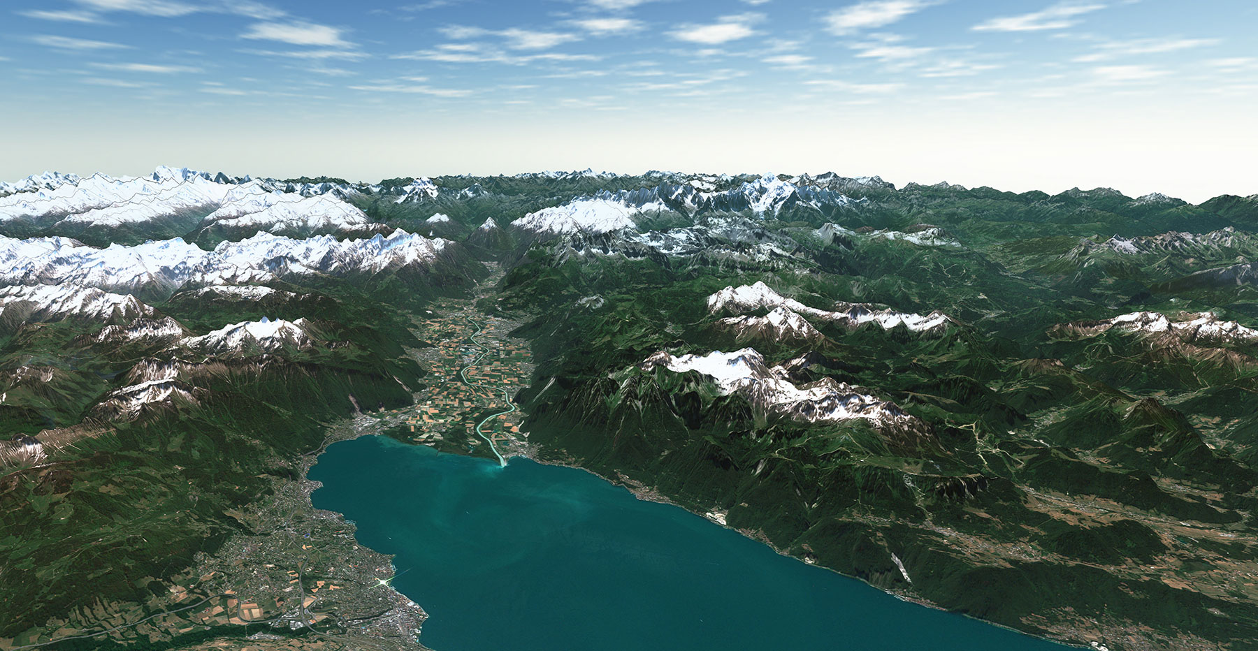
THE SOLUTION - A Reliable and Corrected 3D World Based on Geospatial Data
Sogitec approached our geospatial data company, PlanetObserver, for PlanetSAT global 2D imagery basemap and PlanetDEM global 3D elevation dataset. Our collaboration with Sogitec has been successful for 15 years.
Sogitec chose our geospatial data due to the high visual quality of the imagery, the reliability of the PlanetDEM elevation data, and the perfect combination of both products to produce synthetic environments. The license flexibility of our products was also a contributing factor to their decision. Our company supported Sogitec by listening to their needs and taking into account their timeline. Our prompt deliveries in accordance with the client’s projects helped us in meeting their demands.
THE BENEFITS - The Competitive Edge of Geospatially Enhanced Flight Simulation
PlanetObserver has always been committed to Sogitec’s success and has adapted its products to meet their needs. We have been there for Sogitec to offer updates and upgrades.
Sogitec greatly benefits from having highly reliable geospatial data in their flight simulation solutions. Some of the benefits include:
1. Improved accuracy: By using high-quality geospatial data, Sogitec’s flight simulation solutions can accurately replicate real-world environments and scenarios, leading to a more realistic and effective simulation experience.
2. Enhanced training: With reliable geospatial data, Sogitec’s flight simulation solutions can provide a more comprehensive training experience for aircraft pilots, allowing them to learn and practice in a more accurate and life-like environment.
3. Increased confidence: Pilots trained using a Full Flight Simulator with highly reliable geospatial data would likely have greater confidence in their abilities, knowing that they have been trained in an accurate and life-like environment.
4. Competitive advantage: Sogitec’s flight simulator solutions, equipped with highly reliable geospatial data, set them apart from their competitors and solidify their position as a leader in the simulation and training market.
Discover more Customer Success Stories

Let's talk
Ready to enhance your project with high-quality geospatial data? Talk to our team to get started.
