


PlanetSAT — A Technically Advanced Global Imagery Basemap
Discover how PlanetObserver transforms Sentinel-2 imagery into a seamless, accurate, and visually consistent global imagery basemap.
A New Standard in Global Imagery
In the geospatial sector, the value of satellite imagery lies not only in its visual appeal but also in its accuracy, consistency, and readiness for operational use. Consequently, professionals from a wide range of industries, from defense and simulation to broadcast and GIS, rely on high-quality basemaps to support decision-making, and visualization.
Among the many global imagery products available today, PlanetSAT, developed by PlanetObserver, stands out for its unique combination of visual uniformity, technical robustness, and precision in data processing. Specifically designed to meet the needs of demanding professional applications, PlanetSAT delivers a reliable and visually consistent representation of the Earth.
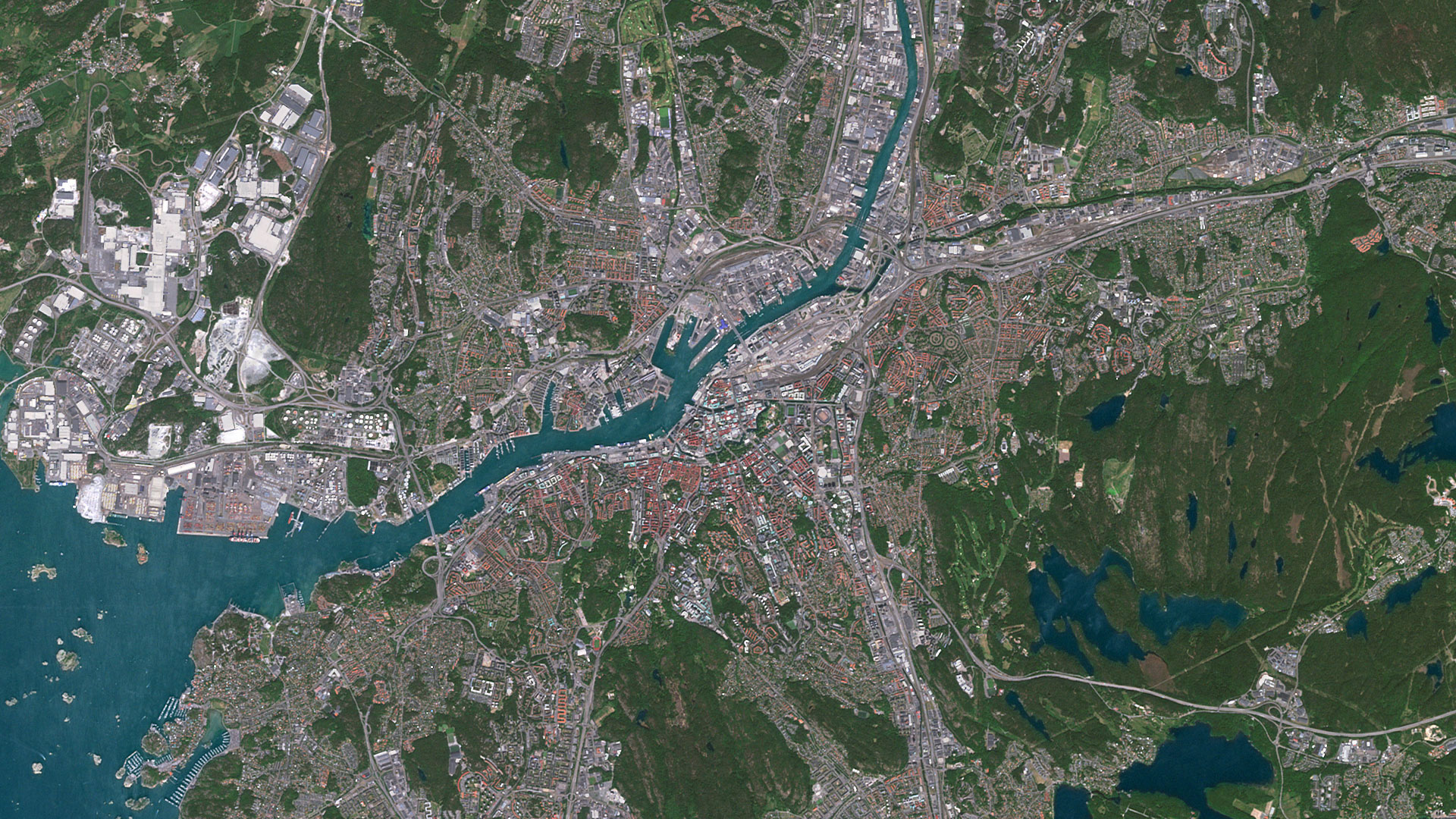
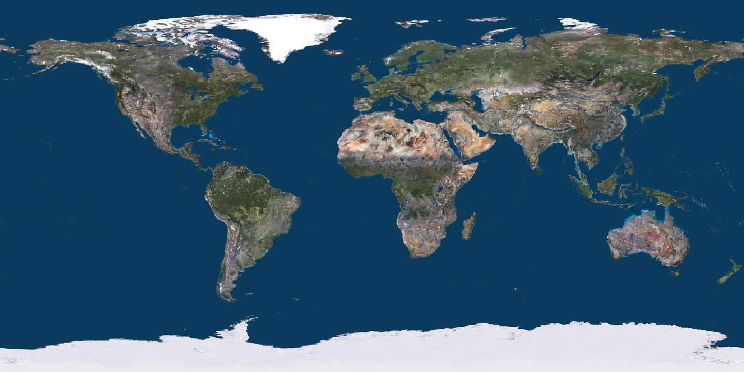
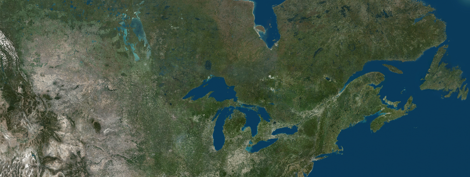
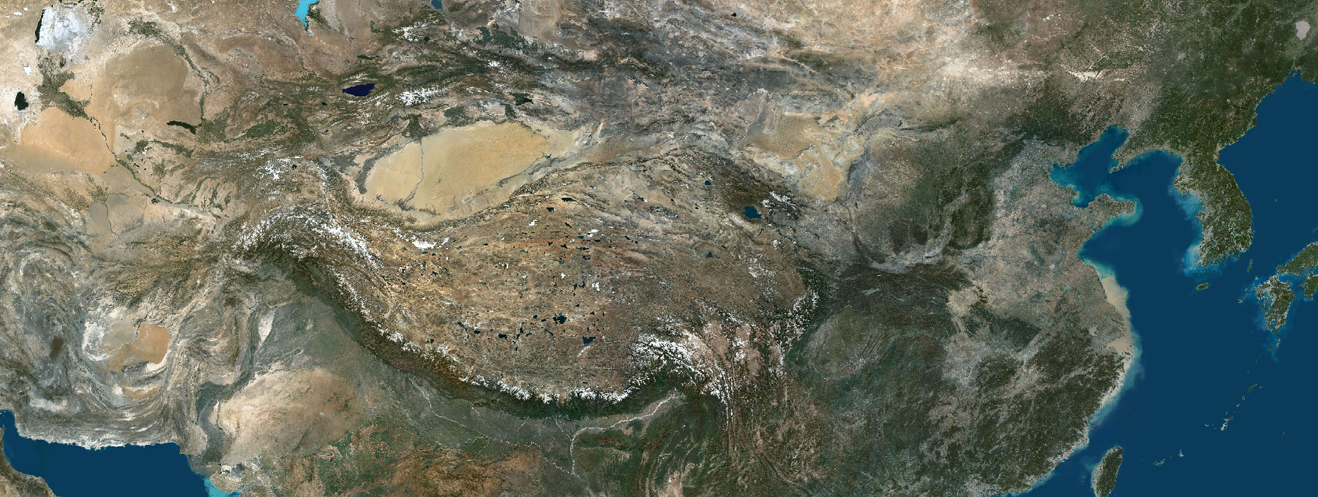
Built primarily from ESA Sentinel-2 imagery at 10-meter resolution, PlanetSAT provides a seamless, cloud-free, and visually coherent view of the Earth’s surface. As a result, it serves as an ideal foundation for mission preparation, real-time visualization, cartographic projects, and other geospatial applications where both accuracy and aesthetics matter.
A Carefully Curated Global Basemap
Producing a global mosaic that meets professional standards begins with meticulous data selection. To achieve this, PlanetSAT is primarily generated from a curated collection of Sentinel-2 scenes, each chosen for its clarity, recency, and minimal cloud coverage.
However, satellite data selection is far from trivial. Beyond image quality alone, each scene must be evaluated for its seasonal balance, radiometric stability, and geographic consistency. Indeed, these criteria are essential for maintaining visual continuity and ensuring that the the mosaic accurately represents the planet’s diversity — from arid deserts to tropical forests and polar regions.
To address this challenge, PlanetObserver has developed a proprietary cataloguing and prioritization process. Through this internal system, the team can efficiently manage petabyte-scale inputs while selecting only the most relevant and consistent scenes for integration. As a result, every tile of the global mosaic reflects the highest-quality data available, both technically and visually. Ultimately, this rigorous selection process lays the foundation for a seamless and reliable global basemap.
Harnessing the Power of Sentinel-2 Imagery
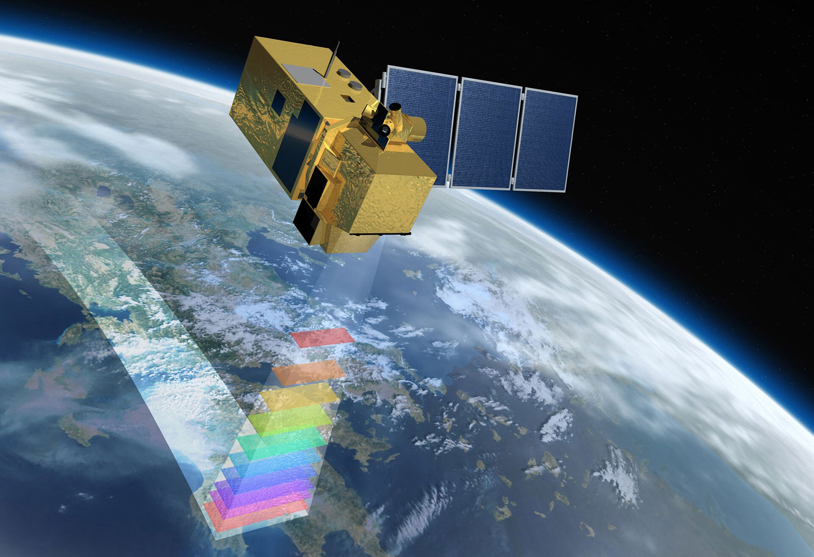
The choice of Sentinel-2 as the primary source is strategic. Operated by the European Space Agency, the twin satellites deliver imagery with high radiometric quality and frequent revisit times — every five days at the equator.
As a result, multiple acquisition opportunities are available for any given location, making it easier to minimize cloud cover and capture optimal seasonal conditions. This represents a significant advantage for global mapping projects, where consistency and coverage are critical.
By using Sentinel-2 data, PlanetSAT benefits from several key advantages:
• Uniform global coverage at 10m resolution.
• Consistent multispectral characteristics ideal for color calibration.
• Free and open data access, ensuring the long-term sustainability and continuity of the dataset.
Ultimately, these strengths contribute to the visual coherence, reliability, and scalability that distinguish PlanetSAT as a professional-grade global basemap.
To see these benefits firsthand, explore the latest version of PlanetSAT through our online viewer. There, you can experience the quality of the updated basemap in a seamless and immersive environment. Furthermore, the viewer highlights the expanded coverage and enhanced visual consistency introduced in the latest release, helping you discover how PlanetSAT can elevate your own geospatial projects.
From Raw Data to a Global Vision
Once the most suitable satellite scenes have been selected, they undergo a series of processing steps that transform them into the finished PlanetSAT basemap. From mosaic assembly and cloud management to color calibration and quality control, each phase contributes to the dataset’s overall coherence, accuracy, and usability.
However, what truly sets PlanetSAT apart is not only the sophistication of its technical processing pipeline but also the careful balance between automation and human expertise. While advanced algorithms perform large-scale processing tasks with speed and consistency, the final product also benefits from decades of experience in visual interpretation and color harmonization.
As a result, PlanetSAT combines the strengths of both approaches. On the one hand, automated technologies ensure efficiency, scalability, and consistency across the entire globe. On the other hand, human expertise plays a critical role in preserving realism, correcting subtle visual inconsistencies, and maintaining the highest standards of visual quality.
Ultimately, this combination defines PlanetObserver’s approach to global basemap production: technology provides the foundation, while expert knowledge delivers the refinement that transforms satellite imagery into a seamless and visually compelling representation of the Earth.
A Foundation for Professional Applications
As a result of this rigorous production process, PlanetSAT has become an essential base layer for professional users who demand both accuracy and aesthetics. Today, its applications span a wide range of industries— from situational awareness and mission planning in defense systems to the immersive realism required by flight simulators and the visual quality required in broadcast media.
Furthermore, PlanetSAT’s seamless and visually consistent representation of the Earth’s surface makes it highly adaptable to a variety of operational environments. Whether used as a standalone map or integrated into a complex simulation platform, it delivers a harmonized view of the planet that users can trust.
Next in the Series:
The second article will reveal how PlanetObserver combines automated preprocessing, cloud masking, and manual color harmonization to create one of the most visually consistent and technically advanced global imagery basemaps available today.
Find out more about Sentinel-2 imagery on Copernicus website [Copernicus is the Earth observation component of the European Union’s Space programme].
Let's talk
Ready to enhance your project with high-quality geospatial data?
Talk to our team to get started.
