


Imagery Basemap in Trophy Games’ Simulation Games

Trophy Games powers real world immersion with PlanetSAT, PlanetObserver’s satellite imagery basemap for simulation games.
Key Benefits
A map players can trust, thanks to visually authentic satellite imagery.
Smooth, responsive performance across all devices using web optimized mosaics.
A seamless experience at every scale with global coverage from Zoom 0 to 14.
Effortless integration into Trophy Games’ workflow, with no data conversion.
Products Used
THE CLIENT - Trophy Games, a Game Studio Built Around Real World Passions
Founded in 2006 in Copenhagen, Trophy Games Development is a data and business driven game studio with no bullshit mentality, as they say on their website. Their mission is simple: build simulation games around real world interests to immerse players in their passions online. At Trophy Games, the team doesn’t just make games; they cultivate a workspace that thrives on joy and engagement. With 51 team members of 21 nationalities, the studio has built something rare in the games industry: a team that stays.
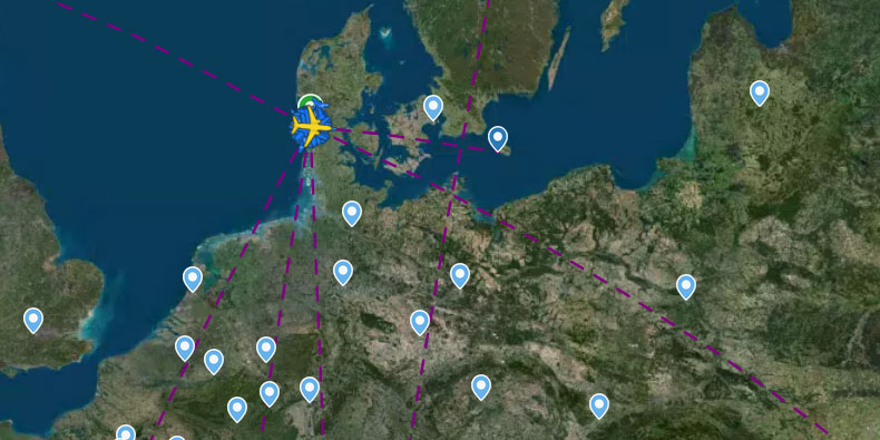
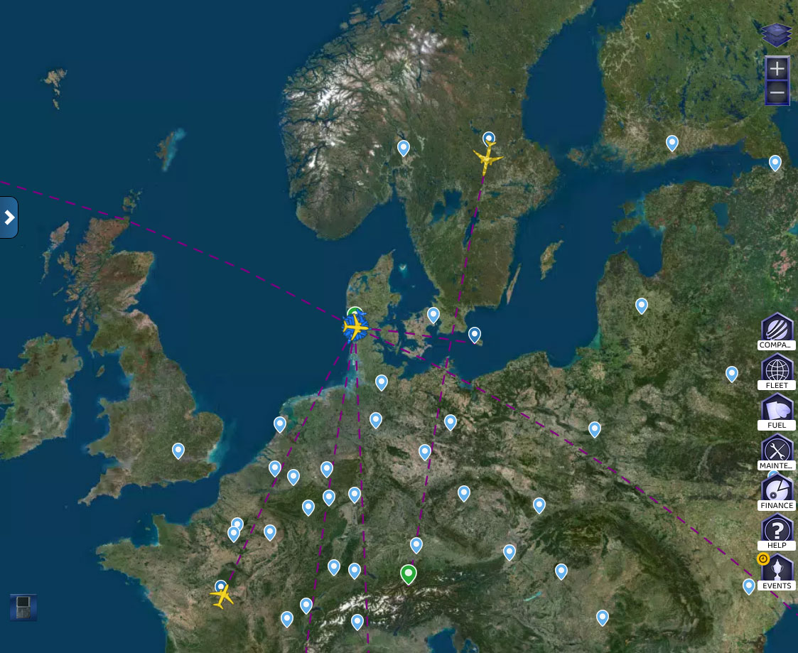
Their flagship title, Airline Manager, is one of the best free airline management games in the world. With over 10 million downloads on the Play Store and a 4.3-star rating of more than 83,700 reviews, it has earned a loyal global following. Players take the role of an airline CEO, choosing from over 360 real plane types and operating routes to more than 4,000 real airports worldwide. Most importantly, they track every flight in real time on an interactive world map. This means the quality of that map is not just a visual detail. It is a core part of the experience.
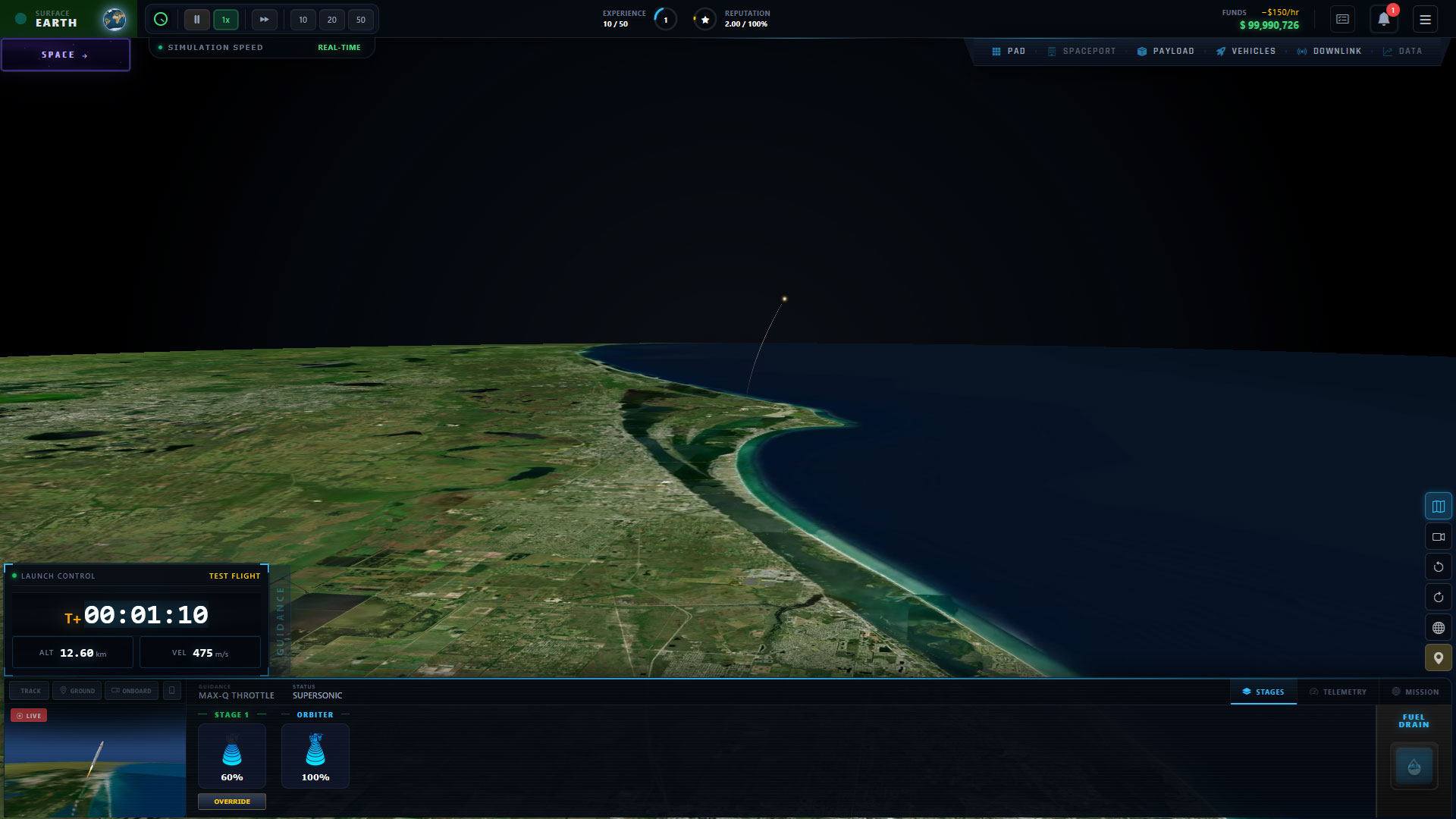
Building on that foundation, Trophy Games is now expanding into aerospace simulation with Space Manager. In Space Manager, players can establish a launchpad, making globally consistent and accurate satellite imagery basemap for simulation games a fundamental requirement.

THE CHALLENGE - When Pixelated Maps Break the Experience
For a studio whose identity is built on realism, the imagery basemap layer cannot be an afterthought. However, that is exactly what it had been in earlier versions of their games. Players noticed and they said so. Feedback pointed to pixelated, outdated imagery that broke the immersive experience the games were designed to deliver. For a team as passionate about quality as Trophy Games, that was unacceptable.
In Airline Manager, the basemap is the stage on which the entire game plays out. Players plan intercontinental routes and track flights in real time. As a result, even subtle inconsistencies in the imagery, color shifts between regions, and blurry tiles at closer zoom levels are immediately visible. They pull players out of the simulation and undermine the credibility of the product.
Beyond visual quality, Trophy Games also had specific technical requirements. They needed imagery delivered on a web compatible format available across a wide range of zoom levels. In short, the solution had to work directly within their game engine pipeline without heavy conversion work on their end.
THE SOLUTION - PlanetSAT Imagery Basemap for Simulation Games
To address both the visual and technical challenges, Trophy Games chose the PlanetSAT Basemap by PlanetObserver for use in both Airline Manager and Space Manager. The data was processed by PlanetObserver specifically to Trophy Games’ requirements.
Working with PlanetObserver was a very positive experience. Their team quickly understood our technical requirements and provided a global imagery dataset that combined visual quality, consistency, and ease of integration. PlanetSAT basemap allows to deliver a realistic and seamless mapping experience to our players. The responsiveness and flexibility of the PlanetObserver team made them a valuable partner throughout the project.
Sigurd Hjorth Andersen, Head of R&D, Trophy Games
The result was a globally consistent, cloud free, color balanced imagery basemap for simulation games delivered to the following specifications:
- Projection: Web Mercator (EPSG:3857), ensuring direct compatibility with their game engine rendering pipeline rather than the standard Geographic WGS84 (EPSG:4326).
- Format: WebP tiles at 256×256 pixels, packaged in MBTiles format for efficient storage and delivery.
- Zoom levels: Zoom 0 to Zoom 14, covering everything from a full planetary overview to detailed regional imagery.
- Processing: Cloud free and color balanced across the entire globe, so every region looks consistent.
THE BENEFITS - A World That Players Believe In
- Visual Authenticity That Supports Immersion
Above all, the upgrade to PlanetSAT imagery basemap resolved the core complaint: pixelated, outdated imagery is gone. Players now see a sharp, natural color, cloud free Earth beneath their routes and decisions. For a game built on the promise of realism, this is not a minor improvement; it is the foundation of player’s trust.
- Full Global Coverage for a Global Audience
Trophy Games’ player base spans the world and so do their games. PlanetSAT provides uniform global coverage with no weak spots. Consequently, every region, whether a player’s home country or a remote destination, is rendered at the same level of quality as imagery for interactive apps. For Space Manager in particular, where players can place a launchpad anywhere on Earth, this global consistency is essential.
- On Demand Processing for Their Exact Needs
PlanetObserver processed the imagery specifically to Trophy Games’ specifications. This on demand approach meant the team received data that was ready to use from the start, enabling quick integration and reducing time to deployment. In other words, the solution was built around their workflow, not the other way around.
By integrating PlanetSAT imagery basemap into both Airline Manager and Space Manager, Trophy Games has ensured that their commitment to real world immersion extends all the way down to the map layer. This gives millions of players a world as authentic as the simulations built upon it.
Discover more Customer Success Stories

Let's talk
Ready to enhance your project with high-quality geospatial data?
Talk to our team to get started.
