


PlanetSAT — A Technically Advanced Global Imagery Basemap
Back to All Articles PlanetSAT — A Technically Advanced Global Imagery Basemap Discover how PlanetObserver transforms Sentinel-2 imagery into a seamless, accurate, and visually consistent global imagery basemap. A New Standard in Global Imagery In the geospatial sector, the value of satellite imagery lies not only in its visual appeal but also in its accuracy, […]
The Satellite World Map Like No Other
Back to All Stories The Satellite World Map Like No Other Discover how PlanetSAT satellite world map has evolved over 20 years, providing seamless global imagery for various industries. In January 2025, we launched our new and improved free online viewer featuring PlanetSAT satellite world map. With new display features, including globe and flat earth […]
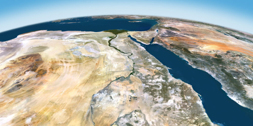
Discover PlanetSAT Imagery Basemap 2025 with Expanded Updates
Back to All Articles Discover PlanetSAT Imagery Basemap 2025 with Expanded Updates Check out PlanetSAT Global Basemap 2025, an advanced imagery basemap with updated coverage, refined colors, and seamless details. Clermont-Ferrand, France – March 25, 2025 – PlanetObserver, a leading provider of high-quality geospatial data, announces the release of PlanetSAT Imagery Basemap 2025, the latest edition […]
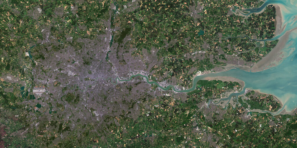
Super Resolution Imagery: The Example of France from 10-Meter to 5-Meter
Back to All Stories Super Resolution Imagery: The Example of France from 10-Meter to 5-Meter Experience clearer, more detailed views of France with our 5m satellite imagery. Explore our super resolution imagery now! In many practical applications, insufficient spatial resolution of images poses a significant limitation, particularly when higher-resolution images are difficult to collect […]
Capabilities of PlanetObserver – Part 5: Ready-to-Use Geospatial Data
Back to All Stories Capabilities of PlanetObserver – Part 5: Ready-to-Use Geospatial Data Explore how PlanetObserver’s customized geospatial data solutions cater to the unique needs of various industries. In the fast-evolving world of geospatial technology, delivering user-adapted data that seamlessly integrates into existing solutions is crucial. At PlanetObserver, we provide ready-to-use geospatial data tailored […]
Meet the Team – Episode 4: Laurent’s Passion for Geospatial Projects
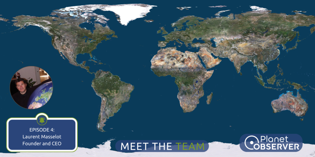
Back to All Stories Meet the Team – Episode 4: Laurent’s Passion for Geospatial Projects In the 4th episode of our « Meet the Team » series, we learn more about our CEO Laurent and his passion for Geospatial Projects. Interview 4: Laurent Meet Laurent Masselot, the visionary founder and CEO of PlanetObserver, whose journey represents […]
Capabilities of PlanetObserver – Part 4: Global Elevation Dataset
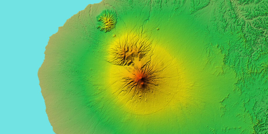
Back to All Stories Capabilities of PlanetObserver – Part 4: Global Elevation Dataset PlanetObserver showcases its skills in Global Elevation Data production. In the field of geospatial data, Digital Elevation Models (DEMs) provide critical insights into Earth’s topography. Among these, PlanetObserver offers a notable contribution with its PlanetDEM 30-meter Global Elevation Dataset. In this […]
Press Release: PlanetSAT Global Basemap 2024
Back to All Stories Press Release: PlanetSAT Global Basemap 2024 PlanetObserver highlights its capabilities in Satellite Imagery Color Correction. CLERMONT-FERRAND, France – April 16, 2024 – PlanetObserver, a prominent supplier of geospatial data, is thrilled to unveil the PlanetSAT Global Basemap 2024. This 10-meter global basemap offers up-to-date, cloud-free, and consistent imagery for a large range of […]
Capabilities of PlanetObserver – Part 3: Satellite Image Color Correction

Back to All Stories Capabilities of PlanetObserver – Part 3: Satellite Image Color Correction PlanetObserver highlights its capabilities in Satellite Imagery Color Correction. Satellite imagery is a powerful tool for understanding our planet. At PlanetObserver, we specialize in transforming raw satellite data into a visually compelling, scientifically accurate global 10-meter imagery mosaic, PlanetSAT Basemap. Additionally, […]
Meet the Team – Episode 3: Satellite Image Color Processing with Bruno
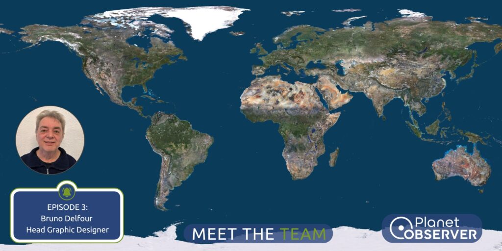
Back to All Stories Meet the Team – Episode 3: Satellite Image Color Processing with Bruno In the 3rd episode of our « Meet the Geospatial Team » series, we get to know Bruno as he talks about satellite image color processing. The process of creating satellite image mosaics is central to our mission, involving the artful […]
