


New PlanetDEM Global Elevation Dataset Enhancing Data Reliability
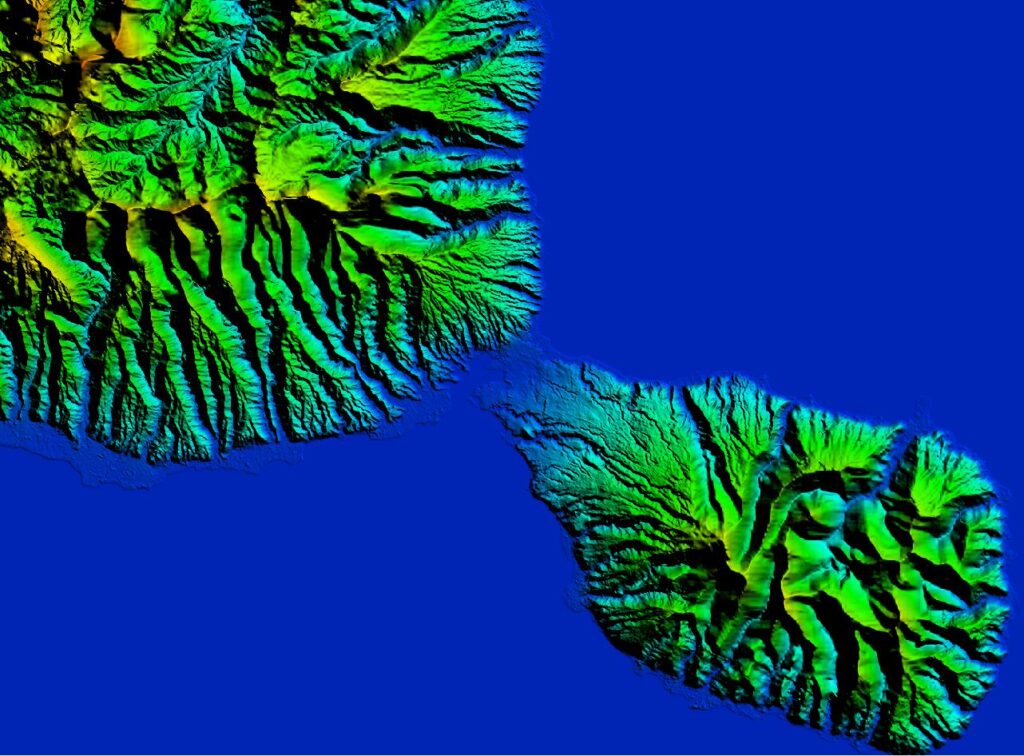
Back to All Articles New PlanetDEM Global Elevation Dataset Enhancing Data Reliability PlanetObserver’s Expertise in Elevation Model: Achieving Global Reliability with AW3D30 Data CLERMONT-FERRAND, France – March 24, 2022 – PlanetObserver is excited to announce the release of PlanetSAT Global 2022, a basemap that provides ready-to-perform, cloudless, and homogeneous imagery. Making Global Elevation Dataset […]
PlanetDEM – A Highly Reliable Digital Elevation Model
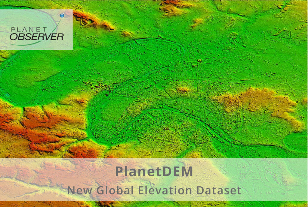
Back to All Articles PlanetDEM – A Highly Reliable Digital Elevation Model Rely on a trusted global 30m Digital Elevation Model ready to use in all civil and military applications. CLERMONT-FERRAND, FRANCE – November 16, 2021 – PlanetObserver has released PlanetDEM, its new global Digital Elevation Model (DEM) with a 30m and a 90m resolution. This new […]
Celebrating the 30th Anniversary of PlanetObserver
Back to All Articles Celebrating the 30th Anniversary of PlanetObserver Thirty years ago, PlanetObserver was founded with the goal of mapping the Earth to understand our planet better. CLERMONT-FERRAND, France – November 25, 2019 – PlanetObserver is a European provider of value-added geospatial data and satellite imagery for civil and military solutions used in various […]
Partnership with Airbus Defence and Space: New VHR Geospatial Data

Back to All Articles Partnership with Airbus Defence and Space: New VHR Geospatial Data PlanetObserver Announces Partnership with Airbus Defence and Space to Distribute their Portfolio of Very High Resolution Geospatial Data in Europe CLERMONT-FERRAND, France – March 26, 2019 – PlanetObserver, provider of value-added geospatial data for civil and military solutions, today announced a […]
Release of PlanetSAT Updated Global Imagery Basemap
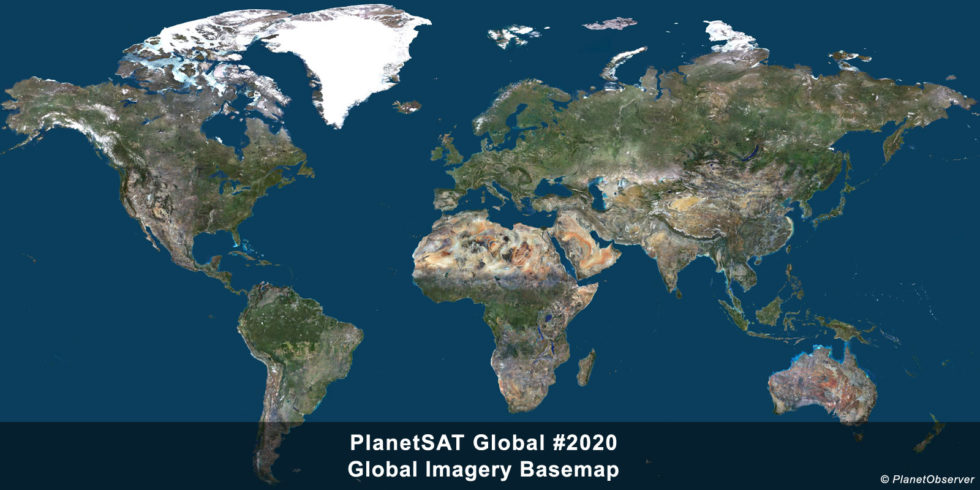
Back to All Articles Release of PlanetSAT Updated Global Imagery Basemap Best available Sentinel-2 imagery is used to update PlanetSAT 10-meter imagery basemap. CLERMONT-FERRAND, France – June 18, 2020 – PlanetObserver is a European provider of value-added geospatial data and satellite imagery for civil and military solutions used in various industries, ranging from Defense to […]
The Collaboration with Aerospace Valley Competitiveness Cluster

Back to All Articles The Collaboration with Aerospace Valley Competitiveness Cluster Happy to join Aerospace Valley ecosystem, the leading cluster of the Aerospace sector in the world. The Competitiveness Cluster dedicated to the Aerospace industry PlanetObserver is excited to become a new member of Aerospace Valley cluster. Aerospace Valley is the leading competitiveness cluster […]
Updated Global Imagery Basemap Released by PlanetObserver
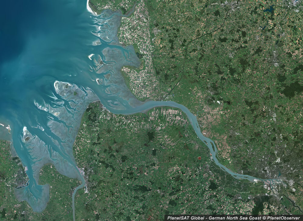
Back to All Articles Updated Global Imagery Basemap Released by PlanetObserver PlanetObserver has committed to an impressive annual update schedule that makes PlanetSAT 10m basemap more robust every year. CLERMONT-FERRAND, France – March 16, 2021 – PlanetObserver is excited to announce the release of PlanetSAT Global version 2021, a basemap that provides ready-to-use, seamless […]
Connect by CNES Backs PlanetObserver

Back to All Articles Connect by CNES Backs PlanetObserver PlanetObserver is very happy to benefit from the support of Connect by CNES for the development of key geospatial projects. CNES expertise at the service of innovation The French National Centre for Space Studies (CNES) is responsible for the development and implementation of the French spatial […]
All New 10m Global Imagery Basemap by PlanetObserver
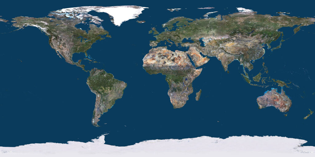
Back to All Articles All New 10m Global Imagery Basemap by PlanetObserver Discover PlanetSAT 2022, the 10m basemap that provides unrivaled seamless and visually stunning imagery of the whole Earth. CLERMONT-FERRAND, France – March 24, 2022 – PlanetObserver is excited to announce the release of PlanetSAT Global 2022, a basemap that provides ready-to-perform, cloudless, […]
