Skip to content
Menu
Fermer
Home
Products
Global Imagery Basemap
Global Elevation Data
Global Imagery Basemap
Global Elevation Data
Industries
Defence & Intelligence
Aerospace
Mapping
Graphics & Animation
Defence & intelligence
Aerospace
Mapping & GIS
Graphics & Animation
Resources
Blog
Customer Stories
About us
Home
Products
Global Imagery Basemap
Global Elevation Data
Global Imagery Basemap
Global Elevation Data
Industries
Defence & Intelligence
Aerospace
Mapping
Graphics & Animation
Defence & intelligence
Aerospace
Mapping & GIS
Graphics & Animation
Resources
Blog
Customer Stories
About us
Home
Products
Global Imagery Basemap
Global Elevation Data
Industries
Defence & Intelligence
Aerospace
Mapping
Graphics & Animation
Resources
Blog
Customer Stories
About us
Contact
Explore the World
Home
Products
Global Imagery Basemap
Global Elevation Data
Industries
Defence & Intelligence
Aerospace
Mapping
Graphics & Animation
Resources
Blog
Customer Stories
About us
Contact
Explore the World
Contact us
Explore the world
Menu
Fermer
Home
Products
Global Imagery Basemap
Global Elevation Data
Global Imagery Basemap
Global Elevation Data
Industries
Defence & Intelligence
Aerospace
Mapping
Graphics & Animation
Defence & intelligence
Aerospace
Mapping & GIS
Graphics & Animation
Resources
Blog
Customer Stories
About us
Home
Products
Global Imagery Basemap
Global Elevation Data
Global Imagery Basemap
Global Elevation Data
Industries
Defence & Intelligence
Aerospace
Mapping
Graphics & Animation
Defence & intelligence
Aerospace
Mapping & GIS
Graphics & Animation
Resources
Blog
Customer Stories
About us
Contact us
Explore the world
Press Release Posts
Back to All Posts
Partners
Geospatial Data
Press Release
Press Release
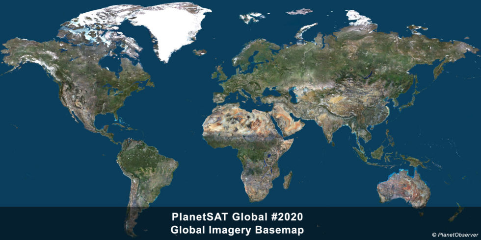
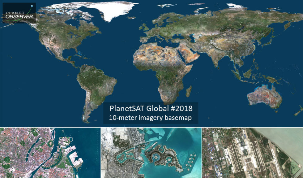
Press Release: PlanetSAT Global Basemap 2024
Press Release
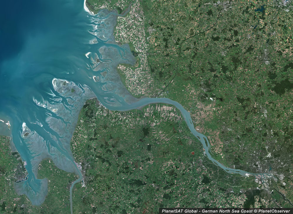
Introducing PlanetObserver’s Stunning 10m Global Imagery Basemap
Press Release
PlanetDEM – A Highly Reliable Digital Elevation Model
Press Release
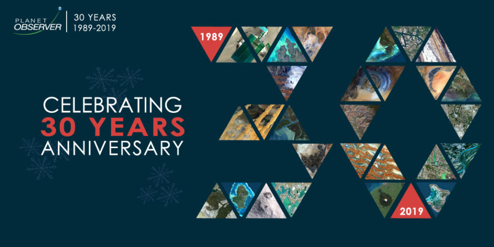
Celebrating the 30th Anniversary of PlanetObserver
Press Release
Partnership with Airbus Defence and Space: New VHR Geospatial Data
Press Release
Release of PlanetSAT Updated Global Imagery Basemap
Press Release
Release of New, Accurate and Recent Global Imagery Mosaic
Press Release
Updated Global Imagery Basemap Released by PlanetObserver
Press Release
All New 10m Global Imagery Basemap by PlanetObserver