


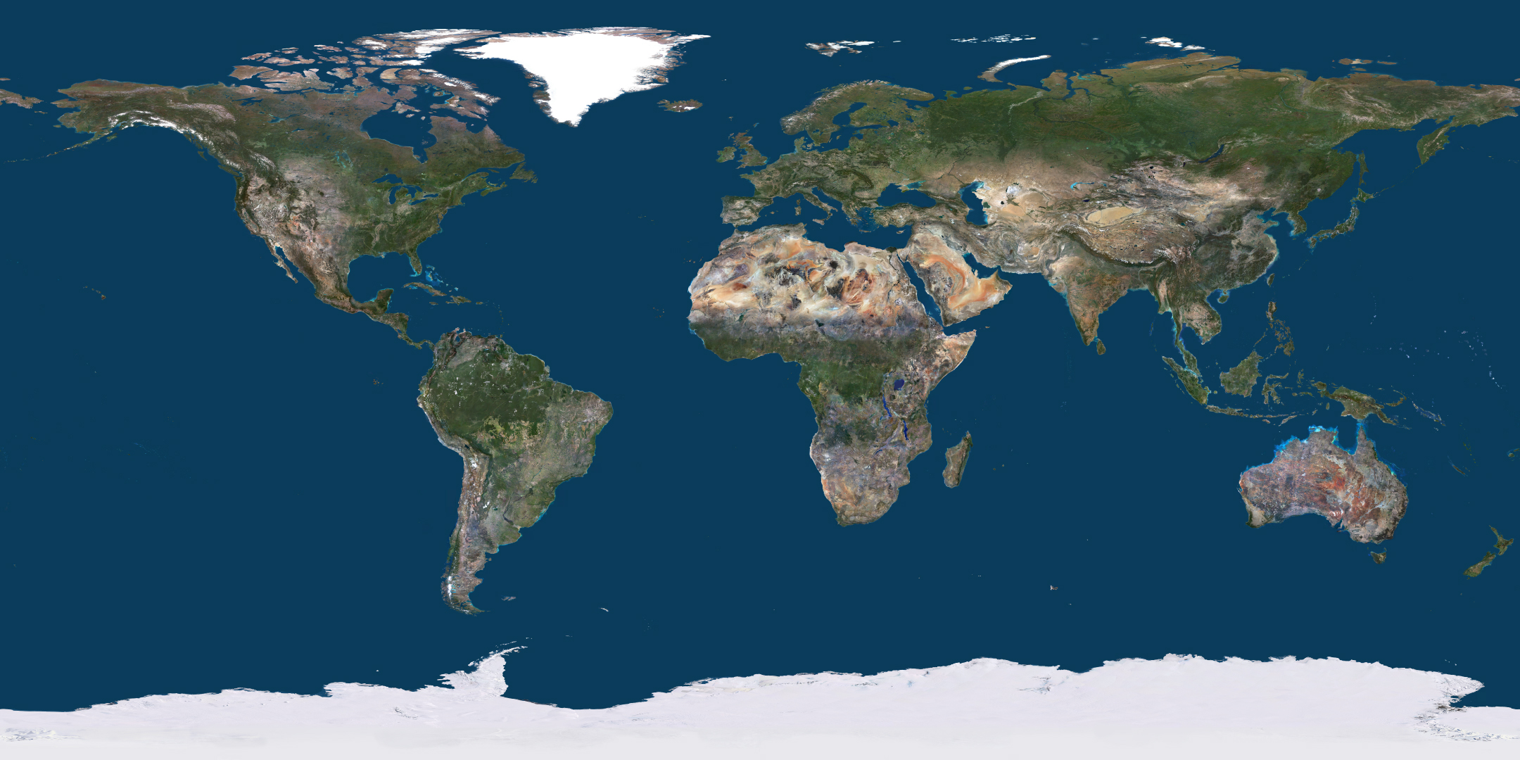
PlanetDEM – A Highly Reliable Digital Elevation Model
Rely on a trusted global 30m Digital Elevation Model ready to use in all civil and military applications.
CLERMONT-FERRAND, FRANCE – November 16, 2021 – PlanetObserver has released PlanetDEM, its new global Digital Elevation Model (DEM) with a 30m and a 90m resolution. This new DEM offers an updated, reliable, and homogeneous 3D dataset of the entire Earth’s land mass to serve a wide range of military and civil applications.
What about quality?
PlanetDEM’s quality control steps include checking the completeness of the dataset, the statistical plausibility, and the overall visual plausibility. The dataset comes with a mask file that details the source of each pixel and complete metadata. This information is key for sensitive DEM applications that need to meet specific reliability standards. Furthermore, these quality control steps, and documentation make PlanetDEM a highly reliable Digital Surface Model.
Who needs PlanetDEM?
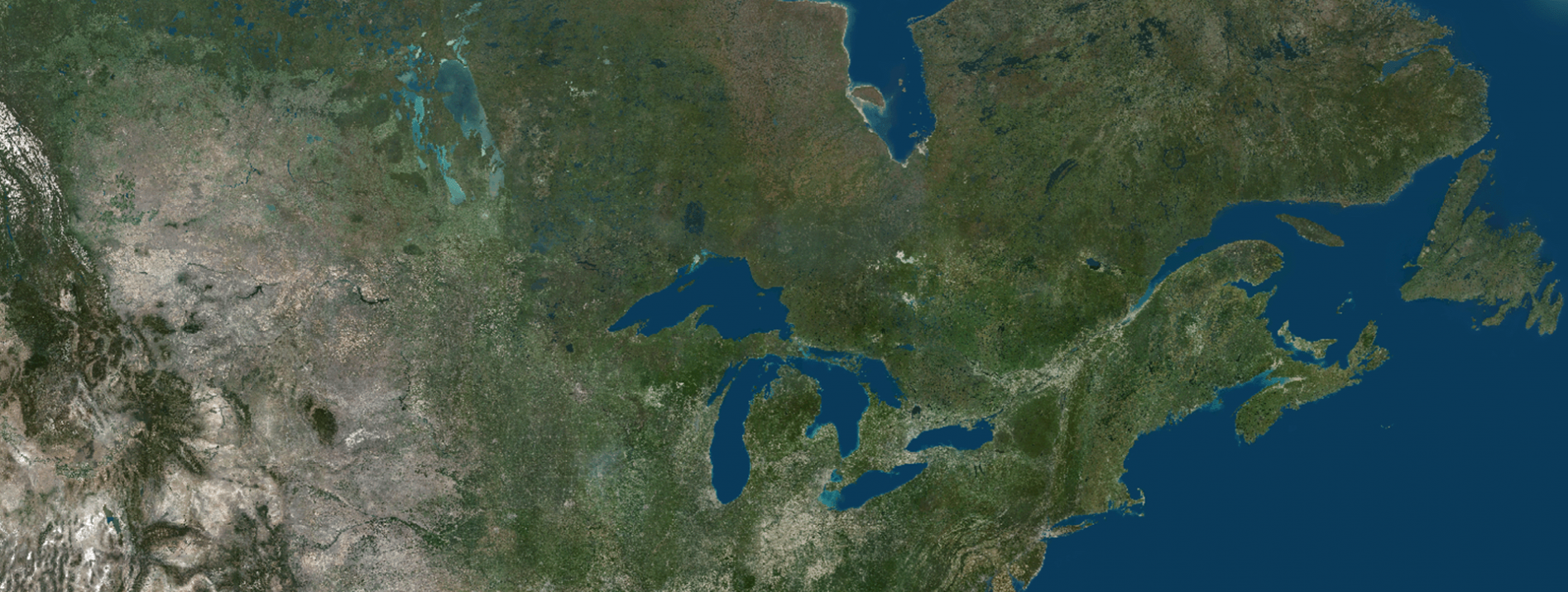
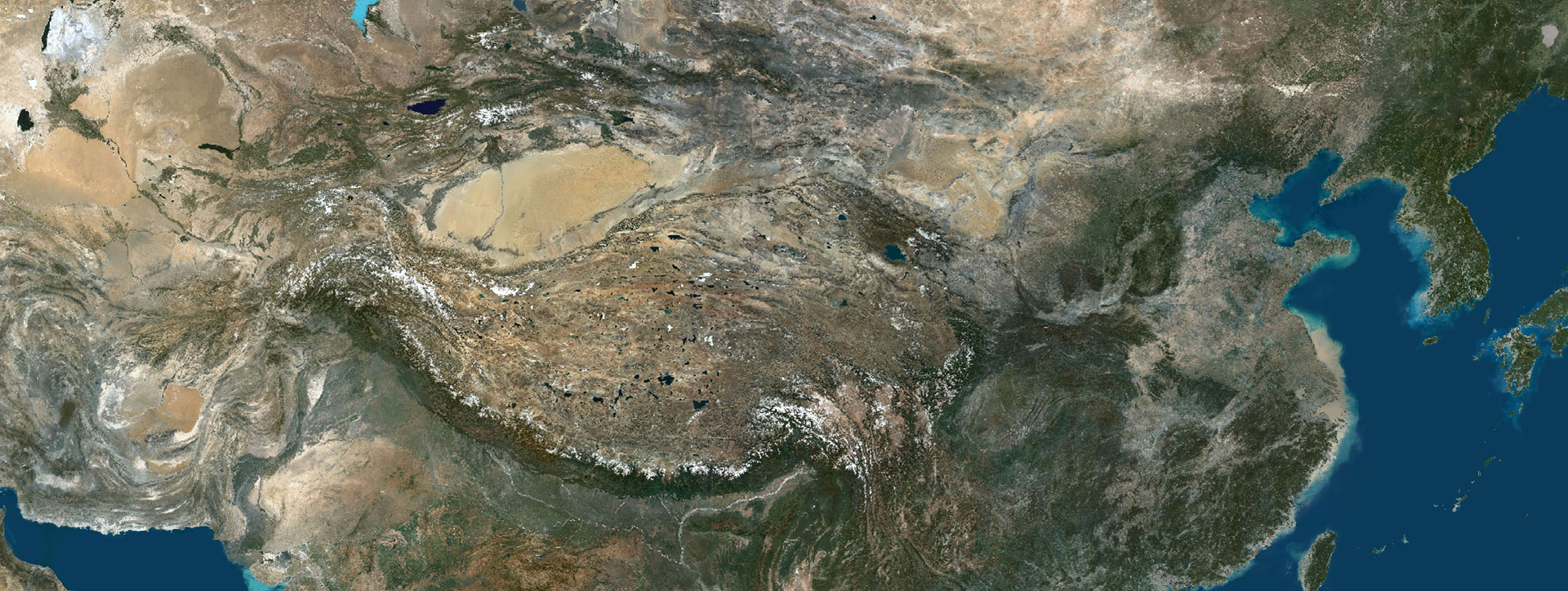
Simply everything… from the source of the data to the documentation of the new PlanetDEM dataset. It is based on ALOS World 3D – 30m (AW3D30) open-source data from the Japan Aerospace Exploration Agency (JAXA). Even though this source data has been greatly improved and complemented, it still contains many errors that limit its reliability and use. Therefore, great value has been added by correcting the highest number of spatial errors possible through the detection of inaccurate artifact spikes and depressions. Also, repairing interposing data that appears when deleting the errors.
As a result, PlanetObserver has corrected 35% of the Earth’s tiles and therefore created a medium-resolution, high-quality elevation model with 7-meter horizontal and vertical accuracy.
« We are the only ones in the industry to have this price/quality ratio, this is really interesting for all types of companies. Our goal has always been to provide innovative solutions both for our industry and to answer our clients’ needs »
Laurent Masselot, PlanetObserver’s CEO
Who needs PlanetDEM?
Due to its reliability and quality, PlanetDEM elevation model is adapted for both civil and military applications. Orthorectification and GIS applications such as land planning and oil and gas projects are some of the main needs of the industry. Regarding military use, PlanetDEM is perfect for flight simulations, mission preparation systems, and geospatial intelligence (GEOINT).
About PlanetObserver
Based in France and established in 1989, PlanetObserver is specialized in the processing and production of high value-added geospatial data. The company develops innovative products that maximize the visual and technological performances of all clients’ projects and solutions in the Defense, Aerospace, Mapping, and GIS sectors. With a constant commitment to R&D and innovation, PlanetObserver is positioned as the supplier and partner of leading companies located in Europe, North America, and Asia-Pacific.
Let's talk
Ready to enhance your project with high-quality geospatial data?
Talk to our team to get started.
