Skip to content
Menu
Fermer
Home
Products
Global Imagery Basemap
Global Elevation Data
Global Imagery Basemap
Global Elevation Data
Industries
Defence & Intelligence
Aerospace
Mapping
Graphics & Animation
Defence & intelligence
Aerospace
Mapping & GIS
Graphics & Animation
Resources
Blog
Customer Stories
About us
Home
Products
Global Imagery Basemap
Global Elevation Data
Global Imagery Basemap
Global Elevation Data
Industries
Defence & Intelligence
Aerospace
Mapping
Graphics & Animation
Defence & intelligence
Aerospace
Mapping & GIS
Graphics & Animation
Resources
Blog
Customer Stories
About us
Home
Products
Global Imagery Basemap
Global Elevation Data
Industries
Defence & Intelligence
Aerospace
Mapping
Graphics & Animation
Resources
Blog
Customer Stories
About us
Contact
Explore the World
Home
Products
Global Imagery Basemap
Global Elevation Data
Industries
Defence & Intelligence
Aerospace
Mapping
Graphics & Animation
Resources
Blog
Customer Stories
About us
Contact
Explore the World
Contact us
Explore the world
Menu
Fermer
Home
Products
Global Imagery Basemap
Global Elevation Data
Global Imagery Basemap
Global Elevation Data
Industries
Defence & Intelligence
Aerospace
Mapping
Graphics & Animation
Defence & intelligence
Aerospace
Mapping & GIS
Graphics & Animation
Resources
Blog
Customer Stories
About us
Home
Products
Global Imagery Basemap
Global Elevation Data
Global Imagery Basemap
Global Elevation Data
Industries
Defence & Intelligence
Aerospace
Mapping
Graphics & Animation
Defence & intelligence
Aerospace
Mapping & GIS
Graphics & Animation
Resources
Blog
Customer Stories
About us
Contact us
Explore the world
Graphics & Animation
Back to All Stories
Defence & Intelligence
Aerospace
Mapping & GIS
Graphics & Animation
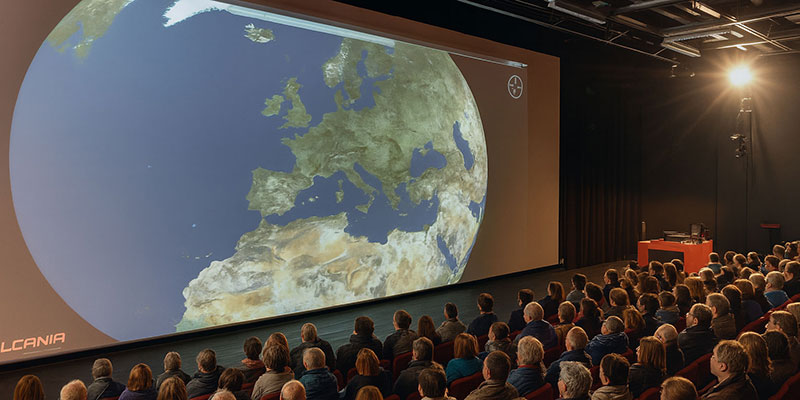
Earth Basemap for Vulcania Scientific Theme Park
How Satellite Imagery for Media Enhances Publishing and Broadcasting
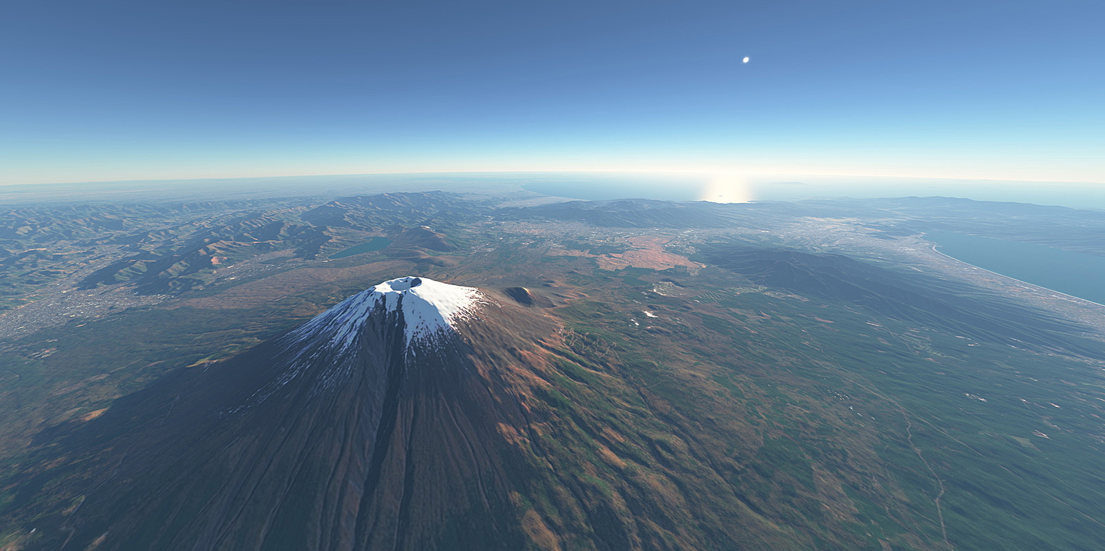
Transforming Planetarium Experiences with High-Quality World Imagery
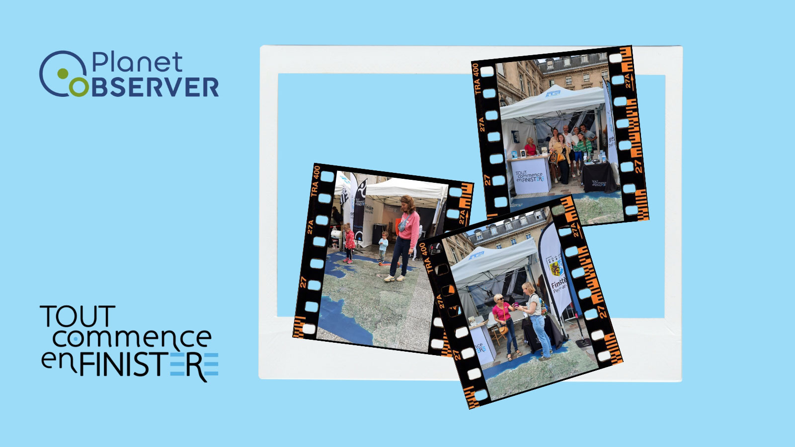
Finistère’s Printed Floor Map: A Powerful Tool for Regional Promotion
Temple University Picks PlanetObserver’s VHR Satellite Imagery
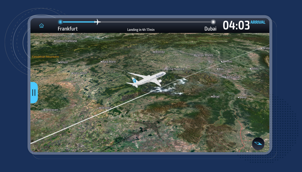
IFE Moving Maps & Imagery in Display Interactive’s Success
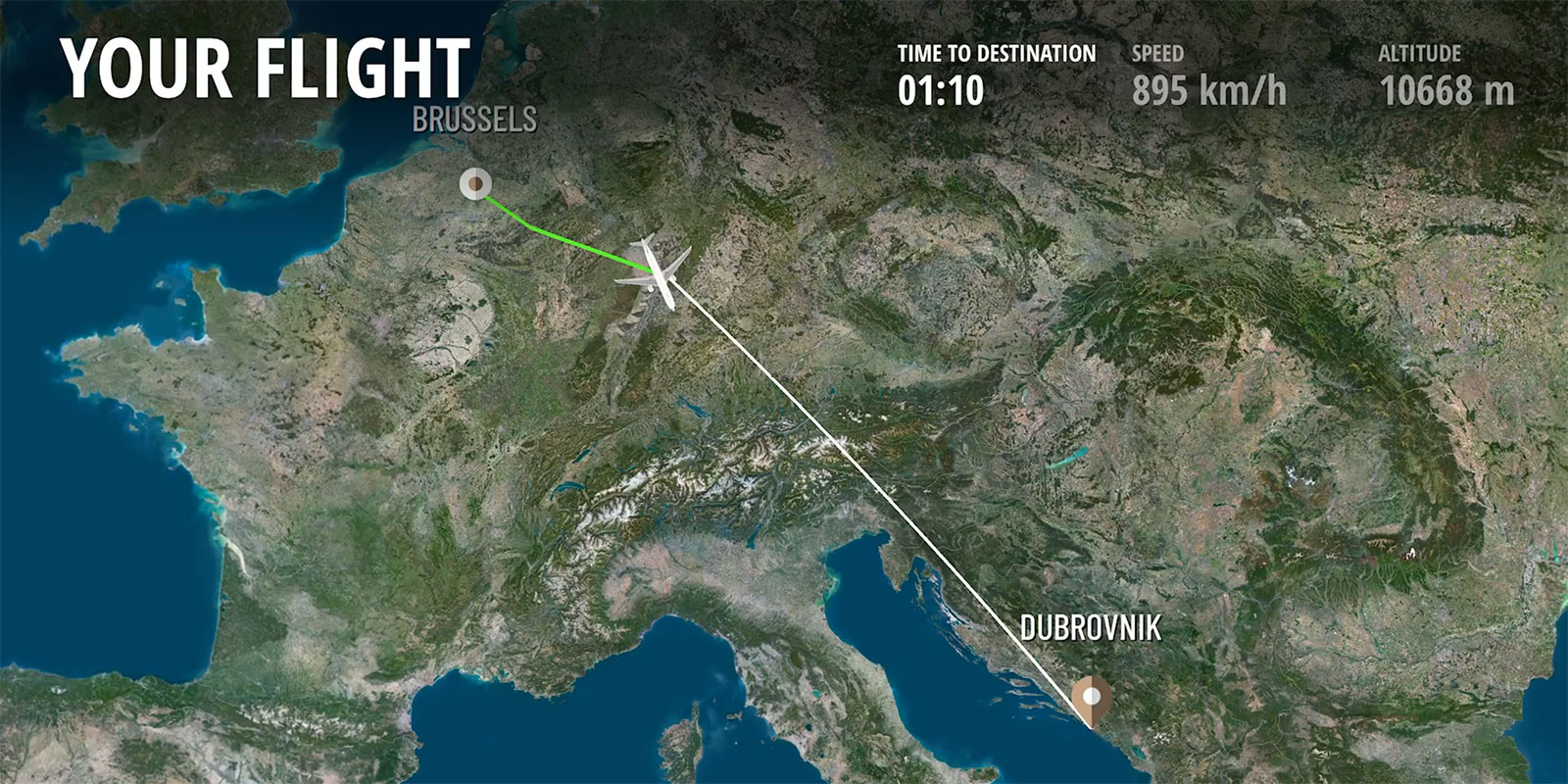
Satellite Imagery Elevating Moving Maps in IFE Solutions
Great 3D Animations Based on Satellite Imagery and Elevation Data
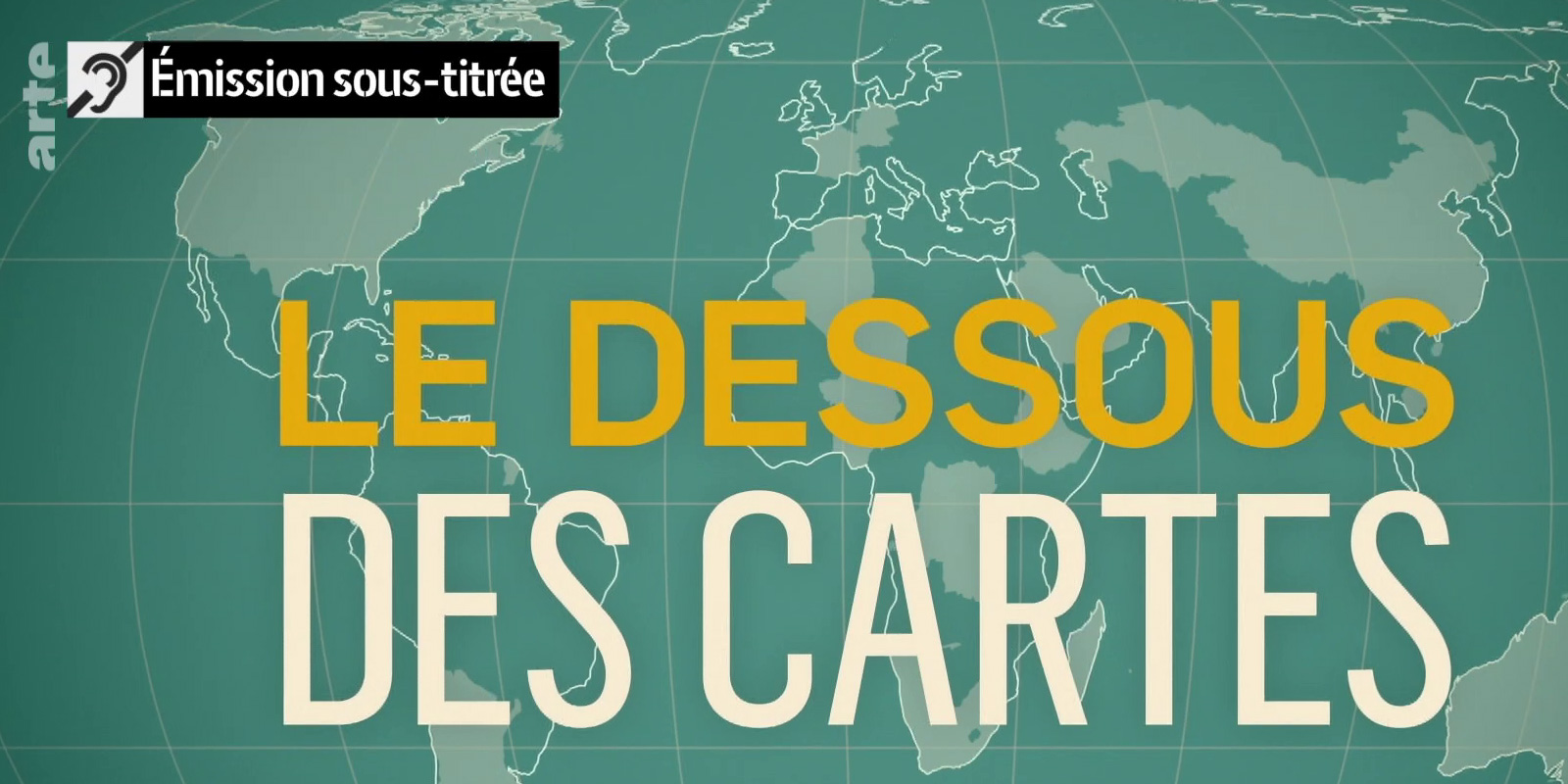
Arte Show “With Open Maps” Features PlanetObserver Satellite Maps
Optimizing Weather Visualization with Imagery and Elevation Data