Skip to content
Menu
Fermer
Home
Products
Global Imagery Basemap
Global Elevation Data
Global Imagery Basemap
Global Elevation Data
Industries
Defence & Intelligence
Aerospace
Mapping
Graphics & Animation
Defence & intelligence
Aerospace
Mapping & GIS
Graphics & Animation
Resources
Blog
Customer Stories
About us
Home
Products
Global Imagery Basemap
Global Elevation Data
Global Imagery Basemap
Global Elevation Data
Industries
Defence & Intelligence
Aerospace
Mapping
Graphics & Animation
Defence & intelligence
Aerospace
Mapping & GIS
Graphics & Animation
Resources
Blog
Customer Stories
About us
Home
Products
Global Imagery Basemap
Global Elevation Data
Industries
Defence & Intelligence
Aerospace
Mapping
Graphics & Animation
Resources
Blog
Customer Stories
About us
Contact
Explore the World
Home
Products
Global Imagery Basemap
Global Elevation Data
Industries
Defence & Intelligence
Aerospace
Mapping
Graphics & Animation
Resources
Blog
Customer Stories
About us
Contact
Explore the World
Contact us
Explore the world
Menu
Fermer
Home
Products
Global Imagery Basemap
Global Elevation Data
Global Imagery Basemap
Global Elevation Data
Industries
Defence & Intelligence
Aerospace
Mapping
Graphics & Animation
Defence & intelligence
Aerospace
Mapping & GIS
Graphics & Animation
Resources
Blog
Customer Stories
About us
Home
Products
Global Imagery Basemap
Global Elevation Data
Global Imagery Basemap
Global Elevation Data
Industries
Defence & Intelligence
Aerospace
Mapping
Graphics & Animation
Defence & intelligence
Aerospace
Mapping & GIS
Graphics & Animation
Resources
Blog
Customer Stories
About us
Contact us
Explore the world
Mapping & GIS
Back to All Stories
Defence & Intelligence
Aerospace
Mapping & GIS
Graphics & Animation
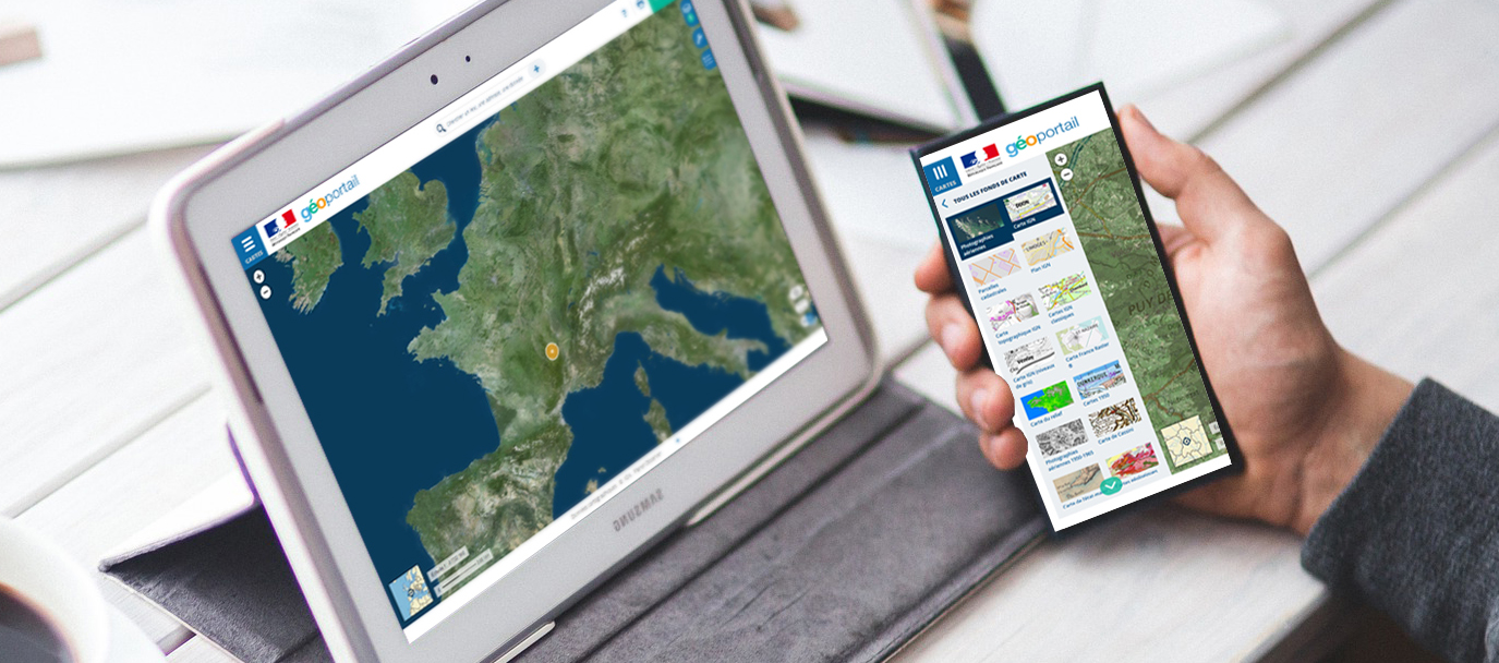
PlanetSAT World Satellite Map Enhances the French Geoportal
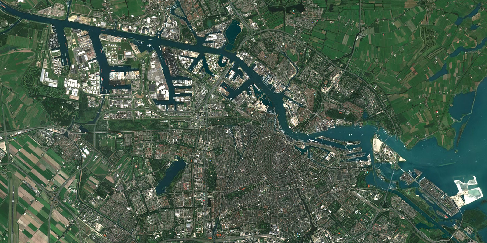
How PlanetSAT Satellite Imagery Enhances a Dutch Govermental Mapping Platform
How to enhance User Experience with Medium Resolution Global Imagery ?
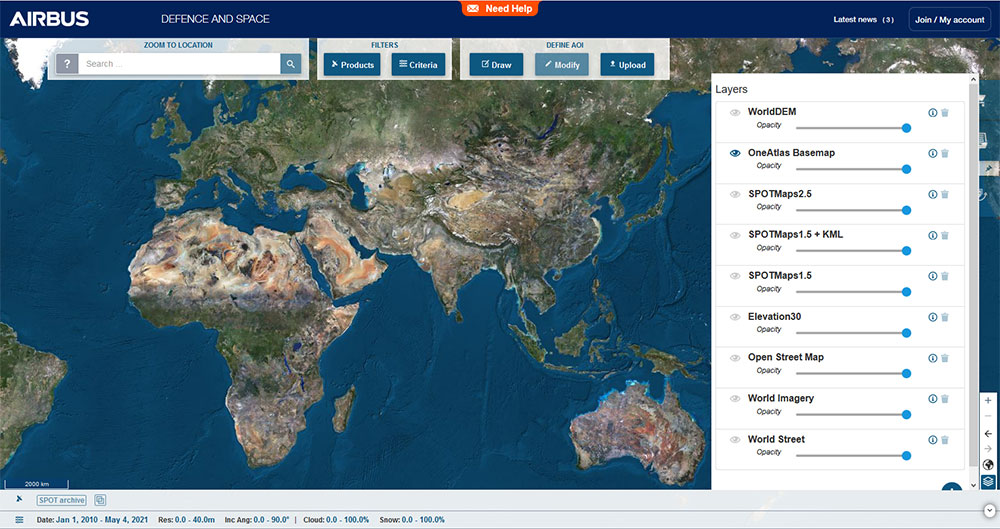
Elevation Data Aids TotalEnergies in Exploring Oil and Gas Projects
Microsoft AI for Earth uses PlanetDEM Geospatial Data
Benefits of Medium Resolution Satellite Imagery Mosaics in GIS