


Great 3D Animations Based on Satellite Imagery and Elevation Data
Explore how stunning 3D animations are created using satellite imagery and elevation data, bringing realistic landscapes and detailed terrain models to life.

Key benefits
These are the key benefits that Kinship gained by using our imagery and elevation data in their 3D animation.
1. Realistic landscapes: Kinship’s 3D animation uses natural color satellite imagery to create highly realistic landscapes.
2. 3D touch: The animation includes elevation data, providing an additional 3D touch and immersive experience.
3. Vast journey: The animation takes viewers on a vast journey and opens up new horizons.
Products used
The client : Kinship - Mitsubishi Motors Automotive Group
Kinship Marketing Agency is a full-service digital marketing firm that specializes in helping businesses and entrepreneurs reach their target audience and achieve their marketing goals. Their team of experienced marketing professionals is dedicated to providing a comprehensive suite of services that includes strategic planning, public relations, social media, and digital marketing.
The Challenge : A Motionless Trip Through Europe
Kinship has been in charge of the digital marketing campaign of the “Outlander PHEV” SUV of Mitsubishi Motors Automotive Group. This campaign shall focus both on the environmentally friendly aspects (this is a plug-in hybrid crossover) and first-rate technology.
How to translate Outlander PHEV SUV’s concept in a digital marketing campaign? The communication agency has imagined a journey…
Five passengers travel in Europe, from Paris to Norway, in the Outlander PHEV SUV. An adventure carried out in the spirit of exploration… Throughout the journey, meetings take place with influencers they admire. Those influencers are all experts and passionate in their domain, that range from fine French pastry, to photography and mountaineering.
This trip throughout Europe is broken into different stages:
• Paris – Rotterdam
• Rotterdam – Hanover
• Hanover – Malmö
• Malmö – Oslo
• Oslo – Bergen
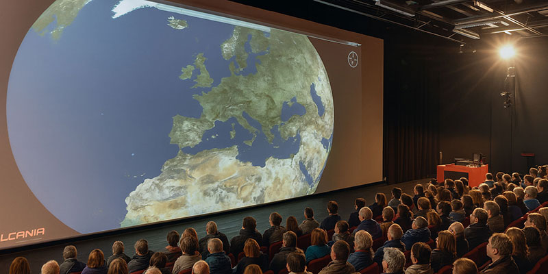
How to depict such a journey through Europe? Kinship decides to show the trip on a highly realistic cartographic background. The whole trip will be displayed in a website dedicated to this large-scale marketing campaign.
For the project, Kinship is looking for attractive satellite imagery of Europe showing the diversity of all landscapes being crossed and stimulating traveling. Moreover, they also need files that are easy to manage and implement in their web application. Short delivery time is another important aspect of this project as the marketing campaign is to be launched rapidly.
The Solution : Satellite Imagery and Elevation Data Covering Europe
Kinship communication agency quite naturally contacted us for thisproject. After carefully reviewing the project specifications, we offered the combination of satellite imagery and elevation data in order to create attractive 3D views.
The end-result proves highly realistic thanks to our satellite imagery in natural colors. All data products are processed on-demand and delivered as ready-to-use files so that the agency does not need to be involved in any data processing.
The project is based on the following data:
- Satellite imagery and elevation data covering all of Europe, sampled at 150-meter resolution.
- Land/water mask in order to separate the water layer and apply special effects on the sea.
Kinship has created a visually stunning 3D animation using our PlanetSAT global satellite imagery product and PlanetDEM our global elevation data. The animation provides a journey through satellite maps, showcasing rich and immersive experiences. The natural color satellite imagery creates a highly realistic landscape while the elevation data adds an extra dimension to the animation. The animation takes the viewer on a vast journey and opens up new perspectives and horizons, showcasing the potential of our products in creating visually stunning and informative animations.
The Benefits : Successful 3D Animation on the Web
These are the key benefits that Kinship gained by using our imagery and elevation data in their 3D animation.
1. Realistic landscapes: Kinship’s 3D animation uses natural color satellite imagery to create highly realistic landscapes.
2. 3D touch: The animation includes elevation data, providing an additional 3D touch and immersive experience.
3. Vast journey: The animation takes viewers on a vast journey and opens up new horizons.

Let's talk
Ready to enhance your project with high-quality geospatial data? Talk to our team to get started.
