


Arte Show “With Open Maps” Features PlanetObserver Satellite Maps
Learn how ARTE’s With Open Maps program showcases PlanetObserver’s high-resolution satellite imagery, providing a breathtaking and detailed perspective of Earth.
Key benefits
These are the key benefits that Arte TV show gained by using our imagery and elevation data in their 2D and 3D animations.
1. Global coverage: PlanetSAT Global imagery basemap and PlanetDEM 30 Plus global elevation data cover the entire Earth’s landmass, providing comprehensive coverage for mapping and analysis.
2. Enhanced satellite maps: PlanetObserver’s maps feature detailed geographic information, making them useful tools for geopolitical and historical analysis.
3. Regular updates: Annual updates of the global imagery basemap are provided to ensure that users benefit from up-to-date and consistent imagery.
4. Flexible usage: The data can be used to create high-quality 2D and 3D cartographic animations, such as flyovers, relief mapping, views of the globe, and zoom-ins to any area in the world.
Products used
The client : Arte
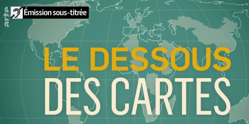
« Le dessous des cartes » (With Open Maps) is a French-German TV show that airs on the Arte channel. Arte is a European cultural TV channel that broadcasts documentaries, news, and cultural programs.
« Le dessous des cartes » is a political and geographical magazine that uses maps and 3D images to explain current events and international relations. Initially presented by Jean-Christophe Victor, the show covers a wide range of topics such as world politics, economics, and history. It aims to give viewers a better understanding of the world by providing them with a visual and geographical perspective on current events and issues. The show has been running since 1990 and has gained a reputation for its in-depth analysis and high-quality visuals.
The Challenge : How to Revamp Arte TV Show on Geopolitics
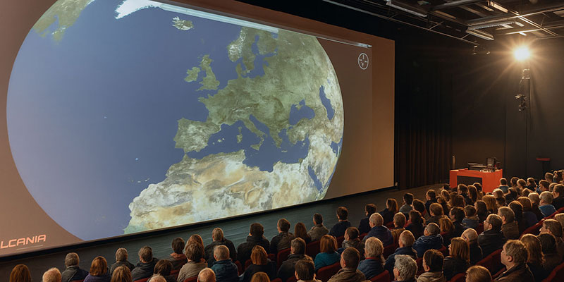
The Franco-German Arte channel launched a revamped version of the show “With open maps”. The new features included a new design, new geographic animations, and new presenter with the journalist Emilie Aubry.
Satellite maps and elevation data also needed to be updated. The show’s producers had specific requirements for the satellite imagery maps and elevation datasets they needed to use as background layers.
Firstly, they needed high-quality visual data that would be able to capture the intricate details of the world’s landscapes and topography. This was essential to ensure that the maps and animations in the show were visually stunning and able to showcase the beauty of the world in a realistic and immersive way.
Secondly, Arte required up-to-date data that would accurately reflect the current state of the world. With a rapidly changing environment, it was important for the data to be as recent as possible to ensure that the maps and animations were as accurate as possible.
Finally, Arte required global coverage, the ability to explore different regions and showcase the diversity of the world was an important aspect of the show.
The Solution : Stunning Satellite Imagery for the Show « With open maps »
PlanetObserver supplied PlanetSAT imagery basemap and PlanetDEM global elevation data to the team. Both datasets cover the entire Earth’s landmass. Processed mainly from up-to-date Sentinel-2 and Landsat 8 data, PlanetSAT basemap offers an excellent visual quality at 10-meter resolution, perfect to map any region in the world. With a 30-meter resolution, the elevation data is totally additional to create stunning 3D views. In addition, those data can be complemented with Very High Resolution satellite images that bring higher levels of details on focused areas.
Moreover, annual updates of the global imagery basemap are provided to the team. We want to make sure that users benefit from up-to-date and consistent imagery reflecting any changes to the landscape.
All those geographic data are used for the show to create high quality 2D and 3D cartographic animations, such as flyover, relief mapping, view of the globe and zoom-in to any area in the world. All scenarios are possible!
The Benefits : Enhanced User Experience
These are the key benefits that Arte TV show gained by using our imagery and elevation data in their 2D and 3D animations.
1. Global coverage: PlanetSAT Global imagery basemap and PlanetDEM 30 Plus global elevation data cover the entire Earth’s landmass, providing comprehensive coverage for mapping and analysis.
2. Enhanced satellite maps: PlanetObserver’s maps feature detailed geographic information, making them useful tools for geopolitical and historical analysis.
3. Regular updates: Annual updates of the global imagery basemap are provided to ensure that users benefit from up-to-date and consistent imagery.
4. Flexible usage: The data can be used to create high-quality 2D and 3D cartographic animations, such as flyovers, relief mapping, views of the globe, and zoom-ins to any area in the world.
Check out this great flyover animation created with PlanetSAT Global satellite images and PlanetDEM 30 elevation data. We take you to Iran with a fly over the country and down to Mount Damavand, the highest peak in the country and in the Middle East, located close to the Caspian Sea.
Let's talk
Ready to enhance your project with high-quality geospatial data? Talk to our team to get started.
