


Benefits of Medium Resolution Satellite Imagery Mosaics in GIS
Learn how medium-resolution satellite imagery mosaics enhance GIS projects by providing consistent, accurate, and cost-effective geographic data for mapping and analysis.

Key benefits
Using PlanetSAT 10-meter imagery of Southern China in their web-based GIS system offers several benefits for the Hong Kong planning department and other departments within the Hong Kong SAR Government, including:
1. High-quality imagery: PlanetSAT 10-meter imagery provides a detailed and accurate view of the terrain and infrastructures of Southern China. This can help government officials make better-informed decisions when it comes to planning and development projects.
2. Time saving: PlanetSAT basemap is available off-the-shelf and ready-to-integrate in any GIS solution and platform.
3. Cost-effective: Using satellite imagery is a more cost-effective way to gather information than on-site surveys or aerial photography. By using10-meter satellite imagery in a web-based GIS system, the Hong Kong planning department can save costs while still obtaining relevant information.
4. Satellite Imagery Processing Expertise: PlanetObserver offers more than 30 years of expertise in satellite imagery processing to support companies and organizations in their mapping and GIS projects.
Products used
The client : Hong Kong Planning Department
The Hong Kong Planning Department was established with a mission to make Hong Kong a better place to live and work. They are in charge of the policy portfolios of planning, land use, buildings and urban renewal in Hong Kong. In addition, they are responsible for the territorial development strategies. Their goal is to provide a broad planning framework to guide future development and provision of strategic infrastructures in Hong Kong.
In the past, the HK Planning Department had overlooked the proper use of land, the construction and buildings, and processes of urban renewal in Hong Kong. Therefore, they needed to come up with efficient solutions in terms of urban planning.
The Challenge : Up-to-date satellite imagery for GIS operations
Satellite imagery data are key components for urban planning. The Hong Kong Planning Department developed a comprehensive web-based GIS (Geographic Information System) project to assist planners and engineers in all areas of urban and infrastructure planning.
To reach their different objectives, the Hong Kong Planning Department needed to analyze and explore not only their local environment but also their surrounding region which covers the whole of Southern China. In other words, they needed to provide the best imagery basemap for geographical reference to their engineers and planners.
The project was to use a 10-meter resolution imagery mosaic covering Southern China. The imagery would be used for visualization through a web-based GIS system aimed at all offices and departments within the Hong Kong Government.
The challenge was to base their planning on an imagery mosaic that would be detailed enough to showcase their whole region of interest. Furthermore, they had set a number of key features to which the product had to conform, i.e.up-to-date data, homogeneous mosaic, and natural color processing.
The Solution : PlanetObserver global imagery mosaic
The client contacted PlanetObserver, leading geospatial data provider and expert in imagery processing. They had indeed identified PlanetObserver’s global satellite imagery basemap with 10-meter resolution. They figured out that this product could potentially meet their needs.
PlanetObserver was definitely up to the challenge and ready to provide the best satellite imagery to help engineers and planners visualize properly Hong Kong surroundings. For this purpose, we supplied PlanetSAT medium resolution satellite imagery mosaic of the whole of Southern China, which offers many benefits to GIS users.
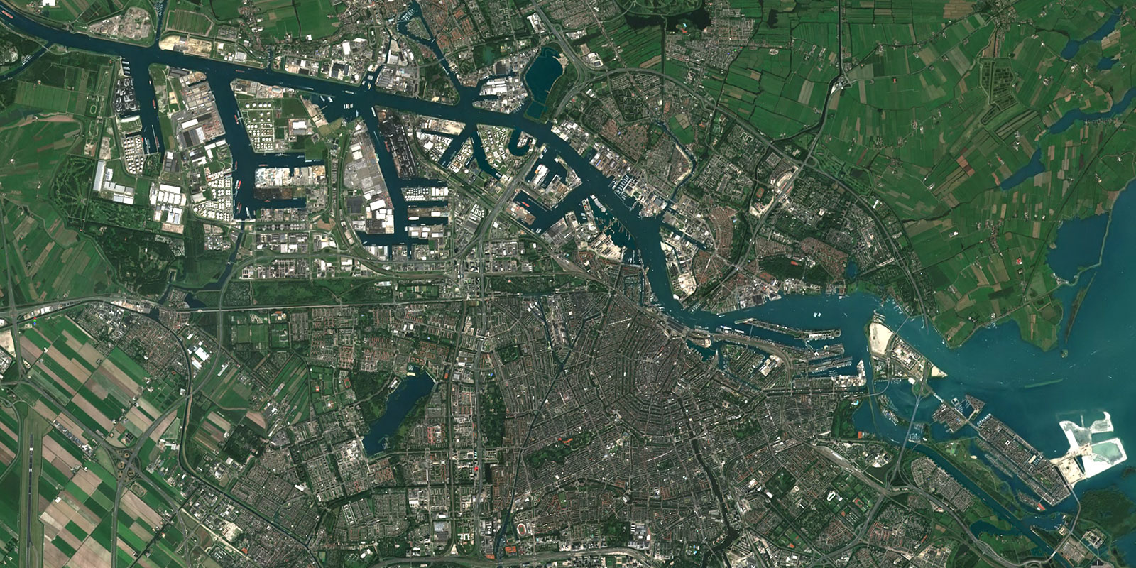
First of all, the imagery basemap is updated every year in order to provide accurate and current geographic information in all regions of the world. Moreover, the mosaic remains unmatched with a 10-meter resolution at the global scale. Such medium resolution provides accurate spatial details that are perfect for land monitoring. In addition to this feature, users benefit from natural colors and a seamless view of the Earth with a reliable and most of all, unrivaled color balance.
Lastly, and most importantly, the satellite imagery mosaic is totally view-ready in a GIS solution and does not need any further processing. All the work is in the expert hands of our team which is in charge of optimizing and adapting the product to the client’s needs. In conclusion, the HK Planning Department eventually benefited from a high-quality satellite imagery mosaic that is totally adapted to their use case.
The Benefits : Improved visualization for better decision-making
Using PlanetSAT 10-meter imagery of Southern China in their web-based GIS system offers several benefits for the Hong Kong planning department and other departments within the Hong Kong SAR Government, including:
1. High-quality imagery: PlanetSAT 10-meter imagery provides a detailed and accurate view of the terrain and infrastructures of Southern China. This can help government officials make better-informed decisions when it comes to planning and development projects.
2. Time saving: PlanetSAT basemap is available off-the-shelf and ready-to-integrate in any GIS solution and platform.
3. Cost-effective: Using satellite imagery is a more cost-effective way to gather information than on-site surveys or aerial photography. By using10-meter satellite imagery in a web-based GIS system, the Hong Kong planning department can save costs while still obtaining relevant information.
4. Satellite Imagery Processing Expertise: PlanetObserver offers more than 30 years of expertise in satellite imagery processing to support companies and organizations in their mapping and GIS projects.

Let's talk
Ready to enhance your project with high-quality geospatial data? Talk to our team to get started.
