


Optimizing Weather Visualization with Imagery and Elevation Data
How PlanetObserver supported MetraWeather in enhancing weather visualization through high-resolution satellite imagery and global elevation data for their Weatherscape XT platform

Key benefits
PlanetObserver global imagery and elevation data for weather visualization provided a number of benefits to MetraWeather, including:
- Accurate and reliable weather forecasting experience: MetraWeather’s customers benefited from the high-quality imagery and elevation maps provided by PlanetObserver, leading to a more accurate and reliable weather forecasting experience.
- Easy Integration: The maps are designed to fit seamlessly into the Weatherscape XT graphics system, requiring minimal effort for integration.
- Customized Maps: PlanetObserver team of experts were able to adapt the maps to MetraWeather’s technical specifications, in terms of file format, tiling structure and projection, which helped greatly MetraWeather to get ready-to-integrate maps.
Products used
The client : MetraWeather
MetraWeather, the international commercial brand of the Meteorological Service of New Zealand, is a global leader in providing innovative weather forecasting and analytics services. Backed by meteorological expertise, technical innovation and operational excellence, MetraWeather positions itself as the weather expert.
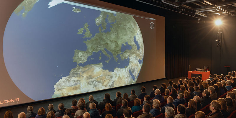
With more than 240 employees in New Zealand, Australia, Asia and Europe, MetraWeather supplies graphical weather presentation solutions to leading broadcasters and media companies around the world for over 20 years. Their leading solution Weatherscape XT is an advanced weather graphics and information system. In other words, it allows TV broadcasters to show high-quality graphics and maps of weather events in their daily news shows.

The Challenge : Improved Weather Graphics System for TV Broadcasters
How do you offer powerful weather intelligence, and visualize it in an engaging way? Providing accurate, up to date, stunning weather visualizations with attractive background maps has become highly critical in a very competitive environment.
MetraWeather’s challenge was to offer better background maps to their clients in Weatherscape XT. They recognized that their clients wished to have more visually appealing maps and up-to-date satellite imagery on which to present weather information. This request was due to the growing use of maps and satellite imagery in many applications across all industries, well beyond the broadcasting industry. As a result, people now expect to see detailed and attractive maps both in consumer and professional applications.
MetraWeather had already defined that those maps had to be based on satellite imagery and elevation data. They also had to offer a global coverage. They evaluated and tested a number of maps that did not meet their expectations in terms of quality, update options and technical feasibility.
The Solution : The Power of Maps in Weather Visualization
PlanetObserver was approached by MetraWeather to provide a high-quality global satellite imagery basemap and elevation dataset for their Weatherscape XT platform. Our expertise in geospatial data processing and ability to deliver customized maps, as well as our portfolio of off-the-shelf global satellite imagery basemaps, made us the ideal partner for MetraWeather.
MetraWeather recognized that our in-house processed datasets would bring significant value to their platform, providing a more accurate and detailed view of the world for their weather forecasting and analytics services.
Additionally, the team at PlanetObserver was able to tailor the maps to meet MetraWeather’s specific technical requirements, such as file format, tiling structure, and projection, making the maps ready for seamless integration into their system.
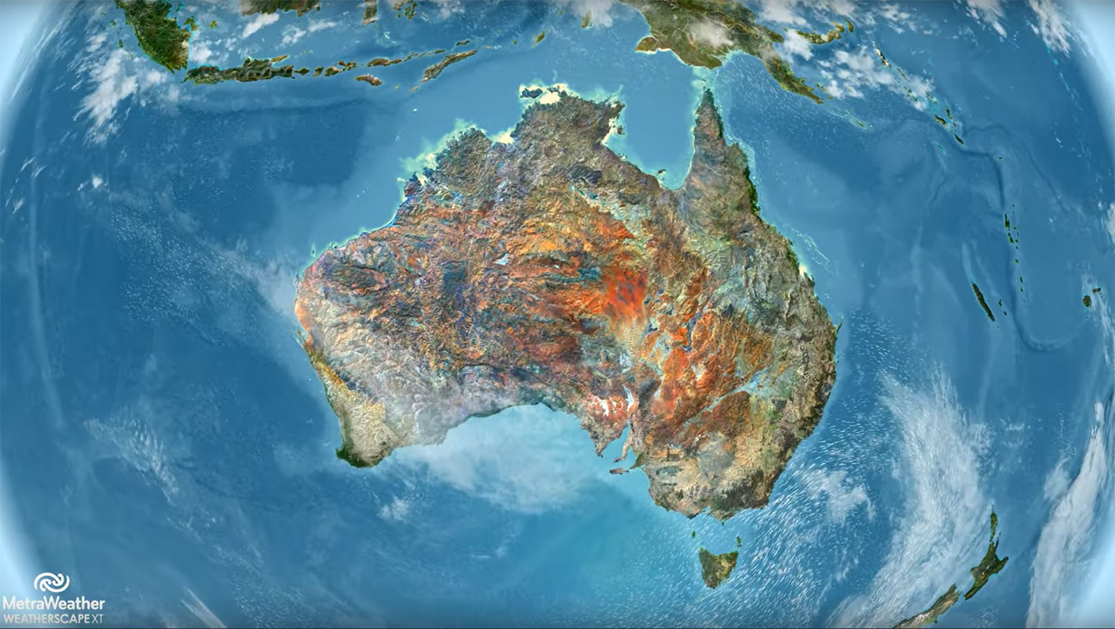
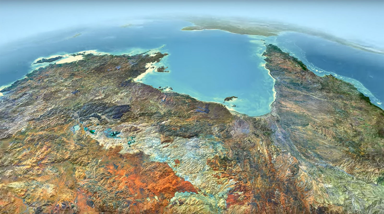
Weatherscape XT operates with maps in specific sizes and formats, and processed by combining different source data, mixing satellite imagery and elevation data. Therefore, PlanetObserver first tested different data combinations for MetraWeather to validate. We then generated four global maps with different textures and at different resolutions.
Finally, MetraWeather benefited from a stunning global satellite imagery map down to 15m or 10m resolution depending on areas. On top of that, they also took advantage from a highly detailed height map perfect to create amazing fly-throughs and 3D animations. This collaboration allowed MetraWeather to enhance their services with the latest and most accurate geographical data.
« The use of PlanetObserver global imagery and elevation data was perfect to upgrade Weatherscape XT maps. We get fully calibrated files for our system that can be updated on-demand. This solution gives us a lot of flexibility to provide customised data to our customers.»
Neville Booth, Product Owner for Weatherscape XT weather visualisation system, MetraWeather.
The Benefits : Enhanced User Experience for Weather Visualization
PlanetObserver global imagery and elevation data for weather visualization provided a number of benefits to MetraWeather, including:
1. Accurate and reliable weather forecasting experience: MetraWeather’s customers benefited from the high-quality imagery and elevation maps provided by PlanetObserver, leading to a more accurate and reliable weather forecasting experience.
2. Easy Integration: The maps are designed to fit seamlessly into the Weatherscape XT graphics system, requiring minimal effort for integration.
3. Customized Maps: PlanetObserver team of experts were able to adapt the maps to MetraWeather’s technical specifications, in terms of file format, tiling structure and projection, which helped greatly MetraWeather to get ready-to-integrate maps.
Let's talk
Ready to enhance your project with high-quality geospatial data? Talk to our team to get started.
