


Enhancing Digital Moving Maps with 2D and 3D Terrain Data
Discover how 2D and 3D terrain data enhance digital moving maps, delivering more accurate navigation, improved situational awareness, and a richer visual experience for end users.

Key benefits
The integration of PlanetSAT imagery basemap and PlanetDEM elevation data into Digital Moving Maps represents a substantial leap forward in both visual quality and functional design. Here’s how PlanetSAT and PlanetDEM solution elevates moving maps to new levels of quality effectiveness:
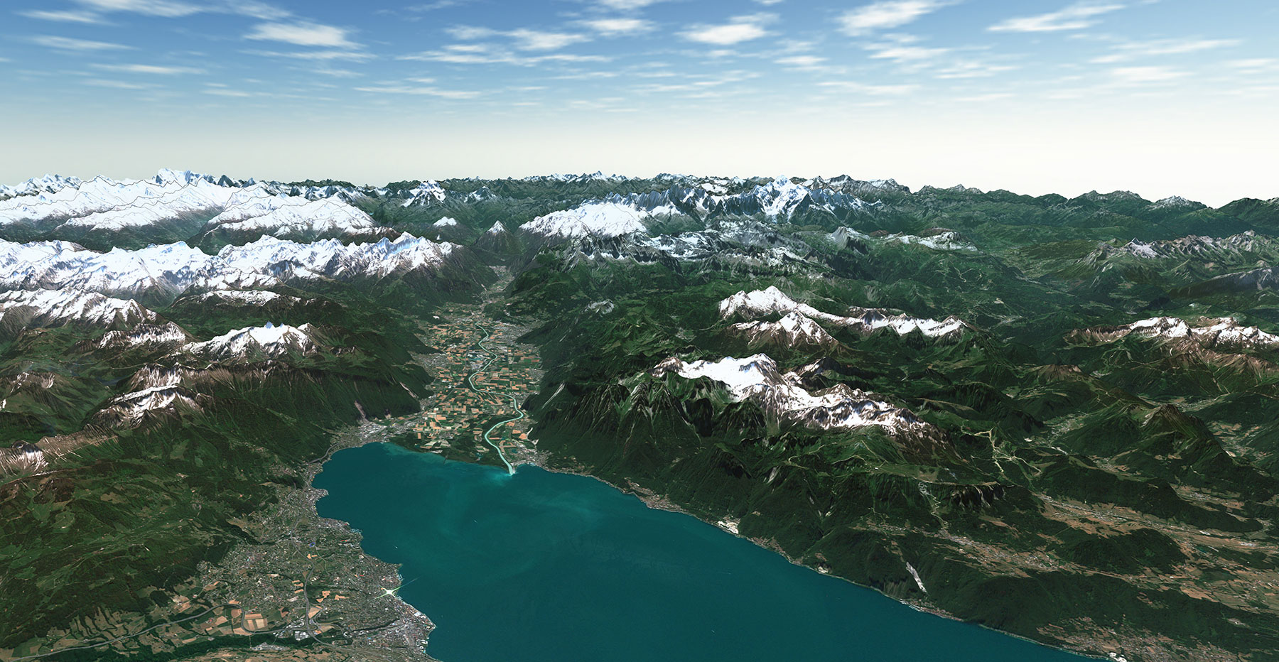
- Visual Enhancement: PlanetSAT’s integration provides an unprecedented visual upgrade to digital moving maps. The high-quality imagery forms a bridge between the user and the external environment, making the maps more engaging and lifelike.
- Situational Awareness Boost: Maps enhanced with PlanetSAT and PlanetDEM provide operators with an increased level of detail on the medium resolution level, significantly aiding in mission success and situational awareness. The vivid images and accurate elevation data create a more intuitive interface for users, allowing quicker and more informed decisions.
- Efficiency and Precision: The synergy of PlanetSAT imagery and PlanetDEM elevation data doesn’t just enhance the aesthetics; it streamlines operations by enabling precise route planning and navigation, reducing errors, and improving overall efficiency in both civilian and military applications.
Products used
The client : Digital Moving Map and Mission Planning Systems
In the fast-paced world of aviation and mission management, Digital Moving Maps play acritical role in providing pilots and aircrews with advanced situational awareness. Digital Moving Map providers focus on the development and integration of technologies that enable pilots, navigators, and mission operators to have a real-time understanding of their environment. Digital Moving Maps provide a dynamic, real-time visual representation of the surrounding terrain and potential obstacles, allowing for safer and more efficient navigation.
Situational Awareness goes beyond mere navigation, encompassing a broader understanding of the operational context, including the location of other aircraft, weather conditions, and mission-critical information.
Together, these tools form an essential part of modern aviation, military operations, and emergency response services, where the integration of accurate, real-time data with existing systems is key to success.
The Challenge : Enhancing Visual Appeal with Configurable 2D and 3D Terrain Data
Companies developing Situational Awareness and Digital Moving Map solutions, such as Boeing and Collins Aerospace, often face the complex challenge of integrating high-quality satellite imagery and elevation data into their existing systems that are up to demanding commercial and military airborne platforms.
They seek solutions that enhance the visual appeal of their systems and provide scalable and configurable 2D and 3D terrain images required for critical aerospace, defense, fire, and search and rescue applications.

The Solution : A Customized Approach to Digital Moving Maps
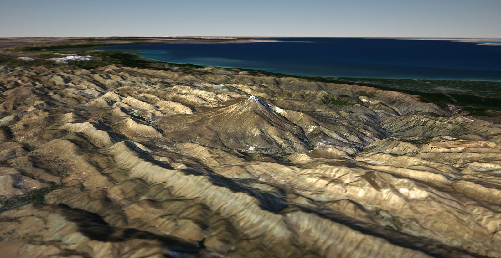
PlanetObserver’s medium-resolution satellite imagery basemap, PlanetSAT, and global elevation data PlanetDEM offer an innovative solution tailored to the specific needs of Digital Moving Map systems and situational awareness providers. By working closely with clients and understanding their unique requirements, PlanetObserver can adapt PlanetSAT and PlanetDEM to match the technical specifications of various systems, whether for mission-critical flying applications or other diverse needs.
The integration process ensures that PlanetObserver’s imagery and elevation data are compliant with the system’s architecture. This includes compatibility with specific hardware configurations, guaranteeing seamless functionality and integration. PlanetSAT imagery basemap combined with PlanetDEM elevation data greatly enhance the visual aspect of the Digital Moving Maps, providing 2D and 3D terrain data totally adapted to situational awareness in civilian and military operations.
The Benefits : Enhanced User Experience for Weather Visualization
The integration of PlanetSAT imagery basemap and PlanetDEM elevation data into Digital Moving Maps represents a substantial leap forward in both visual quality and functional design. Here’s how PlanetSAT and PlanetDEM solution elevates moving maps to new levels of quality effectiveness:
- Visual Enhancement: PlanetSAT’s integration provides an unprecedented visual upgrade to digital moving maps. The high-quality imagery forms a bridge between the user and the external environment, making the maps more engaging and lifelike.
- Situational Awareness Boost: Maps enhanced with PlanetSAT and PlanetDEM provide operators with an increased level of detail on the medium resolution level, significantly aiding in mission success and situational awareness. The vivid images and accurate elevation data create a more intuitive interface for users, allowing quicker and more informed decisions.
- Efficiency and Precision: The synergy of PlanetSAT imagery and PlanetDEM elevation data doesn’t just enhance the aesthetics; it streamlines operations by enabling precise route planning and navigation, reducing errors, and improving overall efficiency in both civilian and military applications.

Let's talk
Ready to enhance your project with high-quality geospatial data? Talk to our team to get started.
