Skip to content
Menu
Fermer
Home
Products
Global Imagery Basemap
Global Elevation Data
Global Imagery Basemap
Global Elevation Data
Industries
Defence & Intelligence
Aerospace
Mapping
Graphics & Animation
Defence & intelligence
Aerospace
Mapping & GIS
Graphics & Animation
Resources
Blog
Customer Stories
About us
Home
Products
Global Imagery Basemap
Global Elevation Data
Global Imagery Basemap
Global Elevation Data
Industries
Defence & Intelligence
Aerospace
Mapping
Graphics & Animation
Defence & intelligence
Aerospace
Mapping & GIS
Graphics & Animation
Resources
Blog
Customer Stories
About us
Home
Products
Global Imagery Basemap
Global Elevation Data
Industries
Defence & Intelligence
Aerospace
Mapping
Graphics & Animation
Resources
Blog
Customer Stories
About us
Home
Products
Global Imagery Basemap
Global Elevation Data
Industries
Defence & Intelligence
Aerospace
Mapping
Graphics & Animation
Resources
Blog
Customer Stories
About us
Contact us
Explore the world
Menu
Fermer
Home
Products
Global Imagery Basemap
Global Elevation Data
Global Imagery Basemap
Global Elevation Data
Industries
Defence & Intelligence
Aerospace
Mapping
Graphics & Animation
Defence & intelligence
Aerospace
Mapping & GIS
Graphics & Animation
Resources
Blog
Customer Stories
About us
Home
Products
Global Imagery Basemap
Global Elevation Data
Global Imagery Basemap
Global Elevation Data
Industries
Defence & Intelligence
Aerospace
Mapping
Graphics & Animation
Defence & intelligence
Aerospace
Mapping & GIS
Graphics & Animation
Resources
Blog
Customer Stories
About us
Contact us
Explore the world
Graphics & Animation
Back to All Stories
Defense & Intelligence
Aerospace
Mapping & GIS
Graphics & Animation
Graphics & Animation
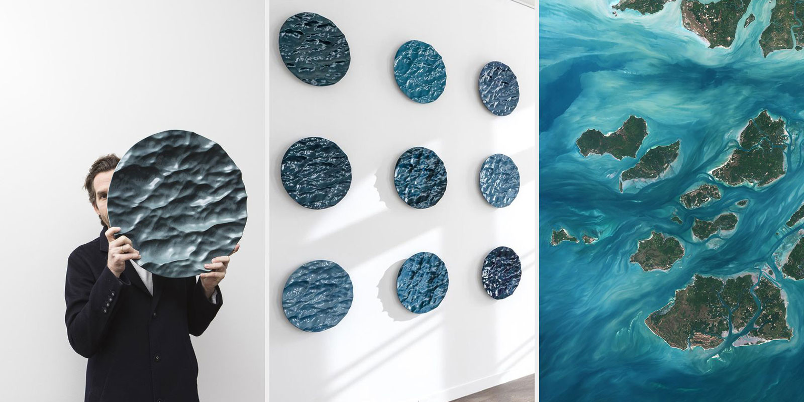
Mathieu Lehanneur Inspired by PlanetObserver Satellite Imagery