Flight simulation & Flight planning apps
Geospatial Solutions Optimized for Aerospace
Geospatial Data That Powers Aerospace Operations
Enrich your aerospace operations with reliable, high-performance geospatial data for flight simulation and planning. We deliver ready-to-use global satellite imagery and elevation data that meet the demands of both military and commercial flight simulation environments, as well as flight planning apps.
Trusted by defense organizations and aviation software providers, our solutions bring greater realism, precision, and confidence to every flight—virtual or real.
Delivering Smart Geospatial Solutions
for Flight Simulation and Planning
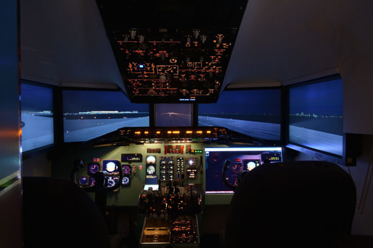
Bring Realism to Flight Simulation with Trusted Geospatial Data
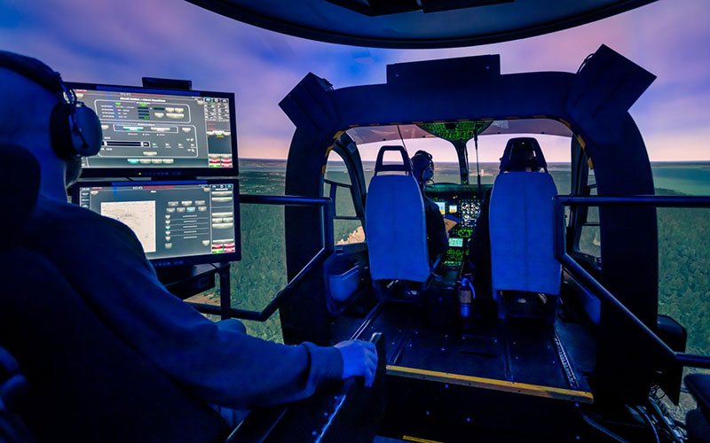
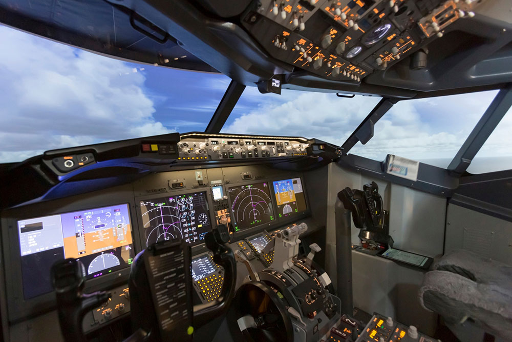
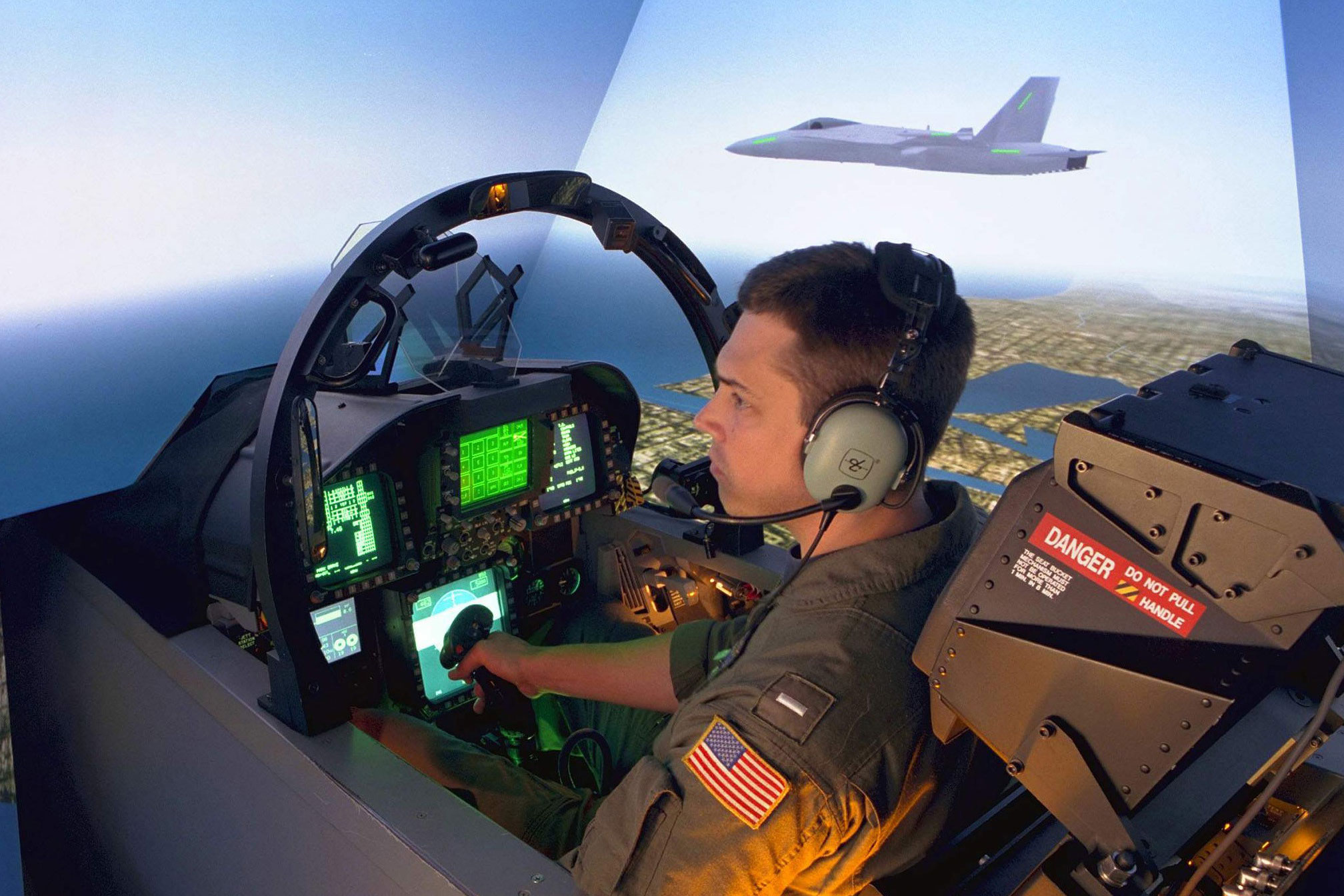
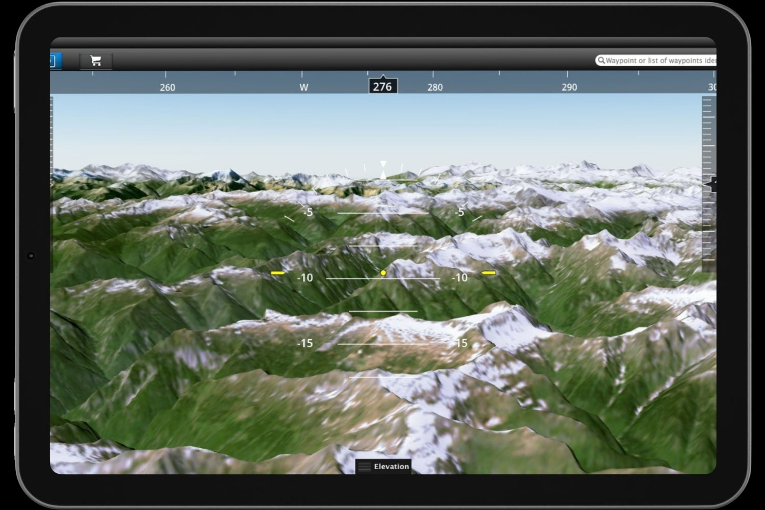
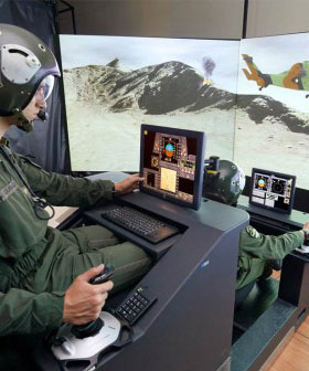
Enhance commercial and military pilot training with geospatial data that mirrors the real world. PlanetObserver’s 10-meter satellite imagery and 30-meter elevation model with global coverage bring unmatched realism to flight simulators—boosting situational awareness, decision-making, and mission readiness.
With 35+ years of experience and the trust of aerospace leaders like Thales and Boeing, we provide reliable, ready-to-integrate data tailored to your flight simulation systems.
Key Applications
- High-fidelity 3D environments for pilot training
- Civil and military flight simulation systems
- Realistic terrain for global and mission-specific scenarios
Our geospatial data supports the development of advanced flight simulators by providing accurate, visually consistent satellite imagery and elevation models. Whether used in commercial pilot training or mission-oriented military simulation, our datasets help create immersive environments that enhance performance, readiness, and training quality.
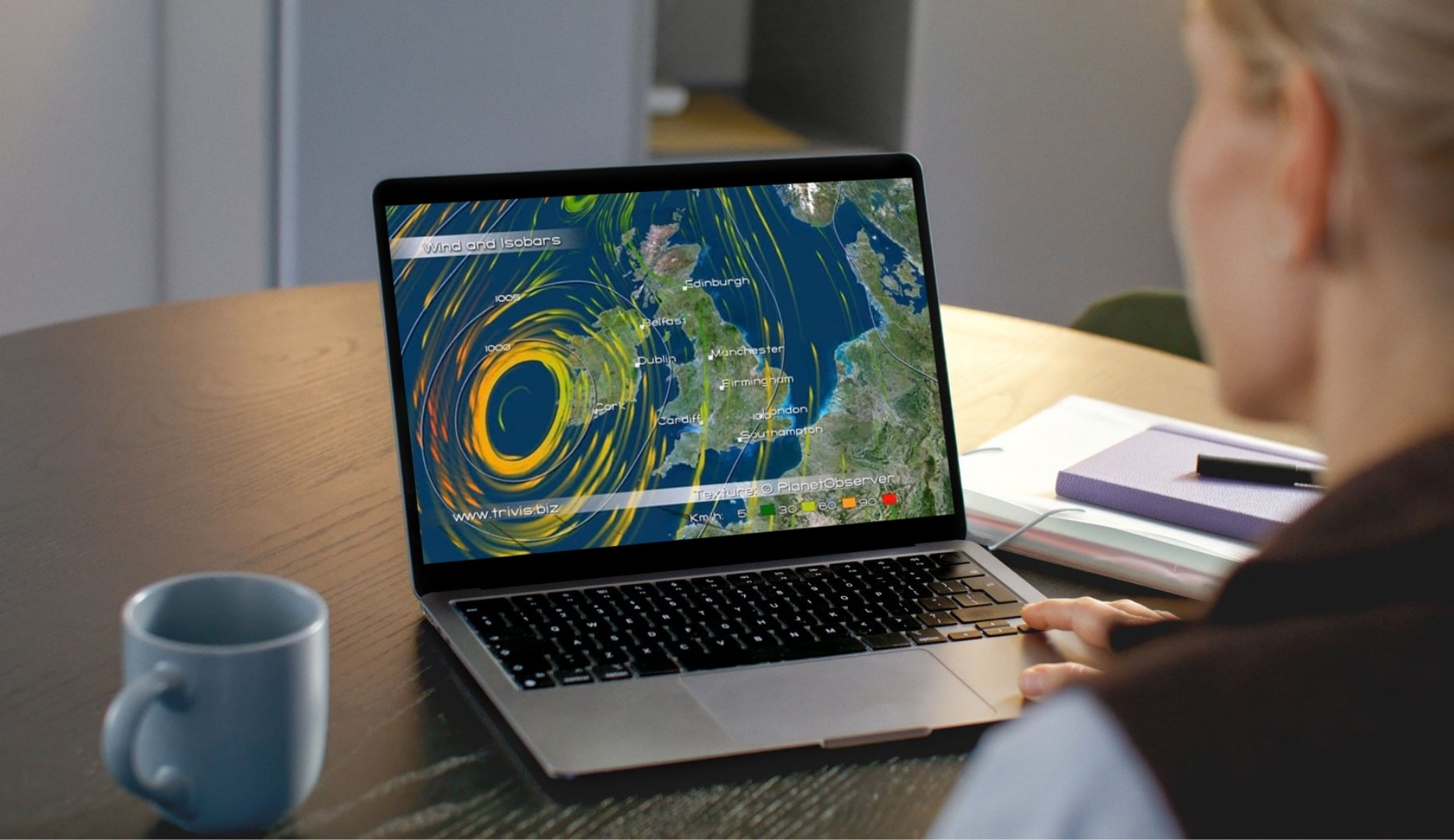
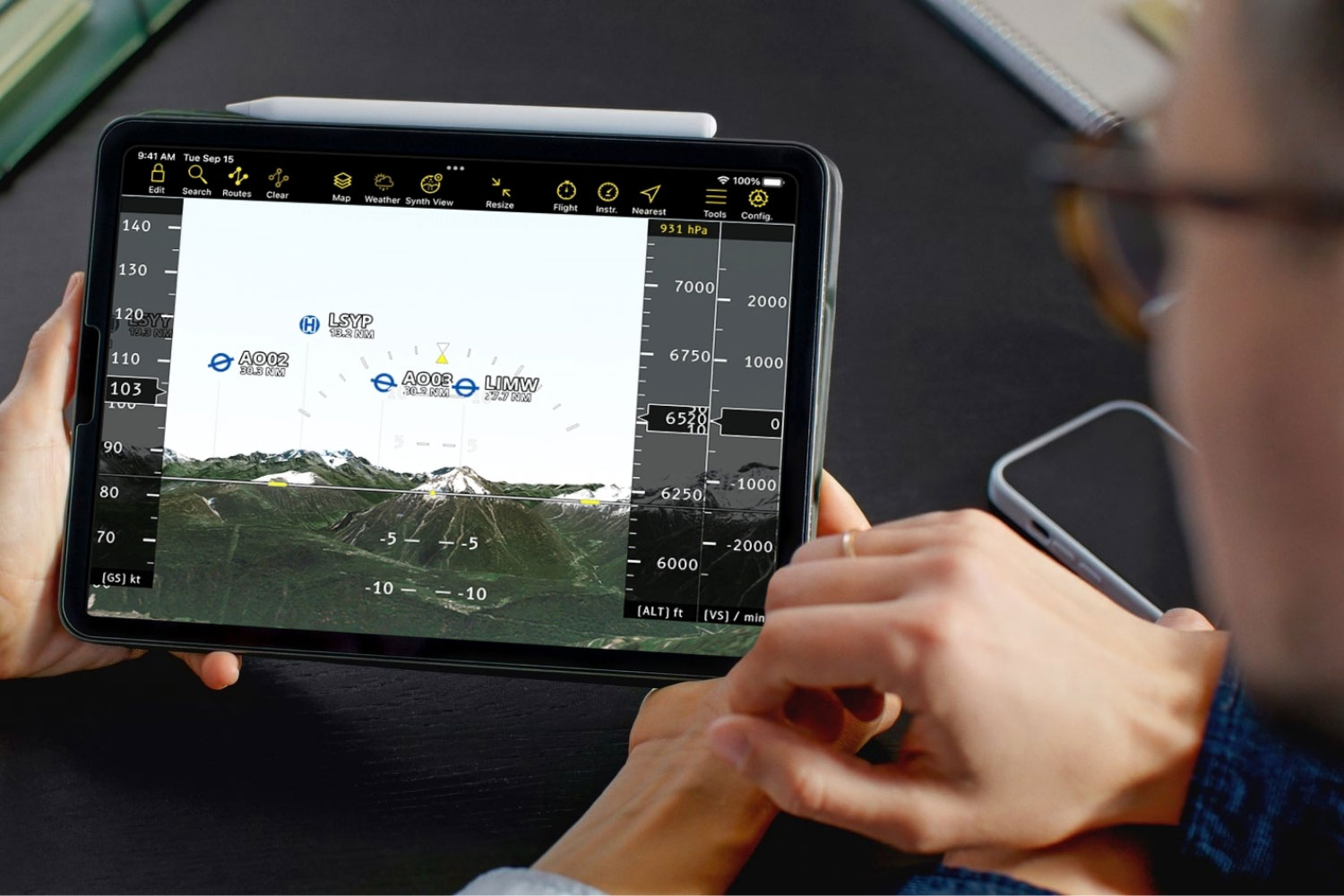
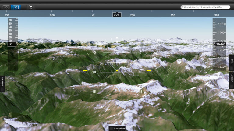
Enhance Flight Planning Apps with Better Geospatial Data
Upgrade your flight planning and real-time navigation apps with professional-grade satellite imagery and 3D elevation data. PlanetObserver’s accurate and visually rich geospatial data improves route visualization, terrain awareness, and in-flight decision-making for both private and commercial pilots.
By integrating our data, you deliver a safer, more intuitive, and more efficient flight planning experience—on the ground and in the air.
Key Applications
- Pre-flight planning with detailed terrain awareness
- Real-time in-flight navigation support
Enhanced situational awareness for private and professional pilots
Adopted by over 20,000 pilots through the Air Navigation Pro app, our reliable imagery basemap and elevation model are built for seamless integration and global performance.
Our Commitment
Trusted geospatial solutions—delivered with precision and care.
Expert support
We go beyond data delivery—offering close collaboration to ensure our solutions align with your goals and technical needs.
Let's talk
Ready to enhance your flight planning and simulation solutions? Contact us to explore how our data can support your project.
Hear What our Amazing Customers Say

« PlanetSAT basemap met our main criteria, i.e. enhanced color quality of the imagery, up-to-date data, and standard formats ready-to-use in our flight simulation solutions. »
– Muriel Amouroux
Manager, Thales Training & Simulation
« PlanetObserver products are easy to implement in Air Navigation, our advanced flight planning and navigation solution for VFR pilots. »
– Johan Huguenin
CEO, Air Navigation
« By integrating PlanetObserver geospatial data into Terra Vista, we deliver a more immersive and accurate simulation experience that enhances decision-making and readiness. »
– Joël Castets
CEO, Agenium.
They trust us
Customer Success Stories
See how organizations around the world use our Earth imagery and elevation data to solve real challenges,
drive innovation, and bring their projects to life. Discover their stories and imagine what’s possible for yours.
Implementing our off-the-shelf imagery basemap in their flight simulation solution helped Thales saving development and production costs.

PlanetObserver’s 2D and 3D data boost Digital Moving Maps for situational awareness in civilian and military use.
Sogitec upgraded their flight simulator visual database for the Defense industry, incorporating our high quality geospatial data.
Air Navigation solution for pilots offers improved flight planning and real-time navigation thanks to our reliable 2D and 3D geospatial data.
Let's talk
Ready to enhance your flight planning and simulation solutions? Contact us to explore how our data can support your project.
More industries we serve
Defence & Intelligence

Mapping & GIS
Graphics & animation