


PlanetSAT 2026: A New Standard in Global Satellite Images
PlanetObserver releases PlanetSAT 2026, delivering accurate and visually consistent global satellite images for GIS, defense and aerospace.
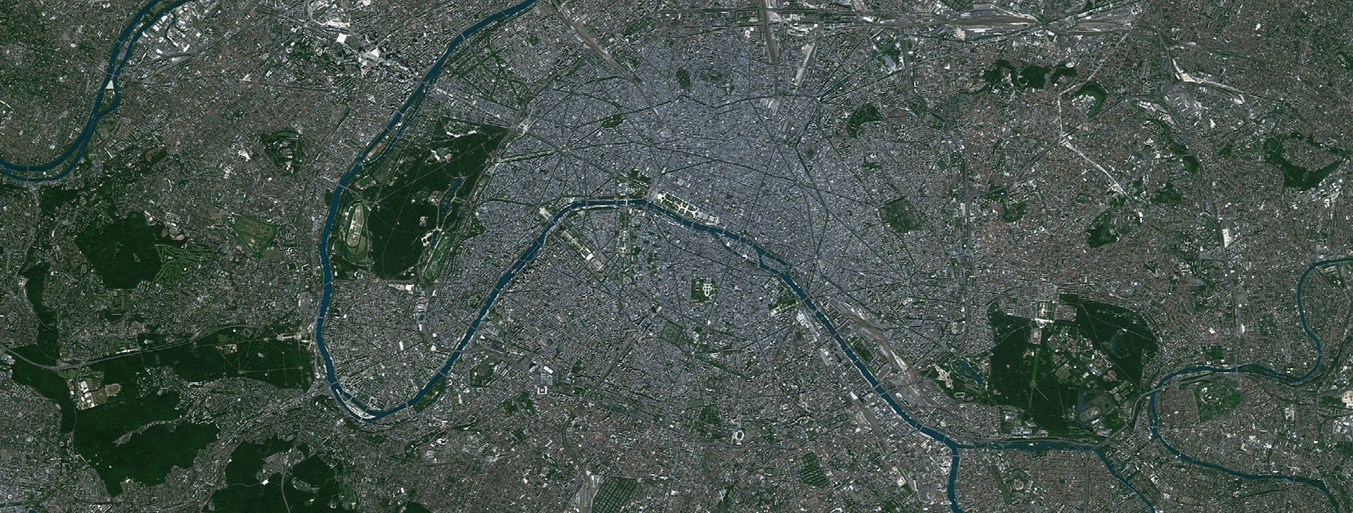
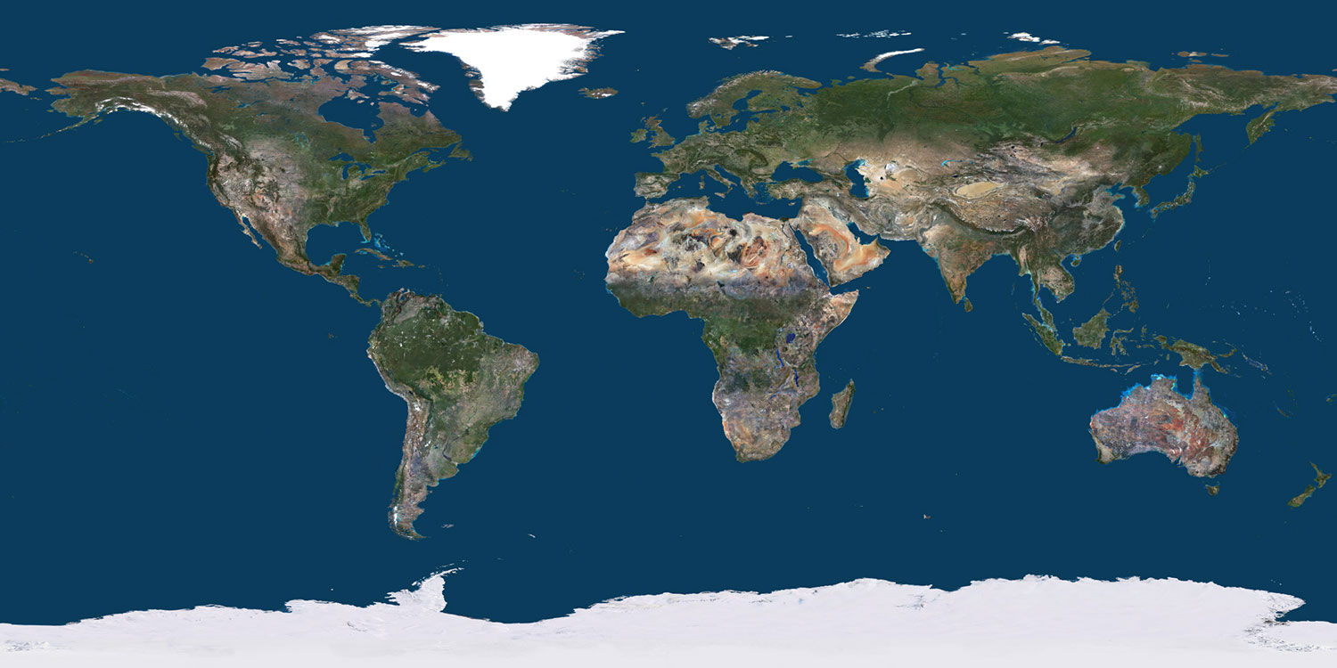
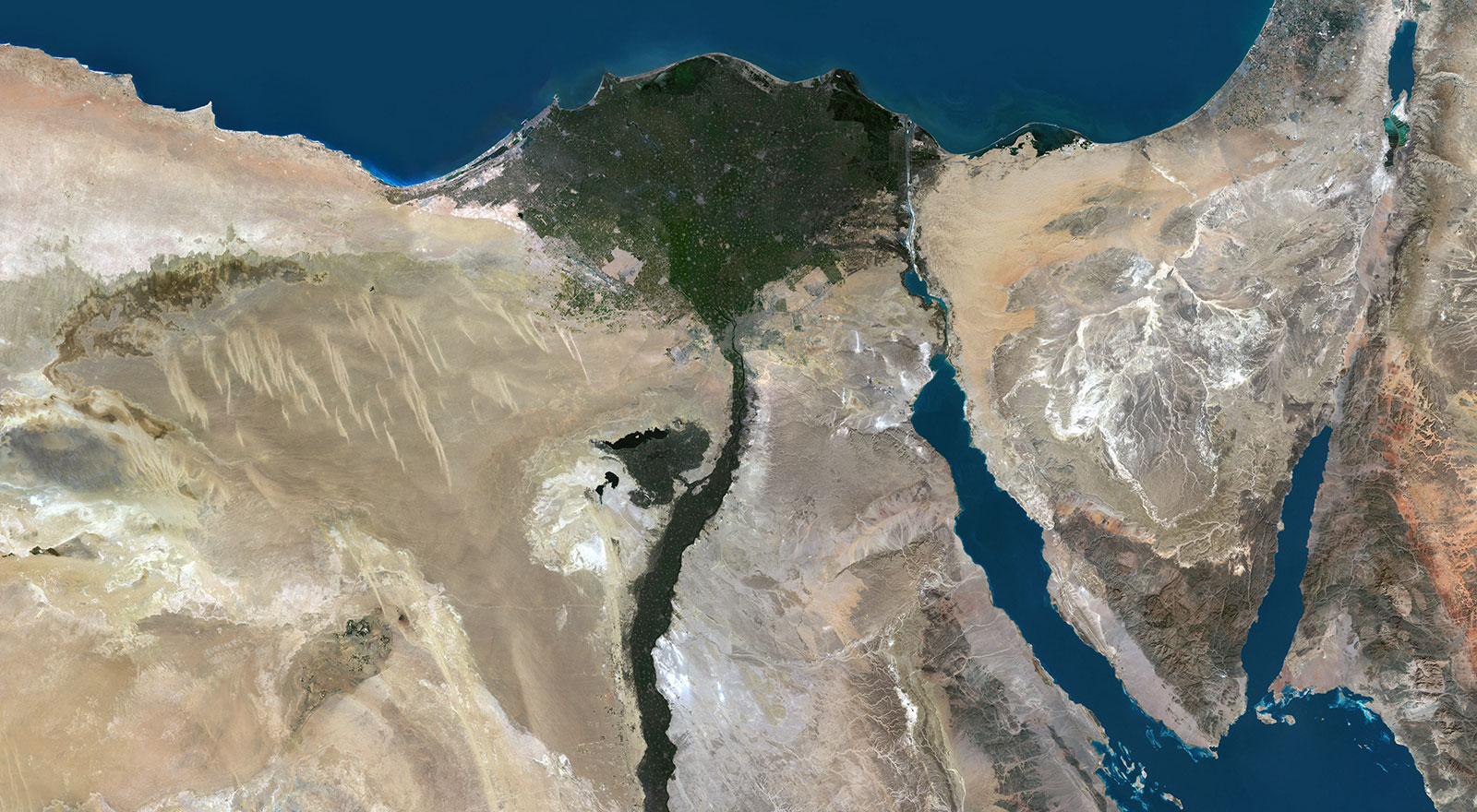
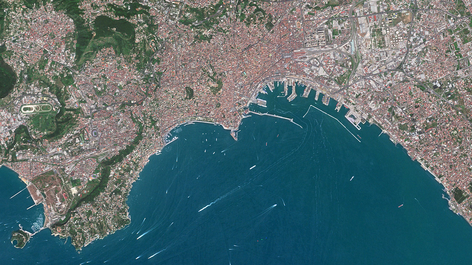
CLERMONT-FERRAND, France – May 5, 2026. PlanetObserver is pleased to announce the release of PlanetSAT Global Basemap 2026, the latest annual update of its globally trusted satellite imagery basemap, delivering accurate and visually consistent global satellite images of our planet. This update brings refreshed imagery across 50 million square kilometers, covering Russia, Central Asia, China, Canada, the Middle East, and France, alongside a refresh of over 120 major cities worldwide.
With 37 years of experience pioneering global satellite imagery, we continue to push the standard forward. For our clients, this edition means one thing: the most visually accurate satellite imagery available on the market, a foundation they can build any project on with full confidence.
Laurent, CEO, PlanetObserver
What's New in Update 2026
Each year, PlanetSAT is updated with the freshest available satellite data across the regions where it matters most. The 2026 edition focuses on six major regions selected based on client demand and data availability, while maintaining the global standards of quality and consistency that PlanetSAT is built on.
• Six major regions refreshed: Russia, Central Asia, China, Canada, the Middle East, and France have all been updated with the latest available imagery, covering 50 million square kilometers in total.
• 120+ cities updated: Urban areas change faster than almost anywhere else on the planet. Keeping major cities current ensures that professionals working at a local level have imagery they can rely on.
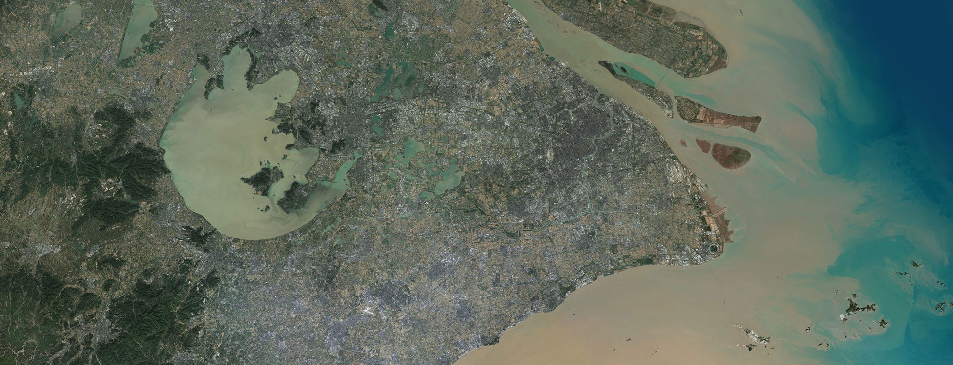
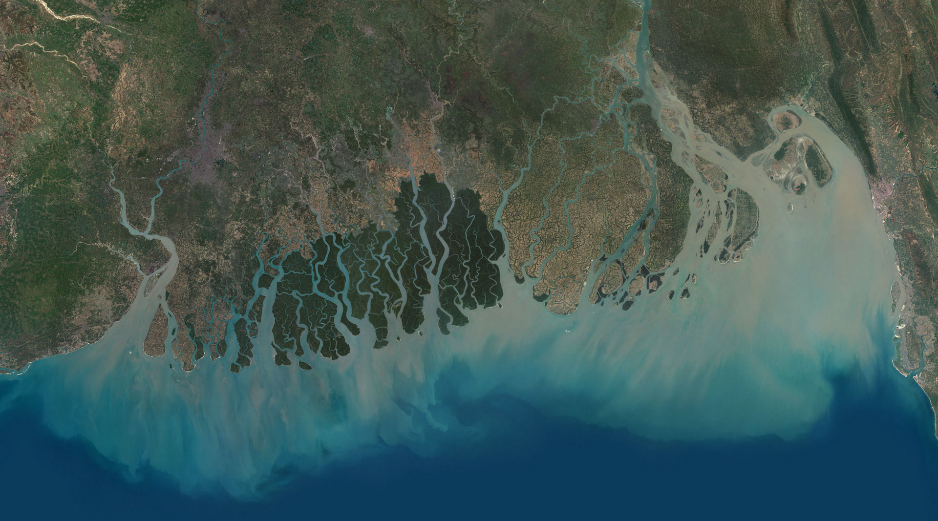
• 10m natural color imagery: Color-balanced orthomosaics in natural RGB, optimized for visual consistency whether you are viewing a single city or an entire continent.
• Multiple delivery formats: Available in GeoTIFF, Cloud Optimized GeoTIFF (COG), and JPEG 2000, ready to integrate directly into existing GIS, simulation, or web-mapping workflows.
• Flexible coverage options: Purchase the full global dataset or license coverage for a specific continent, country, or custom area of interest.
Accuracy Without Compromise
PlanetSAT 2026 is built primarily from Sentinel-2 data, the European Space Agency’s high-resolution optical constellation, complemented by Landsat data where needed. Every scene that makes it into the final basemap has been carefully selected for cloud-free conditions and seasonal consistency, with a preference for spring and summer acquisitions that deliver vivid, natural colors across all latitudes.
What sets PlanetSAT apart is not just the data it is built from, but the care with which it is processed. The result is a set of global satellite images that professionals can rely on color harmonized across thousands of individual scenes, seamlessly stitched across tile boundaries and validated at every step of the pipeline.
Every mosaic tile in PlanetSAT 2026 has been checked and validated by our team, no automated shortcuts. We make sure what we deliver is correct down to the detail and looks exactly like the world you'd see from above. That's what my team and I are most proud of: showing the world as it truly is.
Technical Director, PlanetObserver
An Imagery Solution Across Many Industries
PlanetSAT has been adopted by organizations across a wide range of professional fields, each with their own standards for what good imagery looks like in practice.
- In defense and intelligence, accurate and up-to-date basemap imagery is essential for command and control systems, mission planning tools, and operational visualization platforms. PlanetSAT’s seamless global coverage at 1:50,000 mapping scale provides the clarity and accuracy that large-scale operational analysis requires.
- In aerospace and simulation, the visual fidelity of the environment matters as much as its geographic accuracy. PlanetSAT’s natural color imagery and global seamlessness make it a reliable foundation for flight training simulators and realistic terrain visualization systems. Thales Training & Simulation selected PlanetSAT specifically for its color quality, current data, and standard formats that integrate directly into their solutions.
- In GIS and mapping, professionals building platforms for land administration, energy infrastructure, government services, or urban planning need a basemap that is both spatially accurate and visually consistent. PlanetSAT’s annual update cycle and 10-meter resolution provide a reliable reference layer that keeps pace with a changing world.
- In graphics and media, from news and weather graphics systems to inflight entertainment platforms, imagery that looks great at every scale is a production requirement. PlanetSAT’s color-optimized, seasonally balanced global coverage delivers a visually compelling layer that elevates any media application built on top of it.
Explore PlanetSAT 2026 for Free
PlanetObserver offers an interactive world viewer, freely accessible on its website. The viewer features the full PlanetSAT 2026 Global Basemap, allowing anyone from casual explorers to industry professionals to navigate the planet at 10-meter resolution and experience the quality of the imagery firsthand.
To explore the viewer click here.
Free sample data is also available prior to purchase, allowing integration teams to verify compatibility with their platforms and workflows before committing to a license.
About PlanetObserver
PlanetObserver is a French company based in Clermont-Ferrand, dedicated to the production and distribution of high-quality global geospatial data. With over 37 years of experience and more than 250 trillion pixels processed since its first global basemap in 2003, PlanetObserver is a trusted partner for leading organizations across Europe, North America, and the Asia-Pacific region. Every product is developed entirely in-house, reflecting the company’s deep expertise in satellite imagery processing and its commitment to scientific accuracy and visual quality.
Let's talk
Ready to enhance your project with high-quality geospatial data?
Talk to our team to get started.
