Graphics & animation
Optimized Geospatial Data for Graphics and Animation Tools
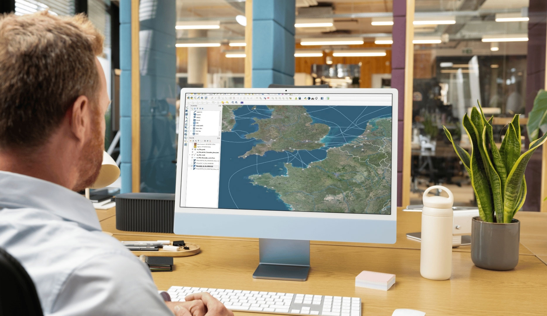
Create Stunning Visuals With Premium Geospatial Data
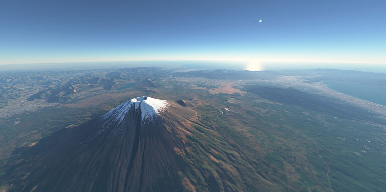
At PlanetObserver, we deliver high-quality geospatial data solutions designed to elevate any visual experience. Our global satellite imagery and terrain models provide the foundation for high-performance graphics used in in-flight entertainment (IFE), weather visualization systems, and planetarium software.
What makes us different? A commitment to visual consistency, data accuracy, and plug-and-play compatibility with professional graphics environments. Our data is optimized for real-time rendering, animation, and integration into 2D and 3D display systems—offering exceptional clarity and performance.
Elevate your Graphics & Animation Solutions
with High-Impact Geospatial Data
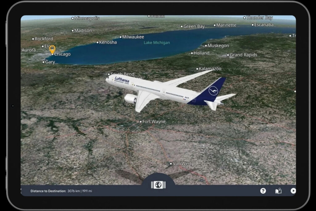
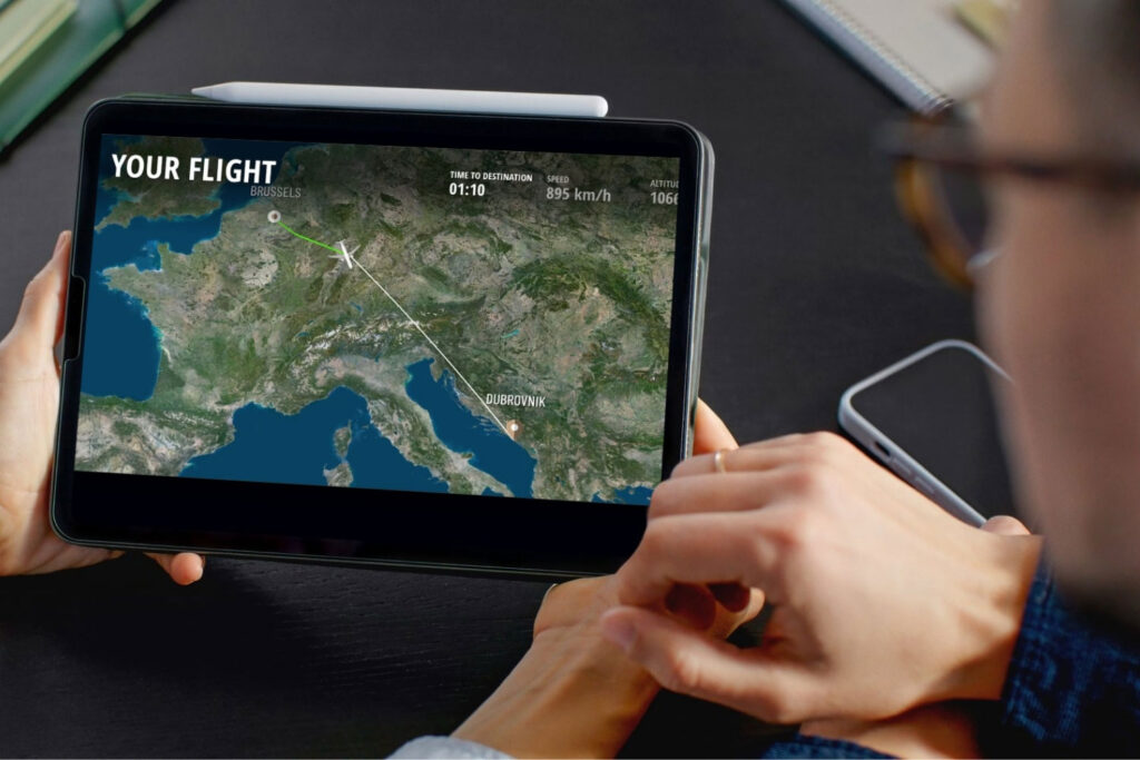
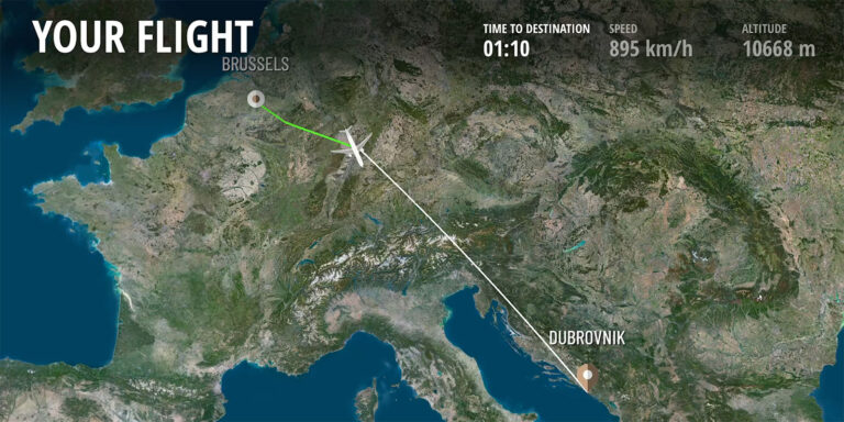
Enhanced Maps for In-Flight Entertainment
Moving map applications are now a central feature to the In-Flight Entertainment (IFE) experience. More than navigation tools, they keep passengers engaged throughout the flight by offering a dynamic, real-time view of their journey. As airlines enhance their infotainment systems, visually rich and interactive maps have become essential.
PlanetObserver provides a seamless, natural-color satellite imagery basemap designed for smooth integration into IFE moving map solutions. Optimized for visual clarity, performance, and global consistency, our imagery brings realism and visual appeal—whether displaying global routes or detailed local terrain.
Key Applications
- Base layer for interactive moving map displays in IFE systems
- Real-time flight tracking
Leading providers such as Display Interactive and FlightPath 3D integrate PlanetObserver’s geospatial data to deliver high-quality, immersive moving map experiences on board commercial and business aircraft.
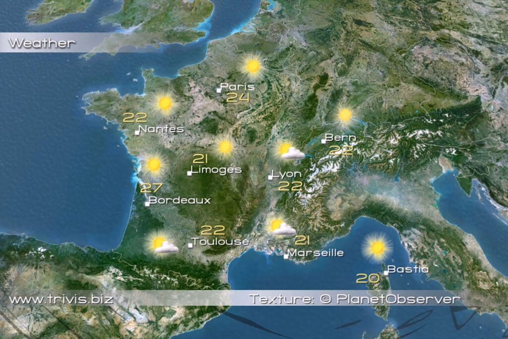
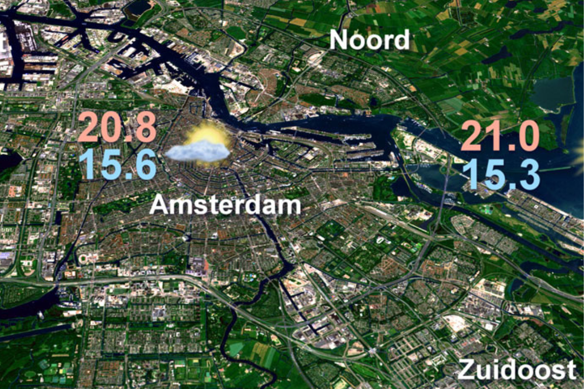
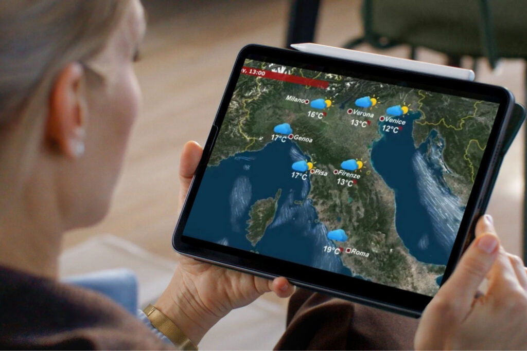
High-Quality Geospatial Data for Weather Graphics
In weather graphics, visual quality is key. PlanetObserver’s satellite imagery and terrain data provide a realistic backdrop that transforms forecasts into engaging visual content.
With natural colors, seamless coverage, and global consistency, our basemap enhances both broadcast and operational weather systems. Easy to integrate, it delivers smooth performance and clear, compelling visuals that capture attention.
Key Applications
- Geographic backdrop for broadcast and digital weather graphics
- Enhanced visuals for real-time forecasting systems
- Integration into 2D/3D meteorological visualization platforms
Providers such as MetraWeather (New Zealand MetService), Chyron, and Ask trust PlanetObserver’s data to deliver clear, engaging forecasts with strong visual impact.
Our Commitment
Trusted geospatial solutions—delivered with precision and care.
Expert support
We go beyond data delivery—offering close collaboration to ensure our solutions align with your goals and technical needs.
Let's talk
Ready to enhance your graphics & animation solutions?
Contact us to explore how our data can support your project.
Hear What our Amazing Customers Say
“Using PlanetSAT imagery basemap and PlanetDEM elevation data allows us to deliver stunning, real-time weather graphics to our broadcast clients”
– MetraWeather
Martin Kantor, Lead Creative Engineer
“PlanetObserver’s imagery brought a new level of visual quality to our moving map, helping us deliver a richer and more immersive inflight experience.”
– Display Interactive
Simon Loizeau, Product Owner
“We’re very happy with the quality of PlanetSAT imagery which integrates seamlessly into our weather graphics solution.”
– ask-Innovative Visualisierungslösungen
Hermin Aftahi & Florian Schröder – CEOs
Customer Success Stories
See how organizations around the world use our Earth imagery and elevation data to solve real challenges,
drive innovation, and bring their projects to life. Discover their stories and imagine what’s possible for yours.
MetraWeather optimizes weather graphics with PlanetObserver’s global imagery and elevation data for more impactful visual forecasts.
Display Interactive’s IFE moving maps, powered by PlanetSAT imagery, enhance the passenger experience with rich in-flight visuals.
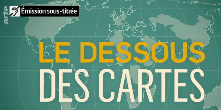
The Arte geopolitics series « With Open Maps » uses PlanetSAT satellite imagery to illustrate global events and conflicts with clarity and impact.
Discover how RSA Cosmos & PlanetObserver enhance planetariums worldwide with high-quality world imagery and immersive experiences.
They trust us


Let's talk
Ready to enhance your graphics & animation solutions?
Contact us to explore how our data can support your project.
More industries we serve
Defence & Intelligence

Aerospace

Mapping & GIS