Capabilities of PlanetObserver – Part 3: Satellite Image Color Correction
PlanetObserver highligts its capabilities in Satellite Imagery Color Correction.
Satellite imagery is a powerful tool for understanding our planet. At PlanetObserver, we specialize in transforming raw satellite data into a visually compelling, scientifically accurate, and annually updated global 10-meter imagery mosaic, PlanetSAT Basemap.
In this third installment of our “PlanetObserver Capabilities” series, we explore the intricate process of satellite image color correction, a blend of algorithms and human expertise that results in vivid, seamless mosaics.
From Raw Pixels to Recognizable Landscapes
When a satellite captures an image, it records data as pixels. Each pixel corresponds to a specific wavelength of light, whether in the visible spectrum (Red, Green, Blue – RGB) or beyond. These raw pixels lack the harmonious colors we associate with landscapes. Our task is to translate these data points into something our eyes recognize. This meticulous process not only requires a deep understanding of color theory but also a profound respect for the natural appearance of the Earth’s surface.
At PlanetObserver, transforming raw satellite images into the stunning visuals of our PlanetSAT Basemap is a blend of science and skill. Through careful steps based on smart algorithms, we make sure our final global mosaic is as beautiful as it is true to life.
Step 1 – Algorithmic Foundations of Satellite Image Color Correction
1. Mosaic Creation: We begin by selecting high-quality satellite images from our main data sources that are Sentinel-2 satellites. Algorithms stitch these images together, creating a continuous mosaic. Clouds and other artifacts are meticulously eliminated through a process of integrating multiple images from varied time frames, resulting in a pure and cloud-free visual canvas. This method ensures the creation of a consistently clear and uninterrupted view of the Earth’s surface.
2. Color Balancing: Algorithms adjust the RGB (Red-Green-Blue) channels to achieve a first color balance.
Step 2 – Seam Removal
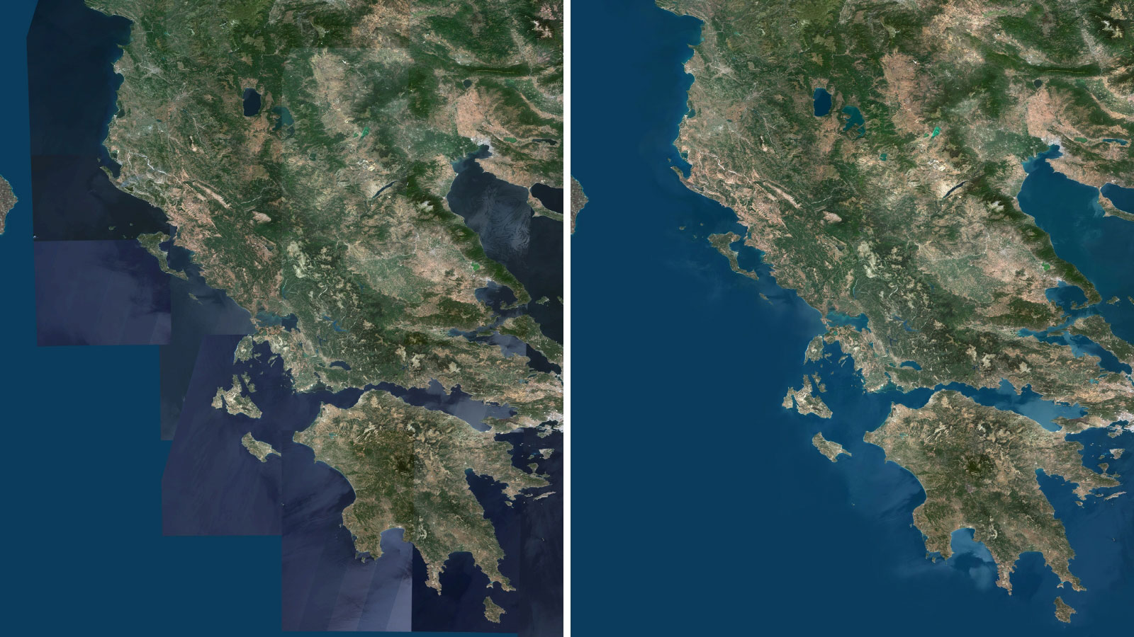
Color correction of satellite images is a complex task, as is the challenge of creating a unified image from numerous individual tiles. Achieving seamless transitions between those image tiles is one of our key challenges. Automated systems can sometimes leave visible seams that disrupt the continuity of the mosaic. To address this issue, our graphic designers meticulously blend the adjacent tiles, ensuring that the Earth’s surface appears continuous and natural. This careful seam removal is an essential part of the overall color correction process, enhancing the visual appeal of the final product.
Below is the example of the mosaic of Greece. The left image displays the mosaic with visible seams, while the right image illustrates the final product with complete color uniformity, both on land and sea.
Step 3 – Global Color Consistency
Color consistency is crucial for the integrity of the global satellite imagery mosaic. Variations in shadows, haze, and different atmospheric conditions can introduce color distortions, compromising and weakening the global visual quality of the imagery. It’s here that our team’s expertise becomes indispensable. By manually adjusting for these inconsistencies, we achieve a level of color fidelity that algorithms alone cannot replicate, ensuring that our depiction of the Earth remains true across the entire mosaic.
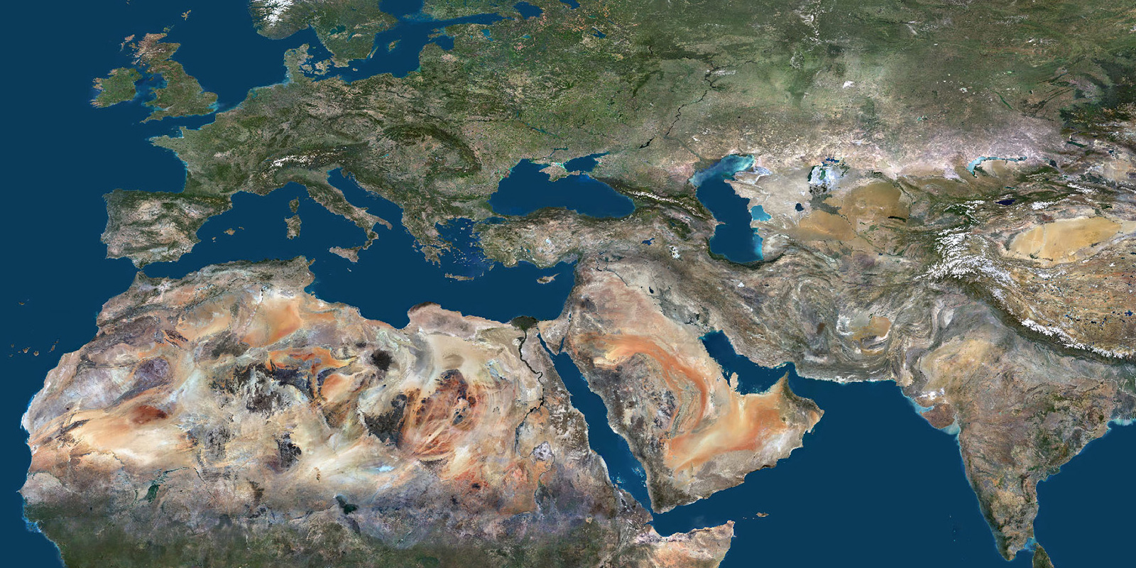
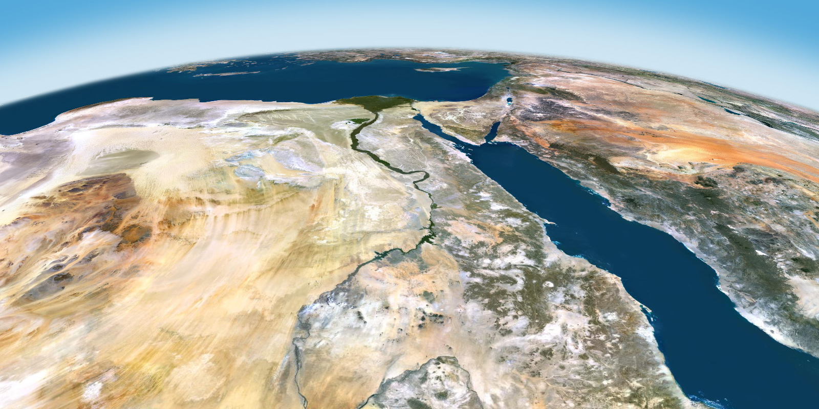
The imagery mosaic of North Africa and the Sahara Desert serves as a good example. The PlanetSAT imagery, shown above, displays the full spectrum of Africa’s colors, from the vibrant oranges of the sand dunes to the dark tones of volcanic mountains. This clearly illustrates that the Sahara desert is far from just a single shade of yellow. In constrast, the mosaic in Google Maps presents a much more limited color palette, offering little insight into the region’s diverse geographical and geological features.

Quality Control: The Final Check
Our commitment to high standards is reflected in our precise quality control process. Every segment of our mosaic undergoes detailed examination to ensure that it meets our quality standards for color accuracy and clarity. This final stage of review is essential, eliminating any residual technical flaws and affirming our dedication to producing imagery that not only is eye catching, but also serves as a reliable source of geographic information.
At PlanetObserver, our approach to satellite image color correction is defined by a commitment to reality and beauty, and the subtle interplay between technology and human insight. Through our dedicated efforts, we work to present the Earth in its true colors, showing the incredible diversity of our planet’s landscapes.
People Behind the Scenes: Insights from Bruno, our Head Graphic Designer
Bruno, our head graphic designer with more than 20 years of experience in color correction and enhancement, shares his insights on satellite image color correction:
“Natural color processing is a fascinating interplay of science and art. Algorithms provide the foundation, but it’s the human touch that brings the pixels to life. Our 10m resolution PlanetSAT global mosaic highlights this synergy. It’s not just about correcting technical imperfections; it’s about creating an authentic view of our planet.”
Keep an eye out for the next installment of our Capabilities series, where we’ll explore our Global Digital Elevation Model, coming soon!