Products
Industries
Resources
PlanetObserver highligts its capabilities in the Production of Satellite Image Mosaics.

The process of creating satellite image mosaics is central to our mission, involving the artful combination of thousands of satellite images to produce seamless, detailed representations of our planet. Our second article in the “PlanetObserver Capabilities” series will focus on the production of these satellite image mosaics, which is another major aspect of our service that lies at the heart of our work.
We're thrilled to bring you more insights from our experienced Technical Director, Pierre Dubus, about how the production of satellite image mosaics unfolds after the selection of the appropriate images.
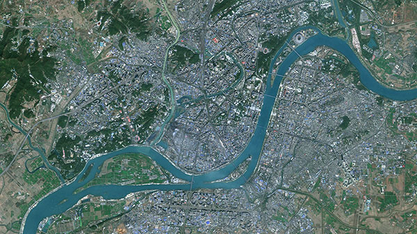
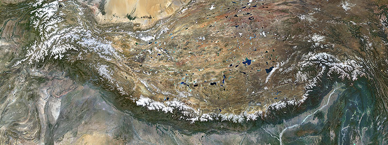
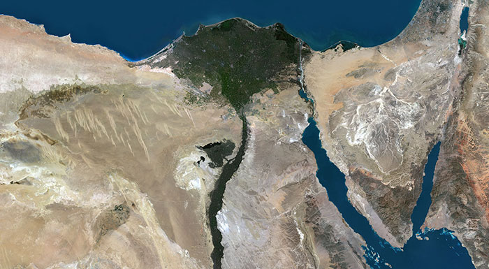
For more than 30 years, PlanetObserver has specialized in producing seamless satellite image mosaics of the Earth in natural colors. With a 10-meter resolution, PlanetSAT global mosaic stands as the flagship product of PlanetObserver. It is a comprehensive, seamless, cloud-free, and natural color mosaic of satellite images from around the globe. All images are meticulously assembled to form a visual map of the world, faithfully capturing the Earth's authentic colors and landscapes.
Every year, PlanetObserver integrates the latest Sentinel-2 imagery to update its PlanetSAT Basemap with new, country-wide satellite image mosaics. But how exactly is this production process carried out?
Once the appropriate scenes have been selected, the production process for creating natural color image mosaics progresses through several key steps:

The majority of these steps are executed through advanced algorithms, streamlining the process. Various tools, such as Global Mapper, play a pivotal role throughout the processing stages. Global Mapper stands out as cutting-edge GIS software, offering a wide number of spatial data processing tools and granting access to a diverse range of data formats, thereby enhancing efficiency and versatility in satellite image mosaic production.
For customized mosaic production, we have the flexibility to leverage a wide range of available images from various sources in the market. This includes utilizing open-source data such as 10-meter Sentinel-2 and 15-meter Landsat 8, as well as very high-resolution commercial data from providers like Maxar and Onyx Space, ensuring we have access to the most suitable imagery for our clients' specific needs.
As we wrap up this segment, we've taken a closer look into how PlanetObserver creates top-notch satellite image mosaics. Keep an eye out for our next article, where we'll dive deeper into the world of color processing and showcase our specialized technical abilities.