Products
Industries
Resources
Get to know our team in the new "Meet the Geospatial Team" series. Meet Pierre in our second episode!

Meet Pierre Dubus, the Technical Director at PlanetObserver, whose three-decades of experience have been marked by innovation and expertise in the geospatial data industry. In this interview, Pierre shares insights into his role, the evolution of technology, and the unique approach taken by PlanetObserver in producing cutting-edge satellite imagery.
Hello, I’m Pierre Dubus. With a Master's Degree in Earth Sciences and dual Ph.D.s in Surficial Geochemistry and Computer Science applied to Earth Sciences, I've served as the Technical Director at PlanetObserver for three decades.
My role involves leading the development and oversight of internal production processes, integrating new technologies to streamline operations and elevate product standards. Additionally, I'm responsible for the continuous refinement and advancement of our two flagship products: the PlanetSAT 10m imagery basemap and the PlanetDEM 30m elevation dataset.
Over the past three decades, my role has undergone significant evolution alongside advancements in technology. The emergence of powerful computing systems and the availability of extensive geospatial data have profoundly shaped my responsibilities. Since the beginning, my focus has been on generating geospatial datasets with broad coverage, ranging from country-wide to global extents—a commitment that persists with our current flagship offerings, PlanetSAT and PlanetDEM datasets.
I oversee the development of specialized production processes for crafting high-quality global imagery products in natural colors. Moreover, I lead the automation efforts across various stages of Earth Observation data processing, ensuring efficiency and accuracy throughout our production pipeline. This is particularly crucial for our PlanetSAT basemap, which undergoes annual updates by our geospatial team to reflect the latest changes on the planet's surface.
At PlanetObserver, satellite imagery production lies at the heart of our operations. Our internal processing chain relies on a suite of methodologies and software tools, with one standout being Global Mapper. This advanced GIS software is tailored for efficient data processing and the precise creation of maps.
What sets PlanetObserver apart is our utilization of image creation, graphic design, and photo editing software in the production of our imagery mosaics. While uncommon in the geospatial industry, this unique approach enables us to achieve advanced color balance and homogeneity, both locally and globally, ensuring unparalleled quality in our products.
The transformation in geospatial technology over the past three decades has been profound. With the emergence of computer technology and Geographic Information System (GIS), the industry has experienced a significant leap forward. I recall starting my career with computers that offered limited computing resources and storage capacities. Since then, we've witnessed a complete revolution—from desktop systems to powerful servers, and now, the vast opportunities presented by cloud computing.
Furthermore, the accessibility of geospatial data has undergone remarkable changes. Gone are the days of ordering and receiving single Landsat 5 scenes on hard drives; today, we have access to an unlimited array of imagery from various cloud-based platforms, revolutionizing the way we gather and utilize geospatial information.

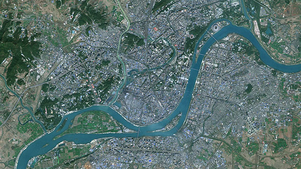
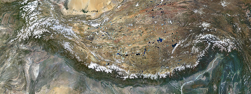
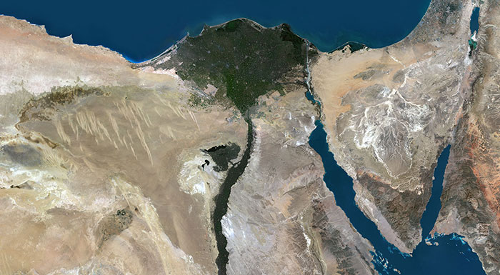
At PlanetObserver, we dedicate extensive time and effort to ensure that our 10-meter imagery basemap, known as PlanetSAT, stands out. My objective is simple: to create the most visually stunning color mosaic with global coverage. How do we achieve this goal? By not only leveraging geospatial tools but also integrating graphic design software into our production process. These tools are operated by technicians from my team who are experts in color blending and achieving optimal color balance. I take pride in the fact that our customers consistently praise the great quality we deliver.
In the dynamic landscape of the geospatial data industry, keeping pace with rapid technological advancements poses a significant challenge. From the integration of AI and blockchain to leveraging scripting languages like Python for cloud-based platforms, innovation is driving the industry forward at an unprecedented pace. At PlanetObserver, our primary focus remains on refining our expertise in producing satellite imagery mosaics using established technologies that have evolved over the years.
However, as a small team with only four members, we acknowledge the limitations of our resources and expertise. Rather than competing directly with geospatial data providers utilizing AI and blockchain technologies, we prioritize leveraging our deep-rooted knowledge and experience to deliver high-quality products to our customers.
In summary, Pierre Dubus brings extensive expertise to geospatial data at PlanetObserver. With a commitment to quality and unique approaches to satellite imagery production, his commitment greatly contributes to the company's ongoing success. As technology advances, Pierre and his geospatial team continue to adapt, striving to maintain high standards and deliver unique results in their field.
Stay tuned for the upcoming Q&As with other members of the geospatial team. See you soon!