Products
Industries
Resources
PlanetObserver has committed to an impressive annual update schedule that makes PlanetSAT 10m basemap more robust every year.

CLERMONT-FERRAND, France – March 16, 2021 – PlanetObserver is excited to announce the release of PlanetSAT Global version 2021, a basemap that provides ready-to-use, seamless and visually stunning imagery.
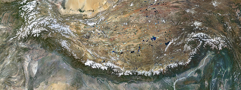
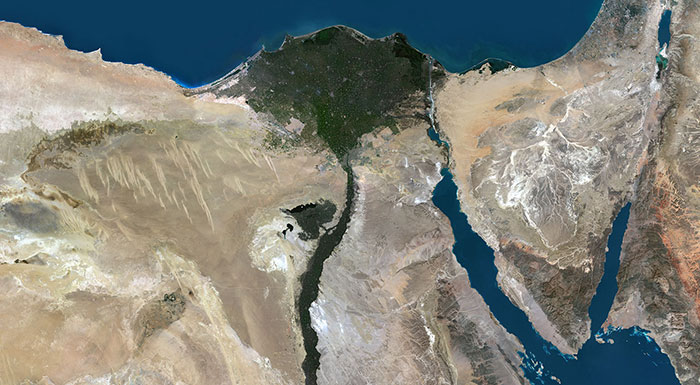
With unmatched 10-meter resolution, PlanetSAT Global imagery basemap provides access to detailed geographic information from global scales all the way down to 1:50,000 map scale.
One of the most important features of the basemap is the updates that we release on an annual basis. We understand that out-dated imagery is often of little or no use for many projects and solutions. Annual updates ensure that our customers can access the most current image layer available.
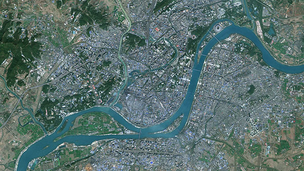
For Version 2021, more than 2 Mil. km² of fresh 10-meter imagery have been ingested in the global basemap. Moreover, new mosaics of Southern and Central Europe are now available. In addition, over 100 cities worldwide including 70 U.S. cities and large populated areas in Asia have been updated.
The refreshed imagery content continues to grow. PlanetObserver has indeed committed to an impressive annual update schedule that makes this global imagery solution more robust every year.
Thanks to advanced image mosaic techniques, including color balancing and seamless blending of thousands of individual imagery scenes, PlanetSAT Global product provides a visually consistent and continuous image layer over the whole world.
The global basemap is therefore best adapted to support mapping and visualization. It gives global context to many professional applications, from modeling and simulation solutions to GIS tools and webmapping platforms.
Moreover, customers get access to a ready-to-integrate global imagery basemap, available off-the-shelf in many professional formats, ranging from GeoTIFF, JPEG to ECW. It is also available in global, continental, country or custom AOI coverage,
PlanetObserver is a French business specialized in the processing and production of high value-added geospatial data. Our mission is to develop innovative products that maximize the visual and technological performance of our clients’ projects and solutions in the Defense, Aerospace, mapping and GIS sectors. All PlanetObserver products are developed in-house and based on the company’s know-how in geospatial data processing as well as more than 30 years of technological expertise.
With a constant commitment to R&D and innovation, and mastery of cutting-edge technologies, PlanetObserver is positioned as the supplier and partner of leading companies located in Europe, North America and Asia-Pacific, such as Airbus DS, Dassault, Thales, Boeing, CEA or New Zealand MetService.