New PlanetDEM Global Elevation Dataset Enhancing Data Reliability
PlanetObserver’s Expertise in Elevation Model: Achieving Global Reliability with AW3D30 Data
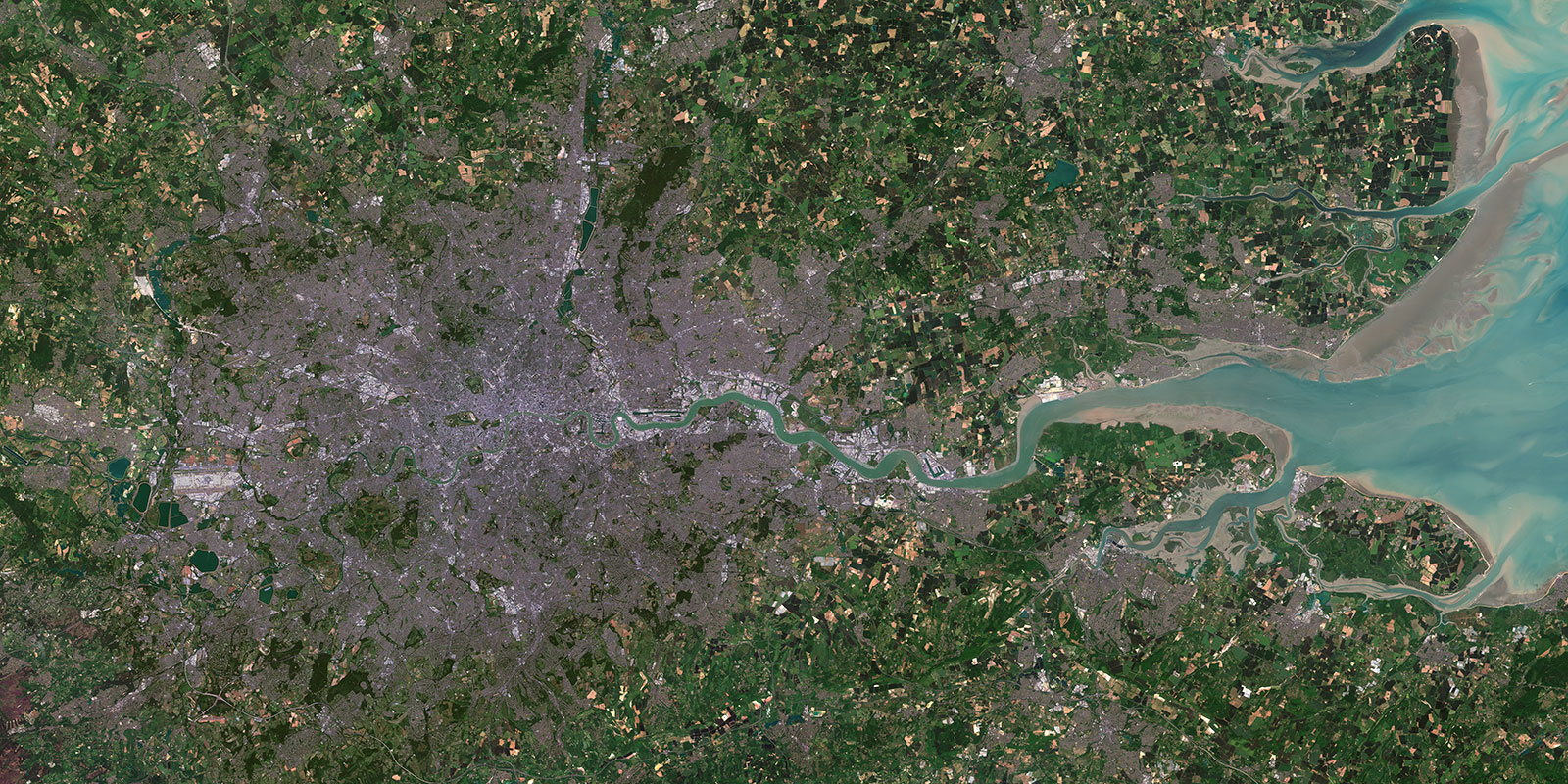
CLERMONT-FERRAND, France – March 24, 2022 – PlanetObserver is excited to announce the release of PlanetSAT Global 2022, a basemap that provides ready-to-perform, cloudless, and homogeneous imagery.
Making Global Elevation Dataset Reliable and Artefact Free
Digital Elevation Models (DEMs) are crucial for many geographic data applications. They are used for visualization, simulation, and landscape modeling projects. DEMs can be generated from remote sensing data or land surveying. They provide a spatial representation of terrain, but may contain errors (artefacts) that can negatively impact the accuracy of high-stake or even simple projects if not corrected.
AI and Machine Learning do not Provide all the Answers
Stereo auto-correlation techniques are utilized to fix overlapping images when creating a DEM. However, even high-performance computing systems like the Blue Waters supercomputer at the National Center for Supercomputing Applications at the University of Illinois at Urbana-Champaign, are not capable of eliminating artefacts such as spikes, pits, and false landforms, which can significantly degrade the quality of the dataset. Currently, the only effective method to correct these artefacts is manual correction, which is costly, resource-intensive, and requires a high level of geographic and topographic knowledge and expertise, making it a challenging task.
PlanetObserver’s Methodology (And why it is more reliable)
The good news is that here at PlanetObserver, our team of experts have got you covered.
Our team of experts is equipped to provide reliable medium-resolution DEMs. With a deep understanding of geographic analysis, terrain topography, and data management, our team can quickly identify and correct artefacts in source data using various techniques. As a result, PlanetObserver has created PlanetDEM, a corrected and globally available Digital Elevation Model with 30-meter resolution. The product, in the form of a Digital Surface Model (DSM), captures the surface features, including natural and man-made structures such as vegetation and buildings.
PlanetDEM is mainly based on ALOS World 3D-30m dataset (JAXA) and corrected with NASADEM data (NASA). The team at PlanetObserver has employed multiple techniques to improve the source data. The first step involved detecting and removing spikes and holes caused by low correlation between AW3D30 images through a semi-automated process. The second step involved identifying and correcting artefacts caused during the processing of the AW3D30 source product, which can occur due to weak correlation between images in areas with low-contrast materials such as water, snow, and ice. This step requires human expertise, which has been developed by PlanetObserver through the production of its previous global DEM, PlanetDEM 30 Plus, based on the SRTM 1-arc-second dataset.
With the knowledge and experience of our experts and auxiliary layer information in the ALOS World 3D-30m product, anomalies and outliers can be identified and corrected, mainly using the Delta SurfaceFill (DSF) replacement method. PlanetObserver’s commitment to delivering high-quality and accurate data sets has led to the creation of PlanetDEM, a corrected global Digital Elevation Model.
As a result, PlanetObserver managed to correct most of the anomalies that commonly appear in many DEMs of the same resolution, as illustrated below.
Achieving a Trusted and Reliable Global Elevation Dataset
PlanetObserver’s team of experts has leveraged cutting-edge technology and their extensive knowledge of terrain topography, geographic analysis, and data management to provide clients with a corrected and highly accurate Digital Elevation Model.
Thus, 35.5% of the tiles of AW3D30 base source product have been corrected. See areas in yellow and red in the image below.
With its highly accurate representation of the terrain, PlanetDEM elevation dataset is a valuable resource for various industries, including Defense, mission preparation systems, flight simulation, and GIS applications across multiple sectors such as agriculture, energy, land planning, infrastructure, and others. Moreover, the dataset is ideal for orthorectifying satellite images and can help improve the overall accuracy and precision of geospatial data analysis.
About the author
Guy Boussougou Boussougou has a PhDin environmental geography and remote sensing obtained at the University ofReunion in 2017. After a year as a research engineer (PhD position) at the French National Institute for Agricultural Research (INRA, 2018-2019), he is since 2020, in charge of research projects and development of innovative products at PlanetObserver, Clermont-Ferrand (France). He is currently working on the processing and production of a global DEM (PlanetDEM) from open source DEMs in collaboration with the Earth Observation Laboratory (Lab’OT) of the French National Center for Space Studies (CNES) via the SME support program, Connect by CNES.