Why is PlanetSAT the most beautiful global imagery basemap?
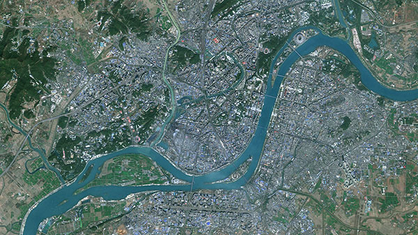
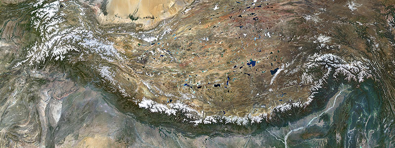
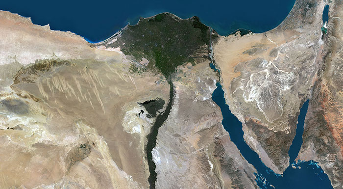
PlanetSAT imagery basemap is the result of expert processing techniques and comprehensive geographic knowledge.

PlanetObserver has been making global satellite imagery basemaps for over two decades now, which leads to an immense amount of work put into the mosaic called PlanetSAT. With a resolution of 10m per pixel, this basemap is primarly created using Sentinel-2 satellite imagery.
At PlanetObserver, it is our job to make an outstanding basemap every year that is visually pleasing and can be used reliably across various industries. We have a team of experts in geography, volcanology, cartography, and graphic design to ensure a high-quality final product.
Here, we outline the key steps involved in our process to deliver the most beautiful basemap.
Key factors to select the proper input data
Selecting the right input data is a crucial step in building a high-quality global satellite imagery basemap. Having the right satellite images at hand translates to more efficiency, a better product, and less resources used. But why is it so challenging to choose the right source data?
One major issue is cloud cover. It can be a challenging task to select images with minimal cloud cover, which is imperative to make a clear and accurate mosaic. To optimize this process, the expert needs to know which seasons of the year have the least clouds across the world. We use different weather applications to optimize this crucial step.
According to NASA, 67% of the earth is consistently covered with clouds, making timing a key factor in getting cloudless images. Some areas of our beautiful planet are covered by clouds almost 100% of the time, making it difficult to obtain cloudless images.
In addition to cloud cover, other criteria must also be taken into account such as vegetation cover, snow cover, mist, and the orientation of the sun which is responsible for casting shadows, especially in mountainous areas. These factors can vary greatly depending on the season and the geographic location. To make a high-quality global mosaic, it is essential to take these elements into consideration and to have a deep understanding of the processing process.

One example of this is how the same area in Europe can change dramatically, based on the season. The top left satellite image was collected in winter, and shows the area covered in snow. The top right image, collected in spring, demonstrates how the landscape changes as the snow melts, and the fields become green. However, in spring, many fields turn yellow due to the flowering of rapeseed plants. We try to avoid selecting images with such yellow fields as they can be misleading and make it difficult to understand the true appearance of the area. This happens mostly in Canada, China, India and Europe, which are the leading rapeseed producing countries in the world. Therefore, we select images that best represent the area, such as the last image taken in August, which captures the true appearance of the area.
To ensure the best quality data, the selection criteria for images include the latitude range, season of data collection, and recentness. In the northern hemisphere, summer images are preferred for areas north of 60°N (i.e. Canada, Northern Europe, Siberia), while spring and summer images are selected for areas between 35°N and 60°N (i.e. USA, Western and Central Europe, Central China). For equatorial and southern hemisphere areas, images can be selected year-round, and for the southern tip of the southern hemisphere, images from November to March are ideal. The most recent images available are also a key factor in our selection process.
Cloudless Imagery Processing
As mentioned before, overcoming the challenge of clouds is crucial to creating a high-quality global satellite imagery basemap. At PlanetObserver, we've developed a cutting-edge process that results in a virtually cloudless map for almost all regions globally.
Our process involves using multiple satellite images of the same area to select cloud-free pixels and seamlessly integrate them into a single, clear image. This step is integral to the production of the basemap, which boasts virtually cloudless coverage for nearly all regions worldwide. Although there is still some minor cloud cover in tropical areas of Africa, South America, and Southeast Asia, we are continuously working to eliminate it.
Our commitment to quality guarantees that the final product is of the highest caliber and can be confidently utilized across various industries.
.jpg)
Advanced color balancing
At PlanetObserver, we are dedicated to creating a high-quality global satellite imagery mosaic that is visually striking and consistent. Our proprietary color balancing process is a critical component to achieve that goal.
Our experienced lead graphic designer, Bruno, has over 20 years of experience in the field and has mastered the art of creating mosaics that are both realistic and impactful. Bruno and his team have gone through millions of images to create our 12 Terabyte global basemap, PlanetSAT.
Creating a seamless and homogeneous global basemap requires an in-depth comprenhension of geographical areas and their unique features. Variations in satellite imagery caused by factors such as weather conditions and seasonal changes make this a challenging task. Different regions demand diverse processing techniques, as oversights such as improper reflection of light on building roofs can result in overly bright city images. The same processing parameters cannot be applied to both deserts and forests, as this would yield unrealistic colors or excessively dark imagery. Bruno and his team expertly navigate these complexities to deliver a consistent and accurate global basemap.
Efficient seamless processing
The production of seamless satellite imagery mosaics has become a standard of the industry, requiring a specialized set of skills and knowledge to execute effectively. At PlanetObserver, we possess the necessary expertise to seamlessly integrate multi-date satellite images into a homogeneous mosaic.
The process of creating a mosaic involves correcting color variations between individual images, referred to as scenes. Seams are formed along the boundaries of these scenes and blended to create a seamless transition. This is often achieved by aligning seams with natural features such as roads or rivers. When these features are not present, seamless feathering techniques are utilized to create a smooth transition, combined with color correction to result in a final, seamless image.

Global homogeneous imagery basemap
PlanetSAT basemap is considered a top quality basemap for several reasons:
1. Expertise in Image Processing: The mastery of all the processing steps and an understanding of geographical areas make it possible to create a consistent and homogeneous global basemap.
2. High Quality and Military Standard Compliance: PlanetSAT basemap not only looks beautiful and realistic, but it is also fully documented and military standard compliant.
3. Accurate Metadata: The basemap comes with metadata for all pixels, making it highly detailed and accurate.
4. Versatile Formats for Easy Use in Various Applications: It is available off-the-shelf in a variety of formats such as GeoTiff, Jpeg 2000, COG, and ECW, making it easy to use in a variety of applications.
5. Accesible through Web Map Services and API for Convenience: Users who do not want to host the data can easily access the basemap through efficient web map services (WMS, WMTS) and API, making it more accessible.
PlanetObserver has a strong track record of providing high-quality global satellite imagery to a wide range of customers across different industries. Some of our most notable customers include Thales, Airbus, and Dassault. Thales, a global leader in defense and aerospace, has been using PlanetSAT basemap for their defense and security applications. Airbus, a leading aerospace company, has been using our basemap for their Earth observation projects. Dassault, a French aerospace company, has been using our basemap for their simulation and training programs. These companies have chosen PlanetSAT basemap because of its high accuracy, consistency, and quality. They trust the expertise of our team and the ability of our basemap to meet their specific needs and requirements.


