Products
Industries
Resources
Find out how PlanetObserver’s imagery quality control ensures precision and reliability for PlanetSAT’s global basemap.

Producing a visually coherent global basemap such as PlanetSAT requires more than advanced data processing and color balancing.
For professional users in defense, simulation, broadcast, and GIS, imagery quality control and reliability are essential. A mosaic that looks beautiful but lacks geographic precision or metadata traceability cannot meet operational needs.
At PlanetObserver, every PlanetSAT product undergoes a comprehensive imagery quality control and validation process to ensure that it meets the expectations of technical users and system integrators worldwide. From visual inspections to metadata structuring, the final stages of production are designed to guarantee accuracy, consistency, and transparency.
Once the global mosaic is assembled, it undergoes a rigorous imagery quality control process that combines careful analysis with expert visual checks.
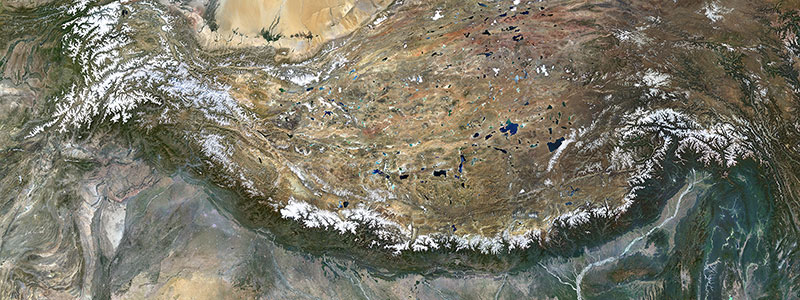
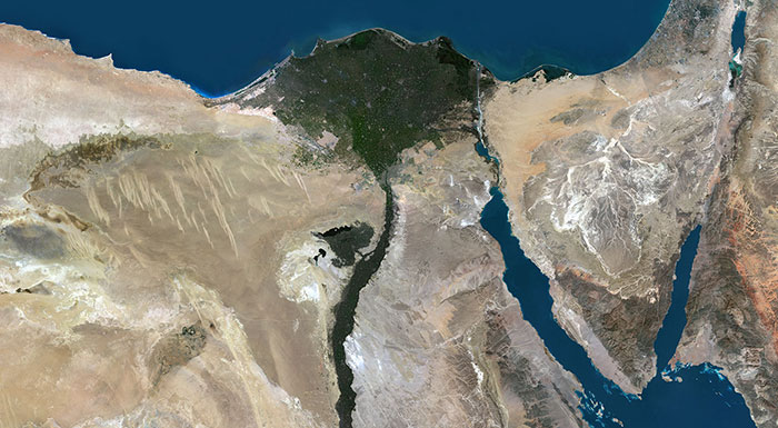
Each region of the mosaic is reviewed at multiple zoom levels to verify color consistency, geometric alignment, and the absence of residual clouds or artifacts. This meticulous visual inspection enables the team to identify subtle irregularities that that automated detection might overlook, particularly in challenging environments such as mountainous areas or coastal regions.

Transparency is a key value in the geospatial industry. Each PlanetSAT tile is accompanied by structured metadata detailing:
• Source imagery (Sentinel-2 scenes used).
• Acquisition dates and geographic coverage.
This metadata provides users with complete traceability and facilitates integration into complex information systems. For defense organizations, simulation developers, or GIS specialists, this means being able to track every data input and processing step, ensuring confidence and interoperability.
Metadata also supports the automation of data ingestion in GIS software, allowing PlanetSAT to be deployed quickly and efficiently in professional workflows.
PlanetSAT is designed to integrate seamlessly into diverse operational environments. To accommodate different system requirements, the dataset is available in several widely used formats:
• GeoTIFF for universal compatibility with GIS and image processing software.
• Cloud-Optimized GeoTIFF (COG) for efficient use in cloud platforms and web-based applications.
• JPEG 2000 for lightweight visualization and bandwidth-efficient distribution.
Users can choose between multiple resolutions depending on their needs:
• Full 10m resolution for detailed analysis and visualization.
• Downsampled versions at 40m or 150m, optimized for large-scale mapping, simulation, or low-bandwidth systems.
This flexibility ensures that PlanetSAT can serve as a core data layer in a wide range of professional applications — from desktop GIS to cloud-based visualization systems and embedded flight simulators.
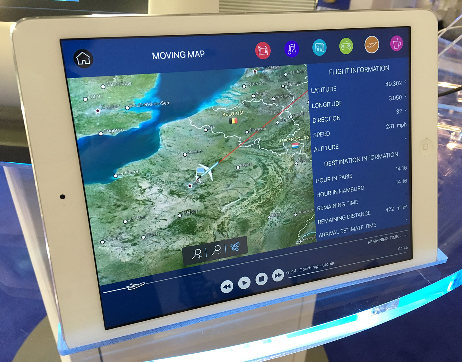
PlanetSAT’s structure and formats are fully compatible with major GIS and simulation software, including ArcGIS, QGIS, ERDAS IMAGINE, and Cesium.
This compatibility allows users to deploy PlanetSAT immediately within their existing infrastructures, without the need for additional preprocessing.
In simulation environments, this integration capacity is critical. Whether used for mission rehearsal, training simulators, or real-time visualization, PlanetSAT’s harmonized global imagery provides a stable and realistic foundation that enhances immersion and situational awareness.
PlanetSAT’s reliability and aesthetic quality have earned the trust of leading organizations in multiple industries:
• Defense and Intelligence — PlanetSAT supports operational planning, terrain analysis, and situational visualization. Long-term users include Thales and Dassault Aviation, who integrate PlanetSAT into mission preparation systems.
• Flight Simulation — Used as a base layer for realistic environment rendering in both civilian and military simulators. PlanetObserver has established long-term partnerships with Sogitec Industries, a Dassault Group company specializing in simulation systems.
• Broadcast Media — The Meteorological Service of New Zealand relies on PlanetSAT for its national weather broadcasts, ensuring visually consistent and geographically accurate map backgrounds for news and meteorological reports, while RSA Cosmos in France integrates it into digital planetariums and immersive visualization systems.
• GIS and Mapping Platforms — PlanetSAT provides a reliable basemap for cartographic projects and visualization. Notably, IGN France uses PlanetSAT in its geoportal for thematic mapping.
Each of these use cases demonstrates PlanetSAT’s ability to adapt to different operational contexts while maintaining high standards of visual quality and precision.
In a market where vast quantities of satellite data are freely available, the challenge no longer lies in access, but in transformation and value creation.
PlanetSAT distinguishes itself by combining automation, scientific rigor, and human craftsmanship to produce a dataset that is both technically robust and visually compelling.
Its continued use in demanding professional domains highlights the importance of curation, consistency, and attention to detail — qualities that turn raw satellite data into a true operational asset.
In the growing world of satellite data, true value lies in imagery quality control, precision, and visual coherence. PlanetSAT embodies these principles and represents of over three decades of PlanetObserver’s expertise in satellite imagery and color processing.
It offers a unique synthesis of technology and artistry, precision and beauty — an Earth basemap ready for professional integration across industries.
Whether used for mission preparation, flight simulation, broadcast graphics, or advanced mapping, PlanetSAT provides a trustworthy, harmonized view of the planet, enabling professionals to see and understand the world with unparalleled clarity.