Products
Industries
Resources
Learn how PlanetObserver refines satellite imagery processing, combining automation and human expertise to create PlanetSAT basemap.
Creating a seamless, realistic view of the entire planet requires both sophisticated automation and human precision. The satellite imagery processing workflow behind PlanetSAT reflects this balance through a multi-stage workflow that transforms thousands of raw satellite images into a uniform and reliable basemap.
From cloud masking to seamline optimization, each phase is carefully designed to ensure visual homogeneity, geometric accuracy, and radiometric consistency across continents and oceans.
The PlanetSAT production pipeline begins with a robust automated preprocessing phase, ensuring that all Sentinel-2 scenes share the same geometric and radiometric reference.
Each satellite image is:
• Reprojected to a unified coordinate system for global consistency.
• Normalized in radiometric terms to reduce sensor-specific or atmospheric variations.
• Filtered to remove corrupted or low-quality data.
This automation enables PlanetObserver to process massive data volumes efficiently while maintaining rigorous standards. The process guarantees that the mosaic aligns accurately with existing GIS datasets and supports professional analytical use.
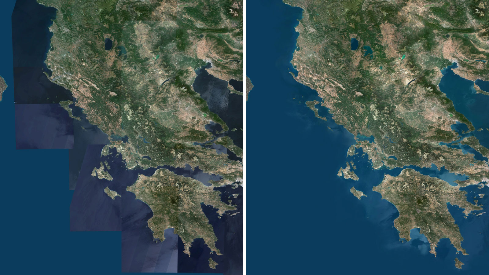
Clouds represent one of the major challenges in satellite imagery processing. Even the best acquisitions are affected by atmospheric conditions.
PlanetSAT uses a multi-temporal compositing strategy to address this issue: cloudy pixels in one image are replaced with clear-sky pixels from overlapping acquisitions taken on different dates.
This cloud-removal process, based on spectral and spatial correlation, ensures a clear and continuous surface representation. It preserves land surface characteristics — vegetation tone, water color, snow extent — without compromising realism or seasonality.
The result is a global mosaic that offers consistent visibility of terrain features, free from the patchiness and white artifacts often found in other satellite datasets.

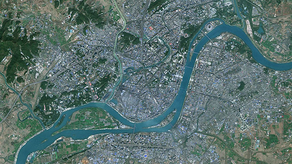
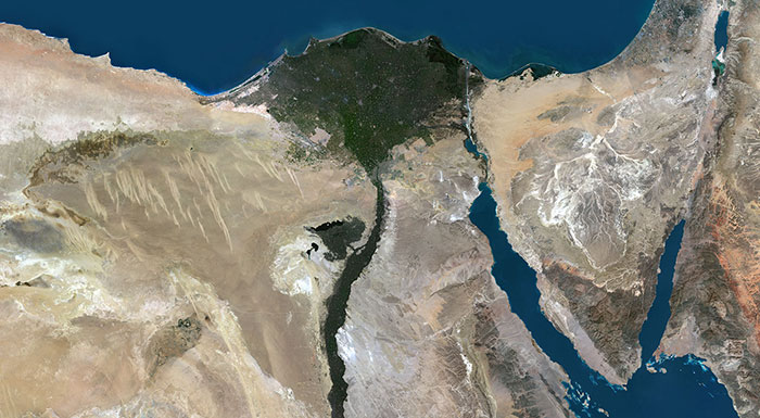
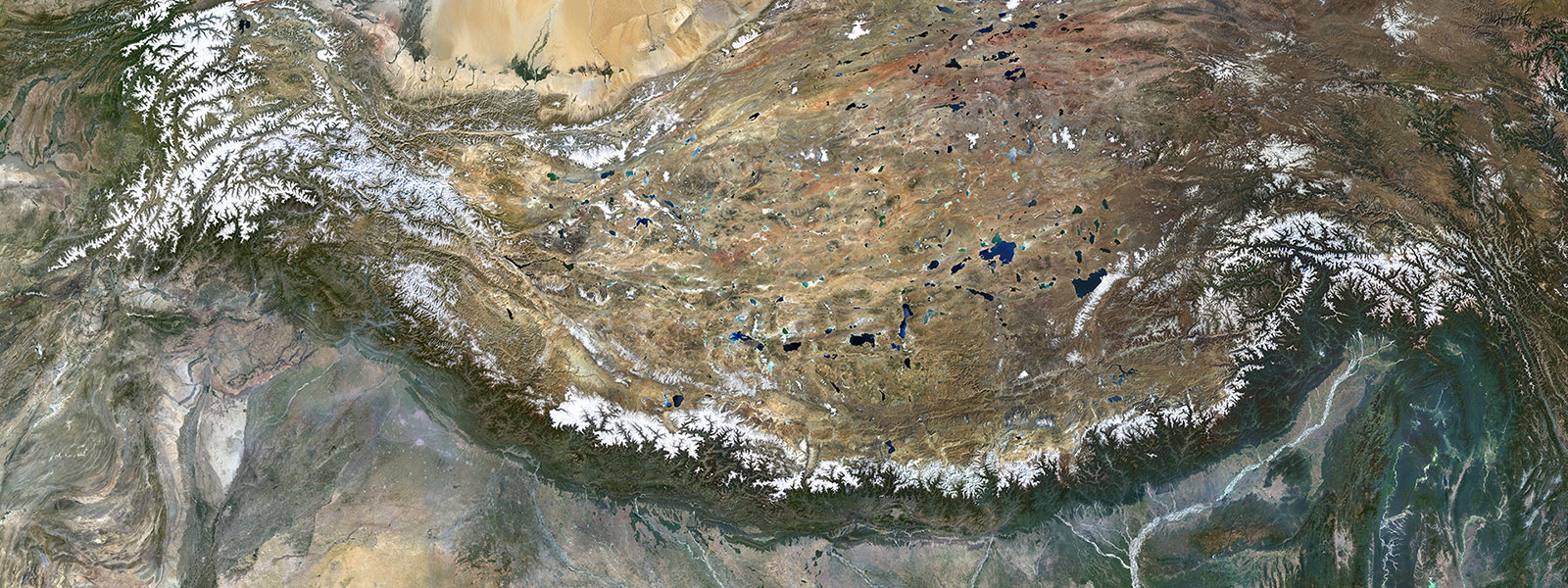
Beyond technical accuracy, PlanetSAT’s strength lies in its visual quality. A global mosaic must be pleasant to view and intuitively understandable, especially when used in flight simulators, broadcast graphics, or mapping interfaces.
To achieve this, PlanetObserver applies an iterative color correction strategy that combines algorithmic harmonization with human artistic judgment:
1. Automated Color Adjustment
RGB channels are statistically balanced across tiles to equalize brightness, contrast, and tonal distribution. This automated step ensures uniform baseline color values.
2. Manual Editing and Seamline Optimization
After automation, PlanetObserver’s in-house graphic designers review seamlines between adjacent tiles. They perform manual retouching to correct inconsistencies in tone and saturation that algorithms cannot fully resolve.
This step is key to the natural appearance of PlanetSAT. The team focuses on maintaining realistic colors — vibrant but not exaggerated — to preserve the authenticity of each region’s natural landscape.
PlanetObserver’s design team plays a decisive role in the PlanetSAT production chain. Their experience in visual interpretation and color theory ensures that the final mosaic achieves not only technical excellence but also visual harmony across diverse environments.
This manual phase is particularly critical in tropical and mountainous regions, where persistent clouds, atmospheric haze, and steep terrain can cause color distortions. The intervention of experienced designers mitigates these issues, guaranteeing that the final product meets the highest standards of realism and aesthetic quality.
Through this advanced satellite imagery processing pipeline — automation for efficiency, human expertise for refinement — PlanetSAT achieves something rare: a global basemap that is both scientifically accurate and visually unified.
Every pixel of PlanetSAT tells a story of precision, patience, and attention to detail — from the first stage of data ingestion to the final retouch that gives Earth its natural, balanced tones.

The third and final article will focus on quality control, metadata structuring, output formats, and real-world use cases of PlanetSAT in defense, simulation, broadcast, and GIS environments worldwide.